Chorleywood
| Chorleywood | |
|---|---|
 Chorleywood Location within Hertfordshire | |
| Population | 11,286 (2011 Census)[1] |
| OS grid reference | TQ025965 |
| District |
|
| Shire county |
|
| Region | |
| Country | England |
| Sovereign state | United Kingdom |
| Post town | RICKMANSWORTH |
| Postcode district | WD3 |
| Dialling code | 01923 01927 |
| Police | Hertfordshire |
| Fire | Hertfordshire |
| Ambulance | East of England |
| UK Parliament |
|

Chorleywood is a village and civil parish in the Three Rivers District, Hertfordshire, England, in the far southwest of the county on the border with Buckinghamshire, approximately 20 miles (32 km) northwest of Charing Cross. It is part of the London commuter belt and included in the government-defined Greater London Urban Area. The parish of Chorleywood was created in 1845 from part of Rickmansworth. The population of the parish was 11,286 at the 2011 census.
In 2004 a study by The Social Disadvantage Research Centre at the University of Oxford named Chorleywood as the “happiest place” to live in the UK. Of the 32,482 communities surveyed, Chorleywood came out top. More recently, Chorleywood has been ranked as the “least deprived” area in the country by the Department of Communities and Local Government.[2][3]
History[]

Settlement at Chorleywood dates to the Paleolithic era when the plentiful flint supply led to swift development of tools by man. The Romans built a village on the ancient site complete with a mill and brewery.[4]
Though variants have been proposed, the name has been derived from the Anglo-Saxon leah, meaning a clearing or a wood, of the ceorla or peasants.[5] A line runs through Chorleywood that once divided the Kingdoms of Mercia and Wessex and now divides the counties of Hertfordshire and Buckinghamshire. Edward the Confessor gave Chorleywood to the Monastery of St Albans.[4]
By 1278, it was known, perhaps duplicating the "woodland" element, as 'Bosco de Cherle' or 'Churl's Wood', Norman for 'Peasant's Wood'.[4] Upon the Dissolution of the Monasteries, it passed to the Bishopric of London, being renamed 'Charleywoode'. It became Crown property during the reign of Elizabeth I. The Turnpike Act (1663) gave Chorleywood a chance to exploit its strategic position, allowing locals the opportunity to charge civilians to use the road from Hatfield to Reading.[4]
Chorleywood is most famous for its Quakers. Non-conformists flocked to Chorleywood, promised sanctuary by the locals. William Penn founded the Pennsylvania Colony with settlers from Chorleywood, Rickmansworth and nearby towns in southern Buckinghamshire, having lived and married in Chorleywood.[4]
Chorleywood House, a Regency mansion, was built in 1822 by John Barnes, replacing an earlier house. John Saunders Gilliat, the Governor of the Bank of England in 1883–1885, lived in it. In 1892, the house was bought by Lady Ela Sackville Russell, eldest daughter of the 9th Duke of Bedford. She modified and enlarged the house turning the grounds into a model estate with market gardens.
The railway was extended to Chorleywood on 8 July 1889.
When the Local Government Act 1894 created districts as subdivisions of the newly created county councils, Chorleywood became part of the Watford Rural District, which encircled Watford. In 1913, the town was separated from Watford Rural District to become Chorleywood Urban District.
In the early 1960s, researchers at the British Baking Industries Research Association in Chorleywood improved upon an earlier American bread-making process. This resulted in the Chorleywood bread process which is now used in over 80% of commercial bread production throughout the UK.[6]
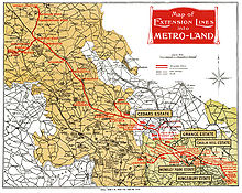
In the 1973 BBC Television documentary, Metro-land, Sir John Betjeman described Chorleywood as "essential Metro-land".[7]
In 1974, the Chorleywood Urban District, Rickmansworth Urban District and most of Watford Rural District were merged to form the Three Rivers non-metropolitan district.
Chorleywood Common[]


Chorleywood Common is 0.8 square kilometres (200 acres) of wooded common land. It is a County Heritage Site, with significant biodiversity. Since cattle grazing ended soon after the First World War, the land has been used for recreational purposes. Chorleywood Golf Club maintains a nine-hole golf course on the Common.
In the 19th century, the MCC established a cricket pitch on the Common, which is used by Chorleywood Cricket Club's senior and junior teams to this day.
Transport[]

Chorleywood has grown in the past century following the extension of the Metropolitan Railway (also known as the Met). Chorleywood station is in Zone 7 of the London Underground Metropolitan line, and is situated between Rickmansworth and Chalfont and Latimer. The majority of trains stopping at Chorleywood are operated by London Underground. The station is also on the Chiltern Railways line running between Marylebone and Aylesbury.
Junction 18 of the M25 with the A404 is at Chorleywood.
The 336 bus route runs via Chorleywood between High Wycombe and Watford.
Politics[]
- Rickmansworth is a part of the UK Parliament constituency of South West Hertfordshire. Gagan Mohindra has been the Member of Parliament since the December 2019 United Kingdom general election.[8][9]
- The Three Rivers Chorleywood district constituency includes Chorleywood, Sarratt and part of Abbots Langley. Liberal Democrat Phil Williams is the councillor at Hertfordshire County Council
- The two wards, Chorleywood North & Sarratt and Chorleywood South & Maple Cross, are divided by the railway line. Chorleywood South & Maple Cross includes most of Chorleywood village and Maple Cross. Chorleywood North & Sarratt includes the north area of Chorleywood, Loudwater, Sarratt and Belsize.
- Chorleywood parish covers all of Chorleywood, Loudwater, and the north-western parts of Rickmansworth.
Schools[]
St Clement Danes School is a mixed-academy school.
Christ Church School, Chorleywood Primary and Russell School are mixed-primary schools.
Demography[]
At the 2011 census, the parish of Chorleywood had a resident population of 11,286, of whom:
| Chorleywood (parish) |
Three Rivers | England & Wales | |
|---|---|---|---|
| Age[10] | |||
| Median age | 44 | 41 | 39 |
| Under 18 | 23.8% | 22.7% | 21.3% |
| Over 65 | 20.5% | 16.8% | 16.4% |
| Ethnic group[11] | |||
| White British | 79.6% | 79.7% | 80.5% |
| White Other | 6.0% | 6.6% | 5.5% |
| Indian or British Indian | 7.9% | 6.0% | 2.5% |
| Other Asian or British Asian | 3.1% | 3.2% | 5.0% |
| Black or Black British | 0.7% | 1.8% | 3.3% |
| Other ethnic group | 0.4% | 0.5% | 1.0% |
| Religion[12] | |||
| Christian | 59.3% | 59.9% | 59.3% |
| Hindu | 5.8% | 4.5% | 1.5% |
| Jewish | 2.8% | 1.8% | 0.5% |
| Muslim | 2.1% | 2.2% | 4.8% |
| Another religion | 1.7% | 1.6% | 1.6% |
| No religion | 20.9% | 22.8% | 25.1% |
| Did not answer | 7.5% | 7.0% | 7.2% |
Twinning[]
 Dardilly, France
Footnotes[]
- ^ "Civil Parish population 2011". Neighbourhood Statistics. Office for National Statistics. Archived from the original on 28 October 2016. Retrieved 28 October 2016.
- ^ "Suburbs score in quality of life". BBC News. 6 May 2004. Retrieved 10 September 2006.
- ^ "Why is Chorleywood, Hertfordshire the happiest place to live in the UK?". Sewell & Gardner. 6 July 2011. Retrieved 20 June 2020.
- ^ Jump up to: a b c d e "Local History". Chorleywood Parish Council. Archived from the original on 5 April 2008. Retrieved 11 June 2008.
- ^ Ekwall, Eilert, 1959, Concise Oxford Dictionary of English Place-Names, fourth edition, page 107.
- ^ "The Chorleywood Bread Process, Training course, Campden and Chorleywood Food Research Association (CCFRA)". Archived from the original on 28 September 2007.
- ^ Davidson, Max (5 June 2002). "End of the line for a poet's scorn". The Daily Telegraph. London. Archived from the original on 11 September 2012. Retrieved 11 June 2008.
- ^ "Hertfordshire South West parliamentary constituency - Election 2019". BBC News. Retrieved 14 December 2019.
- ^ "David Gauke MP". Conservative Party. Archived from the original on 22 November 2006. Retrieved 10 June 2008.
- ^ "Age structure". United Kingdom Census 2011. Office for National Statistics. 12 February 2013.
- ^ "Ethnic group". United Kingdom Census 2011. Office for National Statistics. 30 January 2013.
- ^ "Religion". United Kingdom Census 2011. Office for National Statistics. 30 January 2013.
External links[]
| show Authority control |
|---|
- Three Rivers District
- Villages in Hertfordshire
- Civil parishes in Hertfordshire