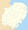
East Hertfordshire
East Hertfordshire District | |
|---|---|
 East Hertfordshire shown within Hertfordshire | |
| Sovereign state | United Kingdom |
| Constituent country | England |
| Region | East of England |
| Non-metropolitan county | Hertfordshire |
| Status | Non-metropolitan district |
| Admin HQ | Hertford |
| Incorporated | 1 April 1974 |
| Government | |
| • Type | Non-metropolitan district council |
| • Body | East Herts Council |
| • Leadership | Leader & Cabinet (Conservative) |
| • MPs | Oliver Heald Stephen McPartland Julie Marson |
| Area | |
| • Total | 183.66 sq mi (475.69 km2) |
| Area rank | 94th (of 309) |
| Population (mid-2019 est.) | |
| • Total | 149,748 |
| • Rank | 138th (of 309) |
| • Density | 820/sq mi (310/km2) |
| • Ethnicity | 94.7% White 1.8% S.Asian 1.2% Black 1.3% Mixed Race 1.1% Chinese or Other |
| Time zone | UTC0 (GMT) |
| • Summer (DST) | UTC+1 (BST) |
| ONS code | 26UD (ONS) E07000242 (GSS) |
| OS grid reference | TL3758624322 |
| Website | www |
East Hertfordshire is a local government district in Hertfordshire, England. Its council is based in Hertford, the county town of Hertfordshire. The largest town in the district is Bishop's Stortford, and the other main towns are Ware, Buntingford and Sawbridgeworth. At the 2011 Census, the population of the district was 137,687.[1]
The district was formed on 1 April 1974, under the Local Government Act 1972, by the merger of the municipal borough of Hertford with Bishop's Stortford, Sawbridgeworth and Ware urban districts, and Braughing Rural District, Ware Rural District and part of Hertford Rural District. By area it is the largest of the ten local government districts in Hertfordshire. It borders the North Hertfordshire district and the boroughs of Stevenage, Welwyn Hatfield and Broxbourne in Hertfordshire, and the districts of Epping Forest, Harlow and Uttlesford in Essex.
In the 2006 edition of Channel 4's "Best and Worst Places to Live in the UK", East Hertfordshire was rated the seventh-best district to live in. In 2012, East Hertfordshire came ninth in Halifax bank's annual survey of most desirable places to live.[2] It came first in this survey in 2020.[3]
Transport[]
The district contains only one motorway - a small stretch of the M11 at Bishop's Stortford. The major roads within the district include:
A10 - (north-south) from London to Cambridge: enters after Hoddesdon, Hertfordshire, leaves before Royston dualled.
A414 - (WSW-ENE) from Welwyn to Harlow, through Hertford, where it forms the Hertford by-pass.
A602 - (SE-NW), connecting at A10 at Ware with the A1(M) at Stevenage.
A120 - (west-east) connecting the A10 at Standon with the M11 at Bishop's Stortford.
None of the above roads are classified as trunk roads. Therefore, they are maintained by Hertfordshire County Council while responsibility for the M11 rests with the Highways Agency.
Stansted Airport is just beyond the edge of the district near Bishop's Stortford, but officially sits within Uttlesford district in neighbouring Essex. Many of the district's towns have rail services into London at King's Cross, Moorgate, and Liverpool Street.
Employment[]
The district's biggest employer is the pharmaceutical company GlaxoSmithKline, which has a research and manufacturing centre in Ware. The company also has a large research centre and office in neighbouring Stevenage.
Parishes[]
The district is entirely parished. See List of civil parishes in Hertfordshire.
References[]
- ^ "Customer Service Strategy Evidence 2015 - 2020" (PDF). East Hertfordshire District Council. p. 8. Retrieved 26 November 2021.
- ^ "Hart in Hampshire remains UK's most desirable place". BBC News. 21 December 2012. Archived from the original on 23 December 2012. Retrieved 22 December 2012.
- ^ "UK's best place to live: The list starts with East Herts" (PDF) (Press release). Halifax. 31 January 2020. Archived from the original (PDF) on 28 November 2020. Retrieved 31 January 2020.
Coordinates: 51°54′N 00°00′W / 51.900°N -0.000°E
| Wikimedia Commons has media related to East Hertfordshire. |
- East Hertfordshire District
- Districts of Hertfordshire

