Fenland District
Fenland District | |
|---|---|
|
| |
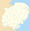
 Fenland shown within Cambridgeshire | |
| Sovereign state | United Kingdom |
| Constituent country | England |
| Region | East of England |
| Non-metropolitan county | Cambridgeshire |
| Status | Non-metropolitan district |
| Admin HQ | March |
| Incorporated | 1 April 1974 |
| Government | |
| • Type | Non-metropolitan district council |
| • Body | Fenland District Council |
| • Leadership | Leader & Cabinet (Conservative) |
| • MPs | Steve Barclay |
| Area | |
| • Total | 210.99 sq mi (546.45 km2) |
| Area rank | 84th (of 309) |
| Population (mid-2019 est.) | |
| • Total | 101,850 |
| • Rank | 234th (of 309) |
| • Density | 480/sq mi (190/km2) |
| • Ethnicity | 98.6% White |
| Time zone | UTC0 (GMT) |
| • Summer (DST) | UTC+1 (BST) |
| ONS code | 12UD (ONS) E07000010 (GSS) |
| OS grid reference | TL417969 |
| Website | www |
Fenland is a local government district in the Isle of Ely, Cambridgeshire, England.
The district covers around 500 square kilometres (190 sq mi) of mostly agricultural land in the extremely flat Fens. The population of the district was 98,262 at the 2011 Census.[1]
It was formed on 1 April 1974, with the merger of the Borough of Wisbech, Chatteris Urban District, March Urban District, Whittlesey Urban District, North Witchford Rural District and Wisbech Rural District.[2]
Settlements in Fenland District[]
Its council covers the market towns of Chatteris, March, Whittlesey and Wisbech (which is often called the "Capital of the Fens").[3] Other villages and hamlets in the district include:
- Benwick
- Christchurch
- Doddington
- Elm
- Coldham
- Friday Bridge
- Ring's End)
- Gorefield
- Leverington
- Manea
- Newton-in-the-Isle
- Tydd St Giles
- Wimblington
- Wisbech St Mary.
The latter includes Guyhirn and Parson Drove.[4]
Governance[]
Fenland District Council is elected every four years, with currently (2020) thirty nine councillors. Since 1976 the Conservative Party has held control of the council, apart from a period after 1995 when Labour had control, the Conservatives regained a majority at the 1999 election. As of April 2021, the council composition is
| Party | Councillors | |
| Conservative Party | 26 | |
| Independent | 10 | |
| Green Party | 1 | |
| Liberal Democrats | 2 | |
In the May 2019 elections, twelve councillors were returned without a vote to Fenland District Council, which topped the Electoral Reform Society's list of 'rotten boroughs'.[5]
Economy[]
The local economy has traditionally been built upon farming and food related industry. The food industry is now well established, and related processing, storage, packaging and distribution has become more sophisticated and diverse. The predominantly rural economy of the area also includes a strong industrial tradition, including brewing, brick making, can making, pet food production, printing and engineering, and many local residents commute outside the district to work or study. The River Nene provides access to the sea via the Port of Wisbech. Other waterways provide opportunities for angling and other water based activities. Marinas are located in Wisbech and March.
The council run markets in three of the towns (the market in Wisbech is run by Wisbech Town Council) and a number of festivals and other events.[6]
A proposal for a new fenland rail link was agreed in June 2020.[7]
Fenland council gave £370,400 to its chief executive Tim Pilsbury when he took early retirement in 2010–11.[8]
Twin towns & sister cities[]
Fenland is twinned with:
- Nettetal in Kreis Viersen in Germany
- Cook County, New Zealand
See also[]
References[]
- ^ "Non Metropolitan District Council population 2011". Neighbourhood Statistics. Office for National Statistics. Archived from the original on 11 October 2016. Retrieved 15 July 2016.
- ^ The English Non-metropolitan Districts (Definition) Order 1972 – SI 1972/2038
- ^ "Wisbech Community Network". Archived from the original on 30 April 2008. Retrieved 29 April 2008.
- ^ "Town and Parish contacts". fenland.gov.uk. Retrieved 5 February 2021.
- ^ "Cambs Times". cambstimes.co.uk. Retrieved 20 May 2019.
- ^ "St. George's Fayre". fenland.gov.uk. Retrieved 5 February 2021.
- ^ "Historic Agreement". wisbechstandard.co.uk. Retrieved 8 August 2020.
- ^ Swinford, Steven; Walton, Gregory (1 January 2013). "£100,000 Pay-Offs For Council Chiefs". The Daily Telegraph. London.
External links[]
- Fenland District
- Non-metropolitan districts of Cambridgeshire

