Borough of Bedford
Bedford
Borough of Bedford | |
|---|---|
 | |
 Coat of arms of Bedford Borough Council | |
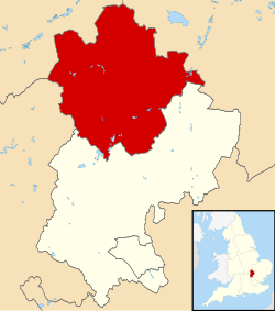 Bedford shown within Bedfordshire | |
| Coordinates: 52°8′0″N 0°27′0″W / 52.13333°N 0.45000°W | |
| Sovereign state | |
| Country | |
| Region | East of England |
| Ceremonial county | Bedfordshire |
| Administrative HQ | Borough Hall, Bedford |
| Government | |
| • Type | Unitary Authority |
| • Governing body | Bedford Borough Council |
| • Executive mayor | Dave Hodgson Liberal Democrats |
| • MPs | Richard Fuller (C) Nadine Dorries (C) Mohammad Yasin (L) |
| Area | |
| • Total | 476.4 km2 (183.9 sq mi) |
| Population (mid-2019 est.)[1] | |
| • Total | 173,292 |
| • Rank | 113th |
| • Density | 360/km2 (900/sq mi) |
| • Ethnicity | 85.5% White British 8.1% British Asian 2.9% Black British 1.3% Chinese or other 2.2% Mixed |
| Time zone | GMT |
| • Summer (DST) | British Summer Time |
| ONS code | 00KB |
| NUTS 3 | UKH22 |
| Website | www |

The Borough of Bedford is a unitary authority area with borough status in the ceremonial county of Bedfordshire, England. Its council is based in Bedford, its namesake and principal settlement, which is the county town of Bedfordshire. The borough contains one large urban area, the 71st largest in the United Kingdom that comprises Bedford and the adjacent town of Kempston, surrounded by a rural area with many villages. 75% of the borough's population live in the Bedford Urban Area and the five large villages which surround it, which makes up slightly less than 6% of the total land area of the Borough.
The borough is also the location of the Wixams new town development, which received its first residents in 2009.
Formation[]
The ancient borough of Bedford was a borough by prescription, with its original date of incorporation unknown. The earliest surviving charter was issued c. 1166 by Henry II, confirming to the borough the liberties and customs which it had held in the reign of Henry I.[2][3] The borough became a municipal borough under the Municipal Corporations Act 1835.
The District of Bedford was formed on 1 April 1974 as a merger of the existing borough of Bedford, along with Kempston Urban District and Bedford Rural District. In 1975 the district was granted a royal charter granting borough status as North Bedfordshire.[4] The borough was renamed as Borough of Bedford in 1992.[5] Over half of the former municipal borough of Bedford is unparished. However, Brickhill is a parish. The rest of the district including Kempston is parished.
The Department for Communities and Local Government have reorganised Bedfordshire's administrative structure as part of the 2009 structural changes to local government in England, meaning that Bedford Borough Council became a unitary authority in April 2009. This means Bedford Borough has assumed responsibility in areas such as education, social services and transport which were previously provided by Bedfordshire County Council.[6][7][8]
Council and cabinet[]
Unlike most English districts, Bedford's council is led by a directly elected mayor of Bedford, who has been Dave Hodgson since 16 October 2009.[9]
The first elections for the new unitary Bedford Borough Council were held on 4 June 2009 when 36 councillors in addition to the mayor were elected. Since an electoral review which came into effect for the local elections in 2011, Bedford Borough has had 40 councillors in addition to the mayor.
| Year | Conservative | Labour | Liberal Democrat | Independent | Green | Control | |
|---|---|---|---|---|---|---|---|
| 2009[10] | 9 | 7 | 13 | 7 | 0 | No overall control | |
| 2011[11] | 12 | 12 | 12 | 4 | 0 | No overall control | |
| 2015 | 15 | 14 | 9 | 2 | 0 | No overall control | |
| 2019 | 11 | 11 | 15 | 1 | 2 | No overall control | |
Since the 2019 elections, Bedford Borough Council’s executive committee (cabinet) is headed by the mayor and includes 10 members from the Liberal Democrat, and Labour groups, and the Independent. Conservative and Green members sit in opposition on the council.[12]
Wards and civil parishes[]
The urban part of the borough consisting of most of the Bedford/Kempston Urban Area is divided into 13 wards, some of which are also civil parishes:[13]
| Ward name | Population (2009 estimate)[13] | Percentage from minority groups[13] |
|---|---|---|
| Brickhill | 8,540 | 14% |
| Castle | 7,190 | 32% |
| Cauldwell | 9,170 | 44% |
| De Parys | 6,840 | 18% |
| Goldington | 8,360 | 19% |
| Harpur | 8,370 | 26% |
| Kempston Central and East | 7,500 | 23% |
| Kempston North | 4,050 | 24% |
| Kempston South | 4,370 | 20% |
| Kempston West | 3,770 | 15% |
| Kingsbrook | 9,280 | 25% |
| Newnham | 7,620 | 18% |
| Putnoe | 7,650 | 14% |
| Queens Park | 8,470 | 58% |
| Total population | 101,180 | 25%[14] |
The wards and constituent civil parishes in the rural part of the borough are as follows:[13]
| Ward name | Civil Parishes[13] | Population (2009 estimate)[13] | Percentage from minority groups[13] |
|---|---|---|---|
| Biddenham & Bromham |
|
7,460 | 9% |
| Clapham | Clapham | 4,670 | 9% |
| Eastcotts | 3,330 | 9% | |
| Elstow | 4,500 | 15% | |
| Great Barford | 6,870 | 6% | |
| Harrold | 4,240 | 4% | |
| Kempston Rural |
|
3,600 | 7% |
| Oakley |
|
3,790 | 5% |
| Riseley | 3,440 | 4% | |
| Sharnbrook | 4,170 | 4% | |
| Wilshamstead | Wilshamstead | 2,550 | 4% |
| Wootton | Wootton | 4,480 | 6% |
| Wyboston | 3,780 | 4% | |
| Total population | 56,880 | 7% |
Premises[]
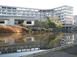
From 1892 the council was based at the Town Hall in St Paul's Square, which had previously been part of Bedford School, with parts of the building dating back to c. 1550. Following the abolition of Bedfordshire County Council in 2009, Bedford Borough Council took over the old County Hall on Cauldwell Street, renaming it Borough Hall.
Freedom of the Borough[]
The following people and military units have received the Freedom of the Borough of Bedford.
This list is incomplete; you can help by . (August 2020) |
Individuals[]
- Etienne Stott MBE: 11 December 2012.[15]
Military Units[]
- Bedfordshire and Hertfordshire Regiment: November 1955
- RAF Cardington: 16 July 1959.[16]
- 287 Regiment Royal Artillery: 5 May 1963.
- 1st Battalion Royal Anglian Regiment: 1980.[17]
- 201 (Hertfordshire and Bedfordshire Yeomanry) Battery Royal Artillery (Volunteers): 3 May 1986.
- RAF Henlow: 26 September 1992.
- 774th USAF Airbase Group: 15 December 1994.
- 134 (Bedford) Squadron Air Training Corps: 1 August 1999.
See also[]
References[]
- ^ "Population Estimates for UK, England and Wales, Scotland and Northern Ireland, Mid-2019". Office for National Statistics. 6 May 2020. Retrieved 6 May 2020.
- ^ Page, William, ed. (1912). "The Borough of Bedford". A History of the County of Bedford: Volume 3. British History Online. Retrieved 8 August 2021.
- ^ "Bedford Borough records introduction". Bedfordshire Archives. Retrieved 8 August 2021.
- ^ North Bedfordshire Borough Council, London Gazette, 31 October 1975, page 13813. Change of name and status from Bedford District to North Bedfordshire Borough with effect from 16 October 1975.
- ^ Bulletin of Changes of Local Authority Status, Names and Areas, 1 April 1992 - 31 March 1993 (Department of the Environment). Change of name from North Bedfordshire to Bedford effective from 1 October 1992.
- ^ Unitary solution confirmed for Bedfordshire – New flagship unitary councils approved for Cheshire – Corporate – Communities and Local Government Archived 22 November 2008 at the Wayback Machine
- ^ County council to be abolished in shake-up – Bedford Today
- ^ A New Beginning Archived 24 February 2009 at archive.today
- ^ "Lib Dem win in mayoral election". BBC News. 16 October 2009.
- ^ "Lib Dems the winners in Borough Hall elections – News". Bedford Today. 5 June 2009. Archived from the original on 8 June 2009. Retrieved 16 August 2013.
- ^ "Bedford Borough Council elections – the results – Local". Bedford Today. 9 May 2011. Archived from the original on 12 December 2013. Retrieved 16 August 2013.
- ^ "Find Councillor | Bedford Borough Council". Retrieved 30 November 2020.
- ^ Jump up to: a b c d e f g "Ward Profiles". Bedford.gov.uk. 5 May 2011. Archived from the original on 6 May 2014. Retrieved 16 August 2013.
- ^ "Archived copy". Archived from the original on 16 March 2012. Retrieved 29 February 2012.CS1 maint: archived copy as title (link)
- ^ https://www.bbc.com/news/uk-england-beds-bucks-herts-20664026
- ^ "RAF Cardington Camp". rafcardingtoncamp.co.uk.
- ^ https://www.bbc.com/news/uk-england-beds-bucks-herts-28424417
External links[]
| Wikimedia Commons has media related to Borough of Bedford. |


Coordinates: 52°08′04″N 0°27′47″W / 52.13444°N 0.46306°W
| show Authority control |
|---|
- Borough of Bedford
- Local government districts of Bedfordshire
- Local government in Bedfordshire
- Unitary authority districts of England
- English unitary authorities created in 2009