Church and 18th Street station
Church and 18th St | |||||||||||
|---|---|---|---|---|---|---|---|---|---|---|---|
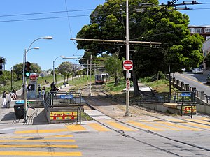 Church and 18th Street station in 2018 | |||||||||||
| Location | Church Street at 18th Street San Francisco, California | ||||||||||
| Coordinates | 37°45′41″N 122°25′42″W / 37.76130°N 122.42838°WCoordinates: 37°45′41″N 122°25′42″W / 37.76130°N 122.42838°W | ||||||||||
| Platforms | 2 side platforms | ||||||||||
| Connections | |||||||||||
| Construction | |||||||||||
| Disabled access | Yes | ||||||||||
| History | |||||||||||
| Opened | August 11, 1917[1] | ||||||||||
| Rebuilt | c. 1982 | ||||||||||
| Services | |||||||||||
| |||||||||||
| Location | |||||||||||
 | |||||||||||

Church and 18th Street (also known as Right Of Way/18th Street) is a light rail stop on the Muni Metro J Church line, located in the southwest corner of Dolores Park in San Francisco, California. The stop opened with the line on August 11, 1917. The inbound platform is located inside Dolores Park on a Muni-only right-of-way; the outbound platform is a boarding island on Church Street. Accessible mini-high platforms for both direction are located inside the park next to 18th Street.
In March 2014, Muni released details of the proposed implementation of their Transit Effectiveness Project (later rebranded MuniForward), which included a variety of stop changes for the J Church line. Under that proposal, the outbound platform would be moved inside Dolores Park opposite the inbound platform.[2]
References[]
- ^ Perles, Anthony (1981). The People's Railway: The History of the Municipal Railway of San Francisco. Interurban Press. p. 61. ISBN 0916374424.
- ^ "Chapter 3: Proposals by Route". Transit Effectiveness Project Implementation Workbook (PDF). San Francisco Municipal Transportation Agency. March 24, 2014. pp. 52–56.
External links[]
![]() Media related to Church and 18th Street station at Wikimedia Commons
Media related to Church and 18th Street station at Wikimedia Commons
- SFMTA - Right Of Way/18th St, Church St & 18th St
- SFBay Transit (unofficial) - Right Of Way/18th St, Church St & 18th St
| Buildings and business | |
|---|---|
| Culture | |
| Geography | |
| Public art | |
| Transportation | |
| Related | |
| |
| Muni Metro | |||||||
|---|---|---|---|---|---|---|---|
| Muni Metro system features |
| ||||||
| Heritage services | |||||||
| Other Muni services | |||||||
| Projects |
| ||||||
| Miscellaneous |
| ||||||
- Muni Metro stations
- Castro District, San Francisco
- Railway stations in the United States opened in 1917