List of Muni Metro stations

Routes:
- J Church – Shortened
- K Ingleside
- L Taraval – Bus
- M Ocean View
- N Judah
- T Third Street
- S Shuttle – Supplementary
Muni Metro is a hybrid light rail/streetcar system serving San Francisco, California, United States. Operated by the San Francisco Municipal Railway (Muni), a part of the San Francisco Municipal Transportation Agency (SFMTA), Muni Metro served an average of 157,700 passengers per weekday in the fourth quarter of 2019, making it the second-busiest light rail system in the United States.
History[]
Two subway stations, West Portal station and Forest Hill station, and five of the six light-rail lines, J Church, K Ingleside, L Taraval, M Ocean View, and N Judah, are remnants of an extensive streetcar system that survived the mass conversion to buses in the 1950s.[1] In 1980, seven subway stations, from Embarcadero station to Castro Street station, were opened with the inauguration of the Market Street subway underneath Market Street, marking the conversion of San Francisco's streetcar system into the Muni Metro.[2] In 1998, four surface stations on The Embarcadero opened, connecting the newly constructed AT&T Park (then called Pacific Bell Park) and Caltrain to Muni Metro.[3][4] In 2007, the T Third Street line was started along 18 new surface stations built along new track laid from Caltrain down the eastern side of the city to the city line.[5]
COVID-19 service impacts and bus substitution[]
All the Muni Metro stations and rail service temporarily shut down due to the COVID-19 pandemic and were replaced with buses on March 30, 2020.[6] But only a few months later on August 22, rail service resumed and all stations reopened, but three days later after the botched re-opening of rail service, rail service and all Muni Metro stations were forced to shut down again due to a malfunctioning overhead wire splice in the subway and the need to quarantine a control center staff over a COVID-19 case.[7] During this brief time, routes were reconfigured to improve reliability in the subway:
• J Church service route was shortened to Church and Market. Transfers to the subway were required at Church station.
• K Ingleside and L Taraval were interlined, running between Taraval and Sunset and Balboa Park; no J, K, and L service entered the subway. Service west of Sunset Boulevard was replaced by buses to allow for construction. Transfers to the subway were required at West Portal.
• M Ocean View and T Third Street were interlined, service ran between Sunnydale and Balboa Park; S Shuttle service increased.[8]
These forced transfers at West Portal and Church stations was criticized by disability advocates.[9]
Only Embarcadero station (for MUNI) reopened on January 23, 2021 when the T Third was partially restored, running between Embarcadero and Sunnydale. Since it couldn't go past Embarcadero, transfers were required to either take BART, or the K, L, and N metro bus lines on surface.[10] Rail service and the rest of all the other subway stations resumed operation on May 15, 2021 with only the K Ingleside, T Third Street, N Judah, and S Shuttle service that entered the subway. K and T lines were interlined, with S Shuttle service now converted to supplementary.[11] M Ocean View resumed rail service on August 14; L Taraval continues to operate with buses.[12]
Infrastructure[]
The system consists of nine subway stations and twenty-four surface stations with high-level 34-inch (860 mm)[13] platforms that allow for level boarding.[14] There are also eighty-seven surface stops[15] whose features vary anywhere between low-level platforms, traffic islands, and markers painted on nearby utility poles.[16] Four stations, from Embarcadero to Civic Center, are shared with Bay Area Rapid Transit (BART). The oldest stations are Forest Hill and West Portal, built in 1918,[17] while the newest stations were opened as part as the Third Street Light Rail Project in 2007.[5]
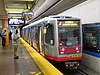
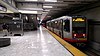
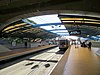
Subway stations[]
| Transfer stations with BART | |
| Transfer stations with BART/Line termini | |
| Line termini |
| Station[a] | Image | Line(s) | Platform Layout | Year Opened |
|---|---|---|---|---|
| Embarcadero |

|
|
Island | 1980 |
| Montgomery Street |
|
|
Island | 1980 |
| Powell Street |

|
|
Island | 1980 |
| Civic Center |
|
|
Island | 1980 |
| Van Ness | 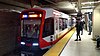
|
|
Island | 1980 |
| Church Street | 
|
|
Side | 1980 |
| Castro Street | 
|
|
Side | 1980 |
| Forest Hill | 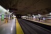
|
|
Side | 1918[17][18][b] |
| West Portal |
|
|
Side | 1918[17] |
Proposed/Future stations[]
These are the stations that are, or may be open for rail service in the future.
| Station[a] | Image | Line(s) | Platform Layout | Year Opening |
|---|---|---|---|---|
| Parkmerced |
– | – | – | |
| Chinatown |

|
Island | 2022 | |
| Union Square/Market Street |

| |||
| Yerba Buena/Moscone | 
|
Abandoned station and stop[]
These were stations that were once opened for streetcar service, but had been abandoned by the railway company.[19]
| Station[a] | Image | Line(s) | Platform Layout | Year Closed |
|---|---|---|---|---|
| Side | 1981 | |||
| Eureka Valley | 
|
|
Side | 1972 |
Surface stations[]
| Transfer stations with Caltrain | |
| Line termini | |
| Transfer stations with Caltrain/Line termini | |
| Transfer stations with BART/Line termini |
| Station[a] | Image | Line(s) | Platform Layout | Year Opened |
|---|---|---|---|---|
| Stonestown[d] | 
|
Island | 1993[20] | |
| San Francisco State University[d] |  |
Island | 1993[20] | |
| Folsom | 
|
|
Island | 1998[3] |
| Brannan | 
| |||
| 2nd and King | 
| |||
| 4th and King |

|
Island | 1998[3] | |
| 4th and King |
Island | 2007 | ||
| Mission Rock | 
|
Side | 2007 | |
| UCSF/Chase Center | 
|
Island | Rebuilt 2018-2019 | |
| Mariposa | 
|
Side | 2007 | |
| 20th Street | 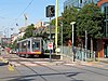
|
Side | 2007 | |
| 23rd Street | 
|
Side | 2007 | |
| Marin Street | 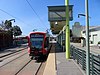
|
Side | 2007 | |
| Evans | 
|
Side | 2007 | |
| Hudson/Innes | 
|
Island | 2007 | |
| Kirkwood/La Salle | 
|
Island | 2007 | |
| Oakdale/Palou | 
|
Island | 2007 | |
| Revere/Shafter | 
|
Island | 2007 | |
| Williams | 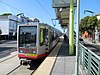
|
Side | 2007 | |
| Carroll | 
|
Side | 2007 | |
| Gilman/Paul | 
|
Side | 2007 | |
| Le Conte | 
|
Island | 2007 | |
| Arleta | 
|
Island | 2007 | |
| Sunnydale |
|
Island | 2007 |
Future surface stations[]
| Station[a] | Image | Line(s) | Platform Layout | Year Opening |
|---|---|---|---|---|
| 4th and Brannan | 
|
Island | 2022 |
Stations with Short/Long platforms, and Accessibility[]
Some stations have truncated platforms; while some stations don't have. Usually, trains access with only one door to facilitate accessibility.[22]
| Station[a] | Image | Line(s) | Platform Layout | Year Retrofitted |
|---|---|---|---|---|
| Balboa Park station |
|
|
2015-2017 | |
| Church and 18th Street AKA Dolores Park |

|
c. 1982 | ||
| Church and 24th Street | 
|
|||
| Church and 29th Street Church and Day Street |

|
c. 1991 | ||
| San Jose and Randall | 
|
|||
| St. Francis Circle[d] | 
|
|
2010 | |
| Junipero Serra and Ocean | 
|
|||
| Ocean and Jules | 
|
|||
| Ocean and Lee | 
|
|||
| Ocean and Phelan AKA City College |

|
1979 | ||
| Taraval and 22nd / 23rd[g] | 
|
c. 1990 | ||
| Taraval and Sunset | 
|
|||
| 46th Avenue and Wawona AKA SF Zoo |

|
|||
| Randolph and Arch | 
|
|||
| Broad and Plymouth | 
|
|||
| San Jose and Geneva |

|
|||
| Duboce and Church | 
|
|
||
| Duboce and Noe Street AKA Duboce Park |

|
|||
| Carl and Cole | 
|
|||
| Irving and 2nd Avenue AKA UCSF Parnassus |
|
|||
| Judah and 9th Avenue | 
|
|||
| Judah and 19th Avenue | 
|
|||
| Judah and 28th Avenue | 
|
|||
| Judah and Sunset | 
|
|||
| Judah and La Playa AKA Ocean Beach |

|
Future Accessibility with extended platforms[]
| Station[a] | Image | Line(s) | Platform Layout | Year Expected |
|---|---|---|---|---|
| Taraval and 17th Avenue (Inbound) | 
|
2022–2024 | ||
| Taraval and 19th Avenue | 
|
|||
| Taraval and 30th Avenue |  |
Notes[]
- ^ a b c d e f g A Muni Metro stop must have high-level platform(s) to be classified as a station.
- ^ Forest Hill did not have high platforms before 1984.
- ^ K and L service do not enter the underground portion of the station.
- ^ a b c d Proposed move underground in Subway Expansion Project
- ^ a b The N Judah station platform is located on the median of King Street immediately southwest of the 4th and King intersection, adjacent to the Caltrain depot. The T Third Street station platform is located on the median of 4th Street immediately southeast of the intersection.[21]
- ^ a b Balboa Park station and San Jose and Geneva are adjacent to each other. Passengers must walk to transfer between these lines.
- ^ inbound platform only
- ^ There is a wayside lift, not a platform [23]
References[]
- ^ "The Muni Paradox — A Brief Social History of the Municipal Railway". Urbanist. San Francisco Planning and Urban Research Association. June 1999. Retrieved January 22, 2009.
- ^ "Historic Streetcars". San Francisco Municipal Transportation Agency. Retrieved January 22, 2009.
- ^ a b c Epstein, Edward (November 4, 1997). "Muni Metro Line Set To Open in January". San Francisco Chronicle. Hearst Communications Inc. Retrieved January 22, 2009.
- ^ Epstein, Edward (January 9, 1998). "Muni's Embarcadero Streetcar Line Set to Make First Runs". San Francisco Chronicle. Hearst Communications Inc. Retrieved January 14, 2009.
- ^ a b "New T-Third Service". San Francisco Municipal Transportation Agency. Archived from the original on May 11, 2008. Retrieved January 14, 2009.
- ^ Fowler, Amy (March 26, 2020). "Starting March 30: New Muni Service Changes" (Press release). San Francisco Municipal Transportation Agency. Retrieved November 28, 2021.
- ^ Dunn, Bradley (August 25, 2020). "Effective August 25 Buses Serve Muni Metro Routes" (Press release). San Francisco Municipal Transportation Agency. Retrieved November 28, 2021.
- ^ Maguire, Mariana (August 18, 2020). "Major Muni Service Expansion August 22" (Press release). San Francisco Municipal Transportation Agency. Retrieved November 28, 2021.
- ^ Graf, Carly (August 18, 2020). "Muni 'improvements' could make things harder for seniors, disabled". San Francisco Examiner. Retrieved December 5, 2021.
- ^ Maguire, Mariana (January 20, 2021). "Muni Expands Service, Access for Equity Neighborhoods in January" (Press release). San Francisco Municipal Transportation Agency. Retrieved December 5, 2021.
- ^ "Welcome Back to the Westside, K Ingleside Trains!" (Press release). San Francisco Municipal Transportation Agency. April 16, 2021. Retrieved November 29, 2021.
- ^ McCarthy, Kate (July 15, 2021). "Welcoming Back the M Ocean View and 31 Balboa" (Press release). San Francisco Municipal Transportation Agency. Retrieved November 29, 2021.
- ^ "S200 SF Light Rail Vehicle" (PDF). Siemens. Retrieved 18 May 2016.
- ^ "San Francisco Municipal Transportation Agency Capital Investment Plan - FY 2009-2013" (PDF). San Francisco Municipal Transportation Agency. August 15, 2008. p. 19. Archived from the original (PDF) on February 5, 2009. Retrieved January 22, 2009.
- ^ "Muni Metro Official System Map" (PDF). San Francisco Municipal Transportation Agency. Archived from the original (PDF) on 18 November 2008. Retrieved 16 August 2011.
- ^ "Info for New Riders: How do I find a bus stop?". San Francisco Municipal Transportation Agency. Archived from the original on July 27, 2011. Retrieved January 22, 2009.
- ^ a b c "West of Twin Peaks". Western Neighborhoods Project. Retrieved January 14, 2009.
- ^ "Forest Hill Station". Western Neighborhoods Project. Retrieved January 14, 2009.
- ^ Wichary, Marcin (December 11, 2018). "The best laid tracks: Stories of San Francisco's ghost stations". Marcin Wichary. Retrieved December 2, 2021.
{{cite web}}: CS1 maint: url-status (link) - ^ a b Callwell, Robert (1999). Transit in San Francisco: A Selected Chronology, 1850-1995. San Francisco: Communications Department, San Francisco Municipal Railway. p. 77. ASIN B0006RDQXK.
- ^ San Francisco Municipal Railway Route Map (Map). San Francisco Municipal Transportation Agency. December 5, 2009. Archived from the original on February 23, 2013. Retrieved January 14, 2010.
- ^ "Muni Metro Accessible Stops". San Francisco Municipal Transportation Agency. Retrieved December 2, 2021.
{{cite web}}: CS1 maint: url-status (link) - ^ "Muni Access Guide" (PDF). SFMTA. 2012. Retrieved 23 May 2019.
External links[]
| Wikimedia Commons has media related to Muni Metro stations. |
San Francisco Municipal Railway | |||||||
|---|---|---|---|---|---|---|---|
| Muni Metro |
| ||||||
| Muni Metro system features |
| ||||||
| Heritage services |
| ||||||
| Other Muni services |
| ||||||
| Projects |
| ||||||
| Miscellaneous |
| ||||||
Active and planned passenger rail stations in the San Francisco Bay Area | |||||||||||||||||||
|---|---|---|---|---|---|---|---|---|---|---|---|---|---|---|---|---|---|---|---|
| |||||||||||||||||||
| |||||||||||||||||||
| |||||||||||||||||||
| |||||||||||||||||||
| |||||||||||||||||||
| |||||||||||||||||||
| |||||||||||||||||||
- Muni Metro stations
- Lists of metro stations
- Lists of California railway stations
- Muni Metro
- San Francisco-related lists