Cigeľ
Cigeľ | |
|---|---|
Village | |
 | |
 Cigeľ Location of Cigeľ in the Trenčín Region | |
| Coordinates: 48°43′N 18°39′E / 48.717°N 18.650°ECoordinates: 48°43′N 18°39′E / 48.717°N 18.650°E | |
| Country | |
| Region | Trenčín |
| District | Prievidza |
| First mentioned | 1362 |
| Area | |
| • Total | 17.35 km2 (6.70 sq mi) |
| Elevation | 465 m (1,526 ft) |
| Population (2004-12-31) | |
| • Total | 1,036 |
| • Density | 60/km2 (150/sq mi) |
| Postal code | 971 01 (pošta Prievidza 1) |
| Area code(s) | +421-46 |
| Car plate | PD |
| Website | www.cigel.sk |


Cigeľ (Hungarian: Cégely) is a village and municipality in Prievidza District in the Trenčín Region of western Slovakia.
History[]
In historical records the village was first mentioned in 1362.
Geography[]
The municipality lies at an altitude of 460 metres and covers an area of 17.35 km². It has a population of about 1,036 people.
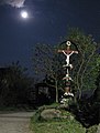
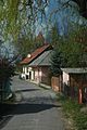
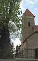
Gallery[]
Genealogical resources[]
The records for genealogical research are available at the state archive "Statny Archiv in Nitra, Slovakia"
- Roman Catholic church records (births/marriages/deaths): 1660-1895 (parish B)
See also[]
External links[]
![]() Media related to Cigeľ at Wikimedia Commons
Media related to Cigeľ at Wikimedia Commons
This Trenčín District location article is a stub. You can help Wikipedia by . |
Categories:
- Villages and municipalities in Prievidza District
- Trenčín geography stubs