Dolné Vestenice
Dolné Vestenice | |
|---|---|
Village | |
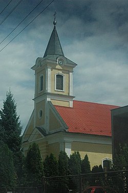 Church of the Immaculate Conception | |
 Dolné Vestenice Location of Dolné Vestenice in the Trenčín Region | |
| Coordinates: 48°42′N 18°24′E / 48.700°N 18.400°ECoordinates: 48°42′N 18°24′E / 48.700°N 18.400°E | |
| Country | |
| Region | Trenčín |
| District | Prievidza |
| First mentioned | 1349 |
| Area | |
| • Total | 13.836 km2 (5.342 sq mi) |
| Elevation | 243 m (797 ft) |
| Population (2004-12-31) | |
| • Total | 2,686 |
| • Density | 190/km2 (500/sq mi) |
| Postal code | 972 23 |
| Area code(s) | +421-46 |
| Car plate | PD |
| Website | www.dolnevestenice.sk |


Dolné Vestenice (Hungarian: Alsóvesztény) is a village and municipality in Prievidza District in the Trenčín Region of western Slovakia.
History[]
In historical records the village was first mentioned in 1349.
Geography[]
The municipality lies at an altitude of 228 metres and covers an area of 13.836 km2. It has a population of about 2,686 people.
Genealogical resources[]
The records for genealogical research are available at the state archive "Statny Archiv in Nitra, Slovakia"
- Roman Catholic church records (births/marriages/deaths): 1702-1935 (parish B)
See also[]
External links[]
![]() Media related to Dolné Vestenice at Wikimedia Commons
Media related to Dolné Vestenice at Wikimedia Commons
| Authority control |
|---|
This Trenčín District location article is a stub. You can help Wikipedia by . |
Categories:
- Villages and municipalities in Prievidza District
- Trenčín geography stubs