Clifton, Colorado
Clifton, Colorado | |
|---|---|
 F Road (US Highway 6) in Clifton looking toward Grand Mesa. | |
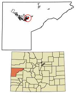 Location of the Clifton CDP in Mesa County, Colorado. | |
 Clifton Location of the Clifton CDP in the United States. | |
| Coordinates: 39°04′35″N 108°27′38″W / 39.0763918°N 108.4605250°WCoordinates: 39°04′35″N 108°27′38″W / 39.0763918°N 108.4605250°W[2] | |
| Country | |
| State | |
| County | Mesa County |
| Government | |
| • Type | unincorporated town |
| Area | |
| • Total | 6.089 sq mi (15.771 km2) |
| • Land | 6.016 sq mi (15.582 km2) |
| • Water | 0.073 sq mi (0.189 km2) |
| Elevation | 4,724 ft (1,440 m) |
| Population (2010) | |
| • Total | 19,889 |
| • Density | 3,306/sq mi (1,276/km2) |
| Time zone | UTC-7 (MST) |
| • Summer (DST) | UTC-6 (MDT) |
| ZIP Code[3] | 81520 |
| Area code(s) | 970 |
| GNIS feature[1] | Clifton CDP |

Clifton is an unincorporated town, a post office, and a census-designated place (CDP) located in and governed by Mesa County, Colorado, United States. The CDP is a part of the Grand Junction, CO Metropolitan Statistical Area. The Clifton post office has the ZIP Code 81520.[3] At the United States Census 2010, the population of the Clifton CDP was 19,889, while the population of the 81520 ZIP Code Tabulation Area was 13,447.[4]
History[]
The Clifton Post Office has been in operation since 1900.[5] The community was named for cliffs near the town site.[6]
Geography[]
The Clifton CDP has an area of 3,897 acres (15.771 km2), including 47 acres (0.189 km2) of water.[2]
Demographics[]
The United States Census Bureau initially defined the Clifton CDP for the 1980 United States Census.
| Year | Pop. | ±% |
|---|---|---|
| 1970 | 5,223 | — |
| 1980 | 6,597 | +26.3% |
| 1990 | 12,671 | +92.1% |
| 2000 | 12,238 | −3.4% |
| 2010 | 19,889 | +62.5% |
| 2020 | — | |
| Source: United States Census Bureau | ||
See also[]
- Outline of Colorado
- State of Colorado
- Colorado cities and towns
- Colorado census designated places
- Colorado counties
- Colorado metropolitan areas
- Grand Junction, CO Metropolitan Statistical Area
- Colorado cities and towns
References[]
- ^ Jump up to: a b c "U.S. Board on Geographic Names: Domestic Names". United States Geological Survey. Retrieved December 24, 2020.
- ^ Jump up to: a b c "State of Colorado Census Designated Places - BAS20 - Data as of January 1, 2020". United States Census Bureau. Retrieved December 24, 2020.
- ^ Jump up to: a b "Look Up a ZIP Code". United States Postal Service. Retrieved December 24, 2020.
- ^ "2010: DEC Summary File 1". United States Census Bureau. Retrieved December 24, 2020.
- ^ "Post offices". Jim Forte Postal History. Archived from the original on 6 March 2016. Retrieved 24 June 2016.
- ^ Dawson, John Frank. Place names in Colorado: why 700 communities were so named, 150 of Spanish or Indian origin. Denver, CO: The J. Frank Dawson Publishing Co. p. 14.
External links[]
 Definitions from Wiktionary
 Media from Wikimedia Commons
 News from Wikinews
 Quotations from Wikiquote
 Texts from Wikisource
 Textbooks from Wikibooks
 Resources from Wikiversity
| show Municipalities and communities of Mesa County, Colorado, United States |
|---|

| show Authority control |
|---|
- Census-designated places in Mesa County, Colorado
- Census-designated places in Colorado