Orchard Mesa, Colorado
Orchard Mesa, Colorado | |
|---|---|
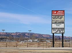 The Mesa County Fairgrounds in Orchard Mesa. | |
 Location of the Orchard Mesa CDP in Mesa County, Colorado. | |
 Orchard Mesa Location of the Orchard Mesa CDP in the United States. | |
| Coordinates: 40°19′55″N 104°07′04″W / 40.3320011°N 104.1177990°WCoordinates: 40°19′55″N 104°07′04″W / 40.3320011°N 104.1177990°W[2] | |
| Country | |
| State | |
| County | Mesa County |
| Government | |
| • Type | unincorporated community |
| Area | |
| • Total | 0.160 sq mi (0.414 km2) |
| • Land | 0.160 sq mi (0.414 km2) |
| • Water | 0.000 sq mi (0.000 km2) |
| Elevation | 4,682 ft (1,427 m) |
| Population (2010) | |
| • Total | 6,836 |
| • Density | 42,725/sq mi (16,512/km2) |
| Time zone | UTC-7 (MST) |
| • Summer (DST) | UTC-6 (MDT) |
| ZIP Code[3] | Grand Junction 81503 |
| Area code(s) | 970 |
| GNIS feature[1] | Orchard Mesa CDP |

Orchard Mesa is an unincorporated community and a census-designated place (CDP) located in and governed by Mesa County, Colorado, United States. The CDP is a part of the Grand Junction, CO Metropolitan Statistical Area. The population of the Orchard Mesa CDP was 6,836 at the United States Census 2010.[4] The Grand Junction post office (Zip Code 81503) serves the area.[3]
Geography[]
The Orchard Mesa CDP has an area of 102 acres (0.414 km2), all land.[2]
Demographics[]
The United States Census Bureau initially defined the Orchard Mesa CDP for the 1960 United States Census.
| Year | Pop. | ±% |
|---|---|---|
| 1960 | 4,956 | — |
| 1970 | 5,824 | +17.5% |
| 1980 | 4,876 | −16.3% |
| 1990 | 5,977 | +22.6% |
| 2000 | 6,456 | +8.0% |
| 2010 | 6,836 | +5.9% |
| 2020 | — | |
| Source: United States Census Bureau | ||
See also[]
- Outline of Colorado
- State of Colorado
- Colorado cities and towns
- Colorado census designated places
- Colorado counties
- Colorado metropolitan areas
- Grand Junction, CO Metropolitan Statistical Area
- Colorado cities and towns
References[]
- ^ Jump up to: a b c "U.S. Board on Geographic Names: Domestic Names". United States Geological Survey. Retrieved December 24, 2020.
- ^ Jump up to: a b c "State of Colorado Census Designated Places - BAS20 - Data as of January 1, 2020". United States Census Bureau. Retrieved December 24, 2020.
- ^ Jump up to: a b "Look Up a ZIP Code". United States Postal Service. Retrieved December 24, 2020.
- ^ "2010: DEC Summary File 1". United States Census Bureau. Retrieved December 24, 2020.
External links[]
Orchard Mesa, Coloradoat Wikipedia's sister projects
 Definitions from Wiktionary
 Media from Wikimedia Commons
 News from Wikinews
 Quotations from Wikiquote
 Texts from Wikisource
 Textbooks from Wikibooks
 Resources from Wikiversity
| show Municipalities and communities of Mesa County, Colorado, United States |
|---|

| show Authority control |
|---|
Categories:
- Census-designated places in Mesa County, Colorado
- Census-designated places in Colorado