Clyde, Ohio
Clyde, Ohio | |
|---|---|
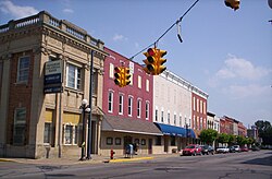 Downtown Clyde, Ohio on South Main Street. | |
 Location of Clyde, Ohio | |
 Location of Clyde in Sandusky County | |
| Coordinates: 41°18′18″N 82°58′36″W / 41.30500°N 82.97667°WCoordinates: 41°18′18″N 82°58′36″W / 41.30500°N 82.97667°W | |
| Country | United States |
| State | Ohio |
| County | Sandusky |
| Government | |
| • Type | council-manager |
| • City manager | Paul Fiser |
| • Mayor | Scott Black |
| Area | |
| • Total | 5.28 sq mi (13.67 km2) |
| • Land | 5.22 sq mi (13.53 km2) |
| • Water | 0.05 sq mi (0.13 km2) |
| Elevation | 696 ft (212 m) |
| Population | |
| • Total | 6,325 |
| • Estimate (2019)[5] | 6,166 |
| • Density | 1,180.10/sq mi (455.61/km2) |
| Time zone | UTC-5 (Eastern (EST)) |
| • Summer (DST) | UTC-4 (EDT) |
| ZIP code | 43410 |
| Area code(s) | 419 |
| FIPS code | 39-16308[4] |
| GNIS feature ID | 1056817[3] |
| Website | https://clydeohio.org |

Clyde /ˈklaɪd/[6] is a city in Sandusky County, Ohio, United States, located 8 miles southeast of Fremont. The population was 6,325 at the 2010 census. The National Arbor Day Foundation has designated Clyde as a Tree City USA.
The town is known for having served as inspiration for the setting of Sherwood Anderson's 1919 collection of short stories Winesburg, Ohio.[7]
History[]
In the 1700s, the area of Ohio including present-day Clyde was inhabited by the Wyandot tribe.[8] The distinction of first settler of Clyde goes to Jesse Benton. Claims that the first settler was Samuel Pogue are not entirely wrong as sometime during the war of 1812, Pogue drove a stake near the spring in the west part of Clyde with the intention of settling there after the war concluded. When Pogue returned in 1820 to take formal possession of the land, he found Jesse Benton had already built a cabin on the land. Shortly after Pogues arrival, Benton ceded his claim of the land to Pogue for a barrel of whiskey. Pogue lived in the Benton cabin until his death in 1828.[9][10]
Clyde was named after Clyde, New York.[11]
Early in the 20th Century, Clyde joined the automobile revolution, hosting the pioneering brass era company, Elmore Manufacturing Company. Elmore was taken over by General Motors in 1909 and operations were moved to Detroit in 1919. However, Louis Krebs resigned from Elmore when General Motors took over and formed his own company which later became the Clydesdale Motor Truck Company. After General Motors moved out, Krebs acquired their site in Clyde for his own operations.[12] The buildings, by this time owned by Clyde Porcelain Steel, burned down November 11, 1945.
The Whirlpool Corporation purchased the Clyde Porcelain Steel Co. in 1952 and began producing washing machines there and then purchased the adjacent property of the Bendix Corporation in 1954, that produced belt-driven washing machines, making it the sole producer of washing machines in the area for the next six decades.
Geography[]
Clyde is located at 41°18′18″N 82°58′36″W / 41.30500°N 82.97667°W (41.304912, -82.976529).[13]
According to the United States Census Bureau, the city has a total area of 5.09 square miles (13.18 km2), of which 5.04 square miles (13.05 km2) is land and 0.05 square miles (0.13 km2) is water.[14]
Demographics[]
| Historical population | |||
|---|---|---|---|
| Census | Pop. | %± | |
| 1860 | 701 | — | |
| 1880 | 2,380 | — | |
| 1890 | 2,327 | −2.2% | |
| 1900 | 2,515 | 8.1% | |
| 1910 | 2,815 | 11.9% | |
| 1920 | 3,099 | 10.1% | |
| 1930 | 3,159 | 1.9% | |
| 1940 | 3,174 | 0.5% | |
| 1950 | 4,083 | 28.6% | |
| 1960 | 4,826 | 18.2% | |
| 1970 | 5,503 | 14.0% | |
| 1980 | 5,489 | −0.3% | |
| 1990 | 5,776 | 5.2% | |
| 2000 | 6,064 | 5.0% | |
| 2010 | 6,325 | 4.3% | |
| 2019 (est.) | 6,166 | [5] | −2.5% |
| Sources:[4][15][16][17][18] | |||
2010 census[]
As of the census[2] of 2010, there were 6,325 people, 2,484 households, and 1,687 families living in the city. The population density was 1,255.0 inhabitants per square mile (484.6/km2). There were 2,707 housing units at an average density of 537.1 per square mile (207.4/km2). The racial makeup of the city was 94.4% White, 0.6% African American, 0.3% Native American, 0.4% Asian, 1.5% from other races, and 2.7% from two or more races. Hispanic or Latino of any race were 5.9% of the population.
There were 2,484 households, of which 35.5% had children under the age of 18 living with them, 47.0% were married couples living together, 14.7% had a female householder with no husband present, 6.3% had a male householder with no wife present, and 32.1% were non-families. 26.8% of all households were made up of individuals, and 12.2% had someone living alone who was 65 years of age or older. The average household size was 2.50 and the average family size was 2.99.
The median age in the city was 37.4 years. 26.3% of residents were under the age of 18; 8.1% were between the ages of 18 and 24; 25.7% were from 25 to 44; 26.1% were from 45 to 64; and 13.8% were 65 years of age or older. The gender makeup of the city was 48.7% male and 51.3% female.
2000 census[]
As of the census[4] of 2000, there were 6,064 people, 2,304 households, and 1,633 families living in the city. The population density was 1,381.5 people per square mile (533.3/km2). There were 2,471 housing units at an average density of 563.0 per square mile (217.3/km2). The racial makeup of the city was 96.04% White, 0.15% African American, 0.12% Native American, 0.26% Asian, 0.03% Pacific Islander, 2.21% from other races, and 1.19% from two or more races. Hispanic or Latino of any race were 4.70% of the population.
There were 2,304 households, out of which 35.0% had children under the age of 18 living with them, 53.9% were married couples living together, 12.4% had a female householder with no husband present, and 29.1% were non-families. 24.4% of all households were made up of individuals, and 9.5% had someone living alone who was 65 years of age or older. The average household size was 2.59 and the average family size was 3.07.
In the city the population was spread out, with 27.0% under the age of 18, 8.7% from 18 to 24, 29.3% from 25 to 44, 22.2% from 45 to 64, and 12.8% who were 65 years of age or older. The median age was 35 years. For every 100 females, there were 91.7 males. For every 100 females age 18 and over, there were 89.4 males.
The median income for a household in the city was $39,764, and the median income for a family was $45,646. Males had a median income of $32,189 versus $23,549 for females. The per capita income for the city was $17,966. About 6.8% of families and 8.6% of the population were below the poverty line, including 11.4% of those under age 18 and 7.9% of those age 65 or over.
Education[]
Clyde is served by the Clyde-Green Springs school district. The nickname for Clyde's school sports teams is the Clyde Fliers, with the mascot being a jet plane sporting the school colors (Gold and royal blue).[19]
Schools[]
- Clyde High School (Grades 9-12)
- Clyde Elementary School (Grades K-4)
- Green Springs Elementary (Grades K-5)
- McPherson Middle School (Grades 6-8)
- Harvest Temple Christian Academy (Grades K-12, Preschool, day care)
Economy[]
Clyde is the home of a Whirlpool Corporation plant.
Media[]
Clyde was served in print by the weekly newspaper The Clyde Enterprise for nearly 138 years, until its closure by Civitas Media in 2016.[20]
Clean Air Radio Network, a Christian radio network broadcasting in Clyde, Findlay, and Coshocton, is owned and operated by Harvest Temple Christian Academy in Clyde.[21]
Notable people[]
- Sherwood Anderson - author
- Tim Anderson - professional football player
- Thaddeus B. Hurd - local historian
- James B. McPherson - Union major general[22]
- George W. Norris - United States Senator from Nebraska[23]
- Rodger Young - Medal of Honor recipient, World War II[24]
References[]
- ^ "2019 U.S. Gazetteer Files". United States Census Bureau. Retrieved July 27, 2020.
- ^ Jump up to: a b "U.S. Census website". United States Census Bureau. Retrieved 2013-01-06.
- ^ Jump up to: a b "US Board on Geographic Names". United States Geological Survey. 2007-10-25. Retrieved 2008-01-31.
- ^ Jump up to: a b c "U.S. Census website". United States Census Bureau. Retrieved 2008-01-31.
- ^ Jump up to: a b "Population and Housing Unit Estimates". Retrieved May 21, 2020.
- ^ "A Pronunciation Guide to Places in Ohio". E.W.Scripps School of Journalism. Archived from the original on 2017-07-25. Retrieved 2008-12-19.
- ^ Winesburg, Ohio, Sherwood Anderson, 1919 Archived 2012-02-07 at the Wayback Machine. Chapter 1. Accessed 13 May 2007.
- ^ Buser, C.A. "Wyandots in Ohio". Wyandotte Nation. Retrieved 28 June 2016.
- ^ "History of Sandusky County Ohio with Illustrations 1882", Originally Published by H.Z. Williams and Bro., Cleveland, Ohio 1882
- ^ "Early History of Clyde", The Early History of Clyde by W.W. Kastrup, Editor of the Clyde Enterprise
- ^ Meek, Basil (1909). Twentieth Century History of Sandusky County, Ohio and Representative Citizens. Whipporwill Publications. pp. 311.
- ^ Tiffany Willey Middleton, James M. Semon, The Clydesdale Motor Truck Company: An Illustrated History, 1917-1939, pp. 18-21, McFarland, 2013 ISBN 0786475870.
- ^ "US Gazetteer files: 2010, 2000, and 1990". United States Census Bureau. 2011-02-12. Retrieved 2011-04-23.
- ^ "US Gazetteer files 2010". United States Census Bureau. Archived from the original on 2012-06-26. Retrieved 2013-01-06.
- ^ "Population: Ohio" (PDF). 1910 U.S. Census. U.S. Census Bureau. Retrieved 28 November 2013.
- ^ "Population: Ohio" (PDF). 1930 US Census. U.S. Census Bureau. Retrieved 28 November 2013.
- ^ "Number of Inhabitants: Ohio" (PDF). 18th Census of the United States. U.S. Census Bureau. 1960. Retrieved 24 April 2020.
- ^ "Ohio: Population and Housing Unit Counts" (PDF). U.S. Census Bureau. Retrieved 22 November 2013.
- ^ Clyde-Green Springs Schools. Accessed 13 May 2007.
- ^ Brooks, Rebecca R. (1 June 2016). "Clyde, Bellevue newspapers cease operation". The News-Messenger. Retrieved 8 July 2016.
- ^ "About". Clean Air Radio Network. Retrieved 8 July 2016.
- ^ James Birdseye McPherson, Major General, Union Commander, Army of Tennessee www.ngeorgia.com. Wayne Bengston, contributing editor. Accessed 13 May 2007.
- ^ NORRIS, George William - Biographical Information. Biographical Dictionary of the United States Congress. Accessed 13 May 2007.
- ^ "Rodger W. Young". Ohio History Central. Ohio History Connection. Retrieved 8 July 2016.
External links[]
| Wikimedia Commons has media related to Clyde, Ohio. |
| show Municipalities and communities of Sandusky County, Ohio, United States |
|---|

| show Authority control |
|---|
- Cities in Sandusky County, Ohio
- Cities in Ohio