Cone, Michigan
Cone, Michigan | |
|---|---|
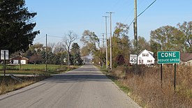 Looking west along Cone Road | |
 Cone Location within the state of Michigan | |
| Coordinates: 42°01′55″N 83°45′11″W / 42.03194°N 83.75306°WCoordinates: 42°01′55″N 83°45′11″W / 42.03194°N 83.75306°W | |
| Country | United States |
| State | Michigan |
| County | Monroe |
| Township | Milan |
| Established | 1869 |
| Elevation | 696 ft (212 m) |
| Time zone | UTC-5 (Eastern (EST)) |
| • Summer (DST) | UTC-4 (EDT) |
| ZIP code(s) | |
| Area code(s) | 734 |
| GNIS feature ID | 623689[1] |


Cone is an unincorporated community in Monroe County in the U.S. state of Michigan.[1] The community is located within Milan Township. As an unincorporated community, Cone has no legally defined boundaries or population statistics of its own.
History[]
The area was first settled in the 1830s when Erastus S. Cone (1798–1869) bought farmland in southwest Milan Township, which itself was organized in 1836. Cone had a very large family, and the name Cone became a prominent name in the area. Many settlers in the community belonged to the Cone family.[2] The growing community became known as West Milan due to its location just southwest of the community of Milan. The community of Azalia—then known as East Milan—was in the opposite direction.
The area received its first post office under the name West Milan on August 4, 1869, with John C. Cone serving as the first postmaster. The Wabash Railroad opened a railway line in West Milan in 1880. Because of the prominence of the Cone family name, the station was named the Cone Station.[3][4] The post office was renamed Cone on January 27, 1882.[5][6][7]
With the opening of the railway, the community of Cone had a direct link to the city of Detroit about 47 miles (76 km) to the northeast. The small community began to prosper and included many businesses and a growing population that mostly belonged to the Cone family. Businesses within Cone included a blacksmith shop, brick and charcoal manufacturers, cheese factory, two churches, several stores, two sawmills, and other manufacturing companies. Despite the growing community and prosperous railway, many of these businesses disappeared after the turn of the century. The post office itself was discontinued on September 15, 1917.[5] Today, the community has no businesses (the last one burning down in 2009) and consists of only a small number of houses, farmland, and a grain elevator and silos.[3] The railway line is currently operated by Norfolk Southern Railway but no longer has a station in the area.[8]
The Rice Cemetery is located near the Cone community.[9] The cemetery has burial sites of many early Cone residents, including some Civil War veterans.[2][10]
Geography[]
The community is centered along Cone Road in the northwest corner of Monroe County. It is located about four miles (6.4 km) west of U.S. Route 23 and is accessible via exit 22. Cone is about five miles (8.0 km) southwest of the city of Milan and 20 miles (32.2 km) west of the city of Monroe.[11] The community sits at an elevation of 696 feet (212 m) above sea level.[1] Bear Swamp Creek runs through the community of Cone.[12]
The community of Azalia is to the east on the other side of U.S. Route 23. Cone uses the Britton 49229 ZIP Code, which is mostly located in Lenawee County to the west.[13][14] Eastern portions of the community may use the Milan 48160 ZIP Code.[15][16] The community is served by Milan Area Schools to the northeast.[17]
References[]
- ^ a b c U.S. Geological Survey Geographic Names Information System: Cone, Michigan
- ^ a b Warnes, Kathy. "Milan Township Communities: Cone and Azalia". Retrieved November 3, 2020.
- ^ a b Robinson, John (9 October 2019). "Michigan 'Lost' Town: The Tiny Town of Cone, in Monroe County". Retrieved November 3, 2020.
- ^ U.S. Geological Survey Geographic Names Information System: Cone Station (historical)
- ^ a b U.S. Geological Survey Geographic Names Information System: Cone Post Office (historical)
- ^ Milan Township History in History of Monroe County, Michigan, Wing, Talcott Enoch, ed. New York, Munsell & company, 1890. p. 593
- ^ Romig, Walter (October 1, 1986) [1973]. Michigan Place Names: The History of the Founding and the Naming of More Than Five Thousand Past and Present Michigan Communities. Great Lakes Books Series (Paperback). Detroit, Michigan: Wayne State University Press. p. 129. ISBN 978-0-8143-1838-6.
- ^ Michigan Department of Transportation (March 2017). "Michigan's Railroad System: Railroads Operating in Michigan" (PDF). Retrieved October 3, 2020.
- ^ U.S. Geological Survey Geographic Names Information System: Rice Cemetery
- ^ Find a Grave (2020). "Rice Cemetery". Retrieved November 4, 2020.
- ^ Michigan Economic Development Corporation (2020). "Monroe County Convention & Tourism Bureau: Cone". Retrieved November 5, 2020.
- ^ U.S. Geological Survey Geographic Names Information System: Bear Swamp Creek
- ^ Google (October 23, 2020). "49229 ZIP Code map" (Map). Google Maps. Google. Retrieved October 23, 2020.
- ^ UnitedStatesZipCodes.org (2020). "ZIP Code 49229: Britton". Retrieved November 6, 2020.
- ^ Google (October 23, 2020). "48160 ZIP Code map" (Map). Google Maps. Google. Retrieved October 23, 2020.
- ^ UnitedStatesZipCodes.org (2020). "ZIP Code 48160: Milan". Retrieved November 6, 2020.
- ^ Michigan Department of Information Technology (March 2008). "Milan Area Schools" (PDF). Retrieved October 22, 2020.
Municipalities and communities of Monroe County, Michigan, United States | ||
|---|---|---|
| Cities |  | |
| Villages | ||
| Charter townships | ||
| Civil townships | ||
| CDPs | ||
| Other unincorporated communities |
| |
| Ghost towns | ||
| Footnotes | ‡This populated place also has portions in an adjacent county or counties | |
| ||
- Unincorporated communities in Monroe County, Michigan
- Unincorporated communities in Michigan
- Populated places established in 1869
- 1869 establishments in Michigan