South Rockwood, Michigan
South Rockwood, Michigan | |
|---|---|
| Village of South Rockwood | |
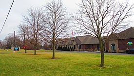 South Rockwood Village Hall | |
 Location within Monroe County | |
 South Rockwood Location within the state of Michigan | |
| Coordinates: 42°03′50″N 83°15′40″W / 42.06389°N 83.26111°WCoordinates: 42°03′50″N 83°15′40″W / 42.06389°N 83.26111°W | |
| Country | United States |
| State | Michigan |
| County | Monroe |
| Township | Berlin |
| Founded | 1863 |
| Incorporated | 1955 |
| Government | |
| • Type | Village council |
| • President | Charles Horn |
| • Clerk | Angela Hightower |
| Area | |
| • Total | 3.33 sq mi (8.64 km2) |
| • Land | 3.27 sq mi (8.48 km2) |
| • Water | 0.06 sq mi (0.16 km2) |
| Elevation | 587 ft (179 m) |
| Population | |
| • Total | 1,675 |
| • Estimate (2019)[4] | 1,657 |
| • Density | 505.95/sq mi (195.36/km2) |
| Time zone | UTC-5 (Eastern (EST)) |
| • Summer (DST) | UTC-4 (EDT) |
| ZIP code(s) | 48179 |
| Area code(s) | 734 |
| FIPS code | 26-75280[5] |
| GNIS feature ID | 0638409[6] |
| Website | Official website |

South Rockwood is a village in Monroe County in the U.S. state of Michigan. The population was 1,675 at the 2010 census. The village is located within Berlin Charter Township.[3]
History[]
South Rockwood was founded in 1863 by John Strong, who named the community after Rockwood, Ontario. The nearby community of Rockwood, Michigan was located just to the north and was settled a few years earlier. Strong established the South Rockwood post office on July 5, 1877. South Rockwood incorporated as a village in 1955.[7]
Geography[]
According to the U.S. Census Bureau, the village has a total area of 2.46 square miles (6.37 km2), of which 2.35 square miles (6.09 km2) is land and 0.11 square miles (0.28 km2) (4.47%) is water.[2]
The Huron River forms the northern boundary of the village and county line with the city of Rockwood in Wayne County.
Major highways[]
 I-75 runs south–north though the center of the village and is accessible via exit 26 (South Huron River Drive).
Demographics[]
| Historical population | |||
|---|---|---|---|
| Census | Pop. | %± | |
| 1880 | 251 | — | |
| 1960 | 1,337 | — | |
| 1970 | 1,477 | 10.5% | |
| 1980 | 1,353 | −8.4% | |
| 1990 | 1,221 | −9.8% | |
| 2000 | 1,284 | 5.2% | |
| 2010 | 1,675 | 30.5% | |
| 2019 (est.) | 1,657 | [4] | −1.1% |
| U.S. Decennial Census[8] | |||
2010 census[]
As of the census[9] of 2010, there were 1,675 people, 687 households, and 453 families living in the village. The population density was 712.8 inhabitants per square mile (275.2/km2). There were 734 housing units at an average density of 312.3 per square mile (120.6/km2). The racial makeup of the village was 95.4% White, 2.3% African American, 0.2% Native American, 0.4% Asian, 0.4% from other races, and 1.3% from two or more races. Hispanic or Latino of any race were 4.1% of the population.
There were 687 households, of which 30.0% had children under the age of 18 living with them, 50.4% were married couples living together, 11.5% had a female householder with no husband present, 4.1% had a male householder with no wife present, and 34.1% were non-families. 25.6% of all households were made up of individuals, and 6.2% had someone living alone who was 65 years of age or older. The average household size was 2.44 and the average family size was 2.95.
The median age in the village was 38.9 years. 20.8% of residents were under the age of 18; 8.9% were between the ages of 18 and 24; 29% were from 25 to 44; 31.1% were from 45 to 64; and 10.1% were 65 years of age or older. The gender makeup of the village was 50.7% male and 49.3% female.
2000 census[]
As of the census[5] of 2000, there were 1,284 people, 450 households, and 359 families living in the village. The population density was 526.1 per square mile (203.2/km2). There were 464 housing units at an average density of 190.1 per square mile (73.4/km2). The racial makeup of the village was 97.59% White, 0.23% African American, 0.23% Native American, 0.08% Asian, 0.08% from other races, and 1.79% from two or more races. Hispanic or Latino of any race were 0.78% of the population.
There were 450 households, out of which 37.3% had children under the age of 18 living with them, 66.9% were married couples living together, 8.9% had a female householder with no husband present, and 20.2% were non-families. 14.9% of all households were made up of individuals, and 5.8% had someone living alone who was 65 years of age or older. The average household size was 2.85 and the average family size was 3.18.
In the village, the population was spread out, with 26.6% under the age of 18, 9.0% from 18 to 24, 29.0% from 25 to 44, 26.3% from 45 to 64, and 9.0% who were 65 years of age or older. The median age was 37 years. For every 100 females, there were 109.8 males. For every 100 females age 18 and over, there were 102.6 males.
The median income for a household in the village was $62,500, and the median income for a family was $68,304. Males had a median income of $50,882 versus $27,813 for females. The per capita income for the village was $22,245. About 2.3% of families and 4.1% of the population were below the poverty line, including 2.9% of those under age 18 and 4.8% of those age 65 or over.
Education[]
The village is served by Airport Community Schools.[10]
References[]
- ^ Village of South Rockwood (2020). "Village Officials". Retrieved April 2, 2020.
- ^ a b "2019 U.S. Gazetteer Files". United States Census Bureau. Retrieved July 25, 2020.
- ^ a b "Michigan: 2010 Population and Housing Unit Counts 2010 Census of Population and Housing" (PDF). 2010 United States Census. United States Census Bureau. September 2012. p. 34 Michigan. Retrieved October 19, 2021.
- ^ a b "Population and Housing Unit Estimates". United States Census Bureau. May 24, 2020. Retrieved May 27, 2020.
- ^ a b "U.S. Census website". United States Census Bureau. Retrieved 2008-01-31.
- ^ "US Board on Geographic Names". United States Geological Survey. 2007-10-25. Retrieved 2008-01-31.
- ^ Romig, Walter (October 1, 1986) [1973]. Michigan Place Names: The History of the Founding and the Naming of More Than Five Thousand Past and Present Michigan Communities. Great Lakes Books Series (Paperback). Detroit, Michigan: Wayne State University Press. p. 527. ISBN 978-0-8143-1838-6.
- ^ "Census of Population and Housing". Census.gov. Retrieved June 4, 2015.
- ^ "U.S. Census website". United States Census Bureau. Retrieved 2012-11-25.
- ^ Michigan Geographic Framework (15 November 2013). "Monroe County School Districts" (PDF). Retrieved October 28, 2021.
Places adjacent to South Rockwood, Michigan | ||||||||||||||||
|---|---|---|---|---|---|---|---|---|---|---|---|---|---|---|---|---|
| ||||||||||||||||
Municipalities and communities of Monroe County, Michigan, United States | ||
|---|---|---|
| Cities |  | |
| Villages | ||
| Charter townships | ||
| Civil townships | ||
| CDPs | ||
| Other unincorporated communities |
| |
| Ghost towns | ||
| Footnotes | ‡This populated place also has portions in an adjacent county or counties | |
| ||
- Villages in Monroe County, Michigan
- Villages in Michigan
- Populated places established in 1863
- 1863 establishments in Michigan