West Monroe, Michigan
West Monroe, Michigan | |
|---|---|
 West Monroe looking east along M-50 | |
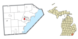 Location within Monroe County | |
 West Monroe Location within the state of Michigan | |
| Coordinates: 41°54′50″N 83°25′54″W / 41.91389°N 83.43167°WCoordinates: 41°54′50″N 83°25′54″W / 41.91389°N 83.43167°W | |
| Country | United States |
| State | Michigan |
| County | Monroe |
| Township | Monroe |
| Area | |
| • Total | 1.25 sq mi (3.2 km2) |
| • Land | 1.23 sq mi (3.2 km2) |
| • Water | 0.02 sq mi (0.05 km2) |
| Elevation | 600 ft (183 m) |
| Population (2010) | |
| • Total | 3,503 |
| • Density | 2,848.0/sq mi (1,099.6/km2) |
| Time zone | UTC-5 (Eastern (EST)) |
| • Summer (DST) | UTC-4 (EDT) |
| ZIP code(s) | 48161 (Monroe) |
| Area code(s) | 734 |
| FIPS code | 26-86050[1] |
| GNIS feature ID | 1867326[2] |


West Monroe is an unincorporated community and census-designated place (CDP) in Monroe County in the U.S. state of Michigan. The population was 3,503 at the 2010 census.[3] The CDP is located within Monroe Charter Township.
Geography[]
According to the United States Census Bureau, the CDP has a total area of 1.25 square miles (3.24 km2), of which 1.23 square miles (3.19 km2) is land and 0.02 square miles (0.05 km2) (1.60%) is water.[3]
Demographics[]
As of the census[1] of 2000, there were 3,893 people, 1,505 households, and 1,044 families residing in the CDP. The population density was 3,100.4 per square mile (1,192.9/km2). There were 1,599 housing units at an average density of 1,273.5 per square mile (490.0/km2). The racial makeup of the CDP was 96.48% White, 0.98% African American, 0.26% Native American, 0.64% Asian, 0.69% from other races, and 0.95% from two or more races. Hispanic or Latino of any race were 1.77% of the population.
There were 1,505 households, out of which 36.7% had children under the age of 18 living with them, 48.6% were married couples living together, 13.9% had a female householder with no husband present, and 30.6% were non-families. 25.3% of all households were made up of individuals, and 7.9% had someone living alone who was 65 years of age or older. The average household size was 2.59 and the average family size was 3.09.
In the CDP, the population was spread out, with 28.1% under the age of 18, 10.7% from 18 to 24, 32.1% from 25 to 44, 19.7% from 45 to 64, and 9.4% who were 65 years of age or older. The median age was 32 years. For every 100 females, there were 97.1 males. For every 100 females age 18 and over, there were 93.4 males.
The median income for a household in the CDP was $42,986, and the median income for a family was $48,628. Males had a median income of $39,958 versus $25,635 for females. The per capita income for the CDP was $20,067. About 7.9% of families and 12.0% of the population were below the poverty line, including 17.0% of those under age 18 and 7.4% of those age 65 or over.
Highways[]
References[]
- ^ a b "U.S. Census website". United States Census Bureau. Retrieved 2008-01-31.
- ^ U.S. Geological Survey Geographic Names Information System: West Monroe, Michigan
- ^ a b "Michigan: 2010 Population and Housing Unit Counts 2010 Census of Population and Housing" (PDF). 2010 United States Census. United States Census Bureau. September 2012. p. 34 Michigan. Retrieved May 1, 2020.
Municipalities and communities of Monroe County, Michigan, United States | ||
|---|---|---|
| Cities |  | |
| Villages | ||
| Charter townships | ||
| Civil townships | ||
| CDPs | ||
| Other unincorporated communities |
| |
| Ghost towns | ||
| Footnotes | ‡This populated place also has portions in an adjacent county or counties | |
| ||
- Unincorporated communities in Monroe County, Michigan
- Census-designated places in Michigan
- Unincorporated communities in Michigan
- Census-designated places in Monroe County, Michigan