Conetoe, North Carolina
Conetoe, North Carolina | |
|---|---|
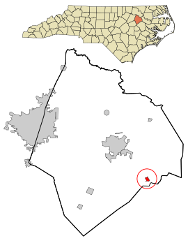 Location in Edgecombe County and the state of North Carolina. | |
| Coordinates: 35°49′2″N 77°27′29″W / 35.81722°N 77.45806°WCoordinates: 35°49′2″N 77°27′29″W / 35.81722°N 77.45806°W | |
| Country | United States |
| State | North Carolina |
| County | Edgecombe |
| Area | |
| • Total | 0.36 sq mi (0.93 km2) |
| • Land | 0.36 sq mi (0.93 km2) |
| • Water | 0.00 sq mi (0.00 km2) |
| Elevation | 49 ft (15 m) |
| Population (2010) | |
| • Total | 294 |
| • Estimate (2019)[4] | 266 |
| • Density | 738.89/sq mi (285.64/km2) |
| Time zone | UTC-5 (Eastern (EST)) |
| • Summer (DST) | UTC-4 (EDT) |
| ZIP code | 27819 |
| Area code(s) | 252 |
| FIPS code | 37-14200[2] |
| GNIS feature ID | 1019753[3] |

Conetoe (/kəˈniːtə/ kə-NEE-tə) is a town in Edgecombe County, North Carolina, United States. It is part of the Rocky Mount, North Carolina Metropolitan Statistical Area. The population was 294 at the 2010 census.
History[]
The Wilkinson-Dozier House and Worsley-Burnette House are listed on the National Register of Historic Places.[5]
Geography[]
Conetoe is located at 35°49′2″N 77°27′29″W / 35.81722°N 77.45806°W (35.817265, -77.458033).[6]
According to the United States Census Bureau, the town has a total area of 0.4 square miles (1.0 km2), all of it land.
Demographics[]
| Historical population | |||
|---|---|---|---|
| Census | Pop. | %± | |
| 1890 | 88 | — | |
| 1900 | 132 | 50.0% | |
| 1910 | 158 | 19.7% | |
| 1920 | 160 | 1.3% | |
| 1930 | 196 | 22.5% | |
| 1940 | 194 | −1.0% | |
| 1950 | 172 | −11.3% | |
| 1960 | 147 | −14.5% | |
| 1970 | 160 | 8.8% | |
| 1980 | 215 | 34.4% | |
| 1990 | 292 | 35.8% | |
| 2000 | 365 | 25.0% | |
| 2010 | 294 | −19.5% | |
| 2019 (est.) | 266 | [4] | −9.5% |
| U.S. Decennial Census[7] | |||
As of the census[2] of 2000, there were 365 people, 125 households, and 90 families residing in the town. The population density was 996.4 people per square mile (380.9/km2). There were 139 housing units at an average density of 379.5 per square mile (145.0/km2). The racial makeup of the town was 35.07% White, 63.56% African American and 1.37% Native American. Hispanic or Latino of any race were 5.48% of the population.
There were 125 households, out of which 30.4% had children under the age of 18 living with them, 48.0% were married couples living together, 18.4% had a female householder with no husband present, and 28.0% were non-families. 24.0% of all households were made up of individuals, and 13.6% had someone living alone who was 65 years of age or older. The average household size was 2.92 and the average family size was 3.47.
In the town, the population was spread out, with 28.8% under the age of 18, 7.9% from 18 to 24, 25.8% from 25 to 44, 23.6% from 45 to 64, and 14.0% who were 65 years of age or older. The median age was 38 years. For every 100 females, there were 85.3 males. For every 100 females age 18 and over, there were 89.8 males.
The median income for a household in the town was $35,227, and the median income for a family was $36,932. Males had a median income of $28,125 versus $24,688 for females. The per capita income for the town was $14,774. About 11.7% of families and 11.8% of the population were below the poverty line, including 12.8% of those under age 18 and 23.3% of those age 65 or over.
References[]
- ^ "2019 U.S. Gazetteer Files". United States Census Bureau. Retrieved July 27, 2020.
- ^ Jump up to: a b "U.S. Census website". United States Census Bureau. Retrieved 2008-01-31.
- ^ "US Board on Geographic Names". United States Geological Survey. 2007-10-25. Retrieved 2008-01-31.
- ^ Jump up to: a b "Population and Housing Unit Estimates". United States Census Bureau. May 24, 2020. Retrieved May 27, 2020.
- ^ "National Register Information System". National Register of Historic Places. National Park Service. July 9, 2010.
- ^ "US Gazetteer files: 2010, 2000, and 1990". United States Census Bureau. 2011-02-12. Retrieved 2011-04-23.
- ^ "Census of Population and Housing". Census.gov. Retrieved June 4, 2015.
| show Municipalities and communities of Edgecombe County, North Carolina, United States |
|---|

| show Authority control |
|---|
- Towns in Edgecombe County, North Carolina
- Towns in North Carolina
- Rocky Mount metropolitan area