Edgecombe County, North Carolina
Edgecombe County | |
|---|---|
U.S. county | |
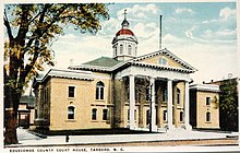 Postcard. Historic Edgecombe County Courthouse in Tarboro, North Carolina. | |
 Location within the U.S. state of North Carolina | |
 North Carolina's location within the U.S. | |
| Coordinates: 35°55′N 77°36′W / 35.91°N 77.6°W | |
| Country | |
| State | |
| Founded | 1741 |
| Named for | Richard Edgcumbe |
| Seat | Tarboro |
| Largest city | Rocky Mount |
| Area | |
| • Total | 507 sq mi (1,310 km2) |
| • Land | 505 sq mi (1,310 km2) |
| • Water | 1.3 sq mi (3 km2) 0.3%% |
| Population | |
| • Estimate (2018) | 52,005 |
| • Density | 112/sq mi (43/km2) |
| Time zone | UTC−5 (Eastern) |
| • Summer (DST) | UTC−4 (EDT) |
| Congressional district | 1st |
| Website | www |

Edgecombe County is a county located in the U.S. state of North Carolina. As of the 2010 Census, the population was 56,552.[1] Its county seat is Tarboro.[2] Edgecombe County is part of the Rocky Mount, North Carolina, Metropolitan Statistical Area.
History[]
The county was formed in 1741 from Bertie County. It was named for Richard Edgcumbe,[3] a Member of Parliament (MP) from 1701 to 1742 and a lord of the treasury, who became 1st Baron Edgcumbe in 1742.
In 1746 part of Edgecombe County became Granville County; in 1758 another portion became Halifax County; and in 1777 yet another part became Nash County. In 1855 the formation of Wilson County from parts of Edgecombe County, Johnston County, Nash County, and Wayne County reduced Edgecombe to its present size, with a minor boundary adjustments.
Edgecombe County was historically home to the Tuscarora Indians. Although most migrated north to New York in the 18th century, descendants of the Tuscarora still live in some parts of the county.
Geography[]
According to the U.S. Census Bureau, the county has a total area of 507 square miles (1,310 km2), of which 505 square miles (1,310 km2) is land and 1.3 square miles (3.4 km2) (0.3%) is water.[4]
Adjacent counties[]
- Halifax County - north
- Martin County - east
- Pitt County - southeast and south
- Wilson County - southwest
- Nash County - west
Major highways[]
Demographics[]
| Historical population | |||
|---|---|---|---|
| Census | Pop. | %± | |
| 1790 | 10,265 | — | |
| 1800 | 10,421 | 1.5% | |
| 1810 | 12,423 | 19.2% | |
| 1820 | 13,276 | 6.9% | |
| 1830 | 14,935 | 12.5% | |
| 1840 | 15,708 | 5.2% | |
| 1850 | 17,189 | 9.4% | |
| 1860 | 17,376 | 1.1% | |
| 1870 | 22,970 | 32.2% | |
| 1880 | 26,181 | 14.0% | |
| 1890 | 24,113 | −7.9% | |
| 1900 | 26,591 | 10.3% | |
| 1910 | 32,010 | 20.4% | |
| 1920 | 37,995 | 18.7% | |
| 1930 | 47,894 | 26.1% | |
| 1940 | 49,162 | 2.6% | |
| 1950 | 51,634 | 5.0% | |
| 1960 | 54,226 | 5.0% | |
| 1970 | 52,341 | −3.5% | |
| 1980 | 55,988 | 7.0% | |
| 1990 | 56,558 | 1.0% | |
| 2000 | 55,606 | −1.7% | |
| 2010 | 56,552 | 1.7% | |
| 2018 (est.) | 52,005 | [5] | −8.0% |
| U.S. Decennial Census[6] 1790-1960[7] 1900-1990[8] 1990-2000[9] 2010-2013[1] | |||
As of the 2010 United States Census, there were 56,552 people living in the county. 57.4% were Black or African American, 38.8% White, 0.3% Native American, 0.2% Asian, 2.3% of some other race and 1.0% of two or more races. 3.7% were Hispanic or Latino (of any race).
As of the census[10] of 2000, there were 55,606 people, 20,392 households, and 14,804 families living in the county. The population density was 110 people per square mile (43/km2). There were 24,002 housing units at an average density of 48 per square mile (18/km2). The racial makeup of the county was 57.46% Black or African American, 40.06% White, 0.20% Native American, 0.13% Asian, 0.01% Pacific Islander, 1.56% from other races, and 0.58% from two or more races. 2.79% of the population were Hispanic or Latino of any race.
There were 20,392 households, out of which 32.80% had children under the age of 18 living with them, 46.20% were married couples living together, 21.50% had a female householder with no husband present, and 27.40% were non-families. 24.00% of all households were made up of individuals, and 10.10% had someone living alone who was 65 years of age or older. The average household size was 2.67 and the average family size was 3.16.
In the county, the population was spread out, with 27.10% under the age of 18, 8.60% from 18 to 24, 28.40% from 25 to 44, 23.40% from 45 to 64, and 12.50% who were 65 years of age or older. The median age was 36 years. For every 100 females there were 86.80 males. For every 100 females age 18 and over, there were 80.80 males.
The median income for a household in the county was $30,983, and the median income for a family was $35,902. Males had a median income of $27,300 versus $21,649 for females. The per capita income for the county was $14,435. About 16.00% of families and 19.60% of the population were below the poverty line, including 27.50% of those under age 18 and 18.40% of those age 65 or over.
Law and government[]
Edgecombe County is a member of the regional .
The North Carolina Department of Corrections previously operated the Fountain Correctional Center for Women in an unincorporated area in the county, near Rocky Mount.[11] It closed in December 2014.[12]
Education[]
Edgecombe County Public Schools has 14 schools ranging from pre-kindergarten to thirteenth grade. These are separated into four high schools, four middle schools, five elementary schools, and 1 K-8 school.[14] It was formed in 1993 from the merger of the old Edgecombe County Schools and Tarboro City Schools systems.[15]
The county is home to Edgecombe Community College with campuses in Tarboro and Rocky Mount.[16]
Communities[]

City[]
- Rocky Mount
Towns[]
- Conetoe
- Leggett
- Macclesfield
- Pinetops
- Princeville
- Sharpsburg
- Speed
- Tarboro (county seat)
- Whitakers
Townships[]
The county is divided into fourteen townships, which are both numbered and named:
- 1 (Tarboro)
- 2 (Lower Conetoe)
- 3 (Upper Conetoe)
- 4 (Deep Creek)
- 5 (Lower Fishing Creek)
- 6 (Upper Fishing Creek)
- 7 (Swift Creek)
- 8 (Sparta)
- 9 (Otter Creek)
- 10 (Lower Town Creek)
- 11 (Walnut Creek)
- 12 (Rocky Mount)
- 13 (Cokey)
- 14 (Upper Town Creek)
Unincorporated communities[]
Notable people[]
- Duncan Lamont Clinch (1787–1849) – born at Ard-Lamont in Edgecombe County, American Army officer in the First and Second Seminole Wars[17]
- Dorsey Pender (1834–1863) – born at Pender's Crossroads in Edgecombe County, Major General in the Confederate Army.
- Josiah Pender (1819-1864) – cousin to Dorsey Pender, who captured Fort Macon from Union soldiers in 1861.
- Hugh Shelton (born 1942) – four-star General and former Chairman of the Joint Chiefs of Staff, appointed by President Clinton.
See also[]
- National Register of Historic Places listings in Edgecombe County, North Carolina
- Edgecombe County serial killer
- Halifax District Brigade#Edgecombe County Regiment
References[]
- ^ Jump up to: a b "State & County QuickFacts". United States Census Bureau. Archived from the original on June 6, 2011. Retrieved October 19, 2013.
- ^ "Find a County". National Association of Counties. Archived from the original on 2012-07-12. Retrieved 2011-06-07.
- ^ Gannett, Henry (1905). The Origin of Certain Place Names in the United States. Govt. Print. Off. pp. 114.
- ^ "2010 Census Gazetteer Files". United States Census Bureau. August 22, 2012. Archived from the original on January 12, 2015. Retrieved January 14, 2015.
- ^ "Population and Housing Unit Estimates". Retrieved July 22, 2019.
- ^ "U.S. Decennial Census". United States Census Bureau. Retrieved January 14, 2015.
- ^ "Historical Census Browser". University of Virginia Library. Retrieved January 14, 2015.
- ^ Forstall, Richard L., ed. (March 27, 1995). "Population of Counties by Decennial Census: 1900 to 1990". United States Census Bureau. Retrieved January 14, 2015.
- ^ "Census 2000 PHC-T-4. Ranking Tables for Counties: 1990 and 2000" (PDF). United States Census Bureau. April 2, 2001. Retrieved January 14, 2015.
- ^ "U.S. Census website". United States Census Bureau. Retrieved 2008-01-31.
- ^ "Fountain Correctional Center for Women." North Carolina Department of Public Safety. December 20, 2014. Retrieved on December 18, 2015. "Street Address 300 Fountain School Road Rocky Mount, N.C. 27804"
- ^ "Closed prisons" (Archive). North Carolina Department of Public Safety. Retrieved on December 18, 2015.
- ^ Leip, David. "Dave Leip's Atlas of U.S. Presidential Elections". uselectionatlas.org. Retrieved 2018-03-15.
- ^ "Edgecombe County Public Schools". North Carolina's School Report Cards. North Carolina Department of Public Instruction. Missing or empty
|url=(help) - ^ Bender, Jaime (July 5, 2003). "Edgecombe schools marks 10 years". The Rocky Mount Telegram.
- ^ "About ECC". Edgecombe Community College. Archived from the original on October 16, 2012. Retrieved January 16, 2013.
- ^ Who Was Who in America, Historical Volume, 1607-1896. Chicago: Marquis Who's Who. 1963.
External links[]
- Official website
 Geographic data related to Edgecombe County, North Carolina at OpenStreetMap
- NCGenWeb Edgecombe County - free genealogy resources for the county
| show Places adjacent to Edgecombe County, North Carolina |
|---|
| show Municipalities and communities of Edgecombe County, North Carolina, United States |
|---|


Coordinates: 35°55′N 77°36′W / 35.91°N 77.60°W
| show Authority control |
|---|
- North Carolina counties
- Edgecombe County, North Carolina
- Rocky Mount metropolitan area
- 1741 establishments in North Carolina
- Populated places established in 1741