Greene County, North Carolina
- Greenville has no relation to Greene County. For the neighboring county that Greenville is in, see Pitt County.
Greene County | |
|---|---|
U.S. county | |
 | |
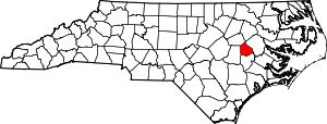 Location within the U.S. state of North Carolina | |
 North Carolina's location within the U.S. | |
| Coordinates: 35°29′N 77°41′W / 35.49°N 77.68°W | |
| Country | |
| State | |
| Founded | 1791 |
| Named for | Nathanael Greene |
| Seat | Snow Hill |
| Largest town | Snow Hill |
| Area | |
| • Total | 266 sq mi (690 km2) |
| • Land | 266 sq mi (690 km2) |
| • Water | 0.5 sq mi (1 km2) 0.2%% |
| Population | |
| • Estimate (2018) | 21,012 |
| • Density | 80/sq mi (30/km2) |
| Time zone | UTC−5 (Eastern) |
| • Summer (DST) | UTC−4 (EDT) |
| Congressional district | 1st |
| Website | www |

Greene County is a county located in the U.S. state of North Carolina. As of the 2010 Census, the population was 21,362.[1] Its county seat is Snow Hill.[2]
History[]
Greene County, being a part of land grant by King Charles II of England in 1663, was first settled around 1710 by immigrants from Maryland, Virginia, and parts of North Carolina. The original inhabitants of the area, the Tuscarora Indians, fought with these immigrants and on March 20–23, 1713, a fighting force of South Carolinians and Yamasee Indians, under Colonel Murice Moore, defeated the Tuscarora, under the leadership of Chief Hancock. This was the final major battle of the Tuscarora War at Fort Neoheroka near current day Snow Hill.
In 1758, the area now recognized as Greene and Lenoir Counties was separated from Johnston and named Dobbs for the Royal Governor. The county was formed in 1791 from the northern part of Dobbs County. It was originally named Glasgow County, for James Glasgow, North Carolina Secretary of State from 1777 to 1798. In 1799, Glasgow's involvement in military land grant frauds forced him to resign and leave the state. Glasgow County was then renamed Greene County in honor of Nathanael Greene, one of General Washington's right-hand men.
The county seat, Snow Hill, is the largest town and major commercial center in the county. The town draws its name from the historic white sandy banks of nearby Contentnea Creek.[3]
Former Greene County[]
Present-day Greene County is the second county of that name in North Carolina. The first (also named for Nathanael Greene) is now Greene County, Tennessee. It was established in 1783, in what was then the western part of the state. That area was ceded to the federal government and became part of the Southwest Territory (1790–1796) and the State of Tennessee (after 1796).
Geography[]
According to the U.S. Census Bureau, the county has a total area of 266 square miles (690 km2), of which 266 square miles (690 km2) is land and 0.5 square miles (1.3 km2) (0.2%) is water.[4]
Adjacent counties[]
- Pitt County - northeast and east
- Wilson County - northwest
- Lenoir County - south
- Wayne County - west
Demographics[]
| Historical population | |||
|---|---|---|---|
| Census | Pop. | %± | |
| 1800 | 4,218 | — | |
| 1810 | 4,867 | 15.4% | |
| 1820 | 4,533 | −6.9% | |
| 1830 | 6,413 | 41.5% | |
| 1840 | 6,595 | 2.8% | |
| 1850 | 6,619 | 0.4% | |
| 1860 | 7,925 | 19.7% | |
| 1870 | 8,687 | 9.6% | |
| 1880 | 10,037 | 15.5% | |
| 1890 | 10,039 | 0.0% | |
| 1900 | 12,038 | 19.9% | |
| 1910 | 13,083 | 8.7% | |
| 1920 | 16,212 | 23.9% | |
| 1930 | 18,656 | 15.1% | |
| 1940 | 18,548 | −0.6% | |
| 1950 | 18,024 | −2.8% | |
| 1960 | 16,741 | −7.1% | |
| 1970 | 14,967 | −10.6% | |
| 1980 | 16,117 | 7.7% | |
| 1990 | 15,384 | −4.5% | |
| 2000 | 18,974 | 23.3% | |
| 2010 | 21,362 | 12.6% | |
| 2018 (est.) | 21,012 | [5] | −1.6% |
| U.S. Decennial Census[6] 1790-1960[7] 1900-1990[8] 1990-2000[9] 2010-2013[1] | |||
As of the census[10] of 2000, there were 18,975 people, 6,696 households, and 4,955 families residing in the county. The population density was 72 people per square mile (28/km2). There were 7,368 housing units at an average density of 28 per square mile (11/km2). The racial makeup of the county was 51.83% White, 41.21% Black or African American, 0.30% Native American, 0.09% Asian, 0.01% Pacific Islander, 5.75% from other races, and 0.80% from two or more races. 7.96% of the population were Hispanic or Latino of any race.
There were 6,696 households, out of which 34.30% had children under the age of 18 living with them, 52.10% were married couples living together, 17.30% had a female householder with no husband present, and 26.00% were non-families. 22.60% of all households were made up of individuals, and 10.00% had someone living alone who was 65 years of age or older. The average household size was 2.65 and the average family size was 3.09.
In the county, the population was spread out, with 25.30% under the age of 18, 9.40% from 18 to 24, 30.90% from 25 to 44, 22.30% from 45 to 64, and 12.10% who were 65 years of age or older. The median age was 36 years. For every 100 females there were 105.70 males. For every 100 females age 18 and over, there were 103.90 males.
The median income for a household in the county was $32,074, and the median income for a family was $36,419. Males had a median income of $27,048 versus $21,351 for females. The per capita income for the county was $15,452. About 16.00% of families and 20.20% of the population were below the poverty line, including 28.30% of those under age 18 and 20.50% of those age 65 or over.
Communities[]

Towns[]
- Hookerton
- Snow Hill (county seat)
- Walstonburg
Census-designated place[]
Unincorporated community[]
Townships[]
- Bull Head
- Carrs
- Hookerton
- Jason
- Olds
- Ormondsville
- Shine
- Snow Hill
- Speights Bridge
Politics[]
Prior to the 1965 Voting Rights Act, Greene County was an overwhelmingly Democratic “Solid South” bastion. Between 1932 and 1956, every Democratic nominee reached 93.5 percent of the county's vote, and up to 1960 Herbert Hoover in the religiously polarized 1928 election had been the only post-disfranchisement Republican to pass 22 percent of the county's vote. Unlike the Black Belts of the Deep South, Greene County completely resisted the Dixiecrat movement of 1948 to be only 0.07 percent shy of Texas’ Duval County as Harry Truman’s strongest in the country,[11] and in 1952 it was indeed Adlai Stevenson II’s strongest county in his landslide loss to Dwight D. Eisenhower,[12] besides being his strongest behind Georgia’s Baker County in 1956.[13] However, anger at the social engineering[dubious ] of the Lyndon Johnson administration turned the county over to George Wallace in the 1968 presidential election, and Richard Nixon became the first Republican winner since Benjamin Harrison in 1888[14] with 75 percent of the vote in 1972. Since then, Greene County has gradually become Republican-leaning: the last Democratic Presidential candidate to carry the county was Bill Clinton in 1992, although no Democrat except McGovern and Humphrey has fallen under 40 percent.
Despite having voted Republican in six consecutive presidential elections, Greene County is represented by Democratic Senator Don Davis in the North Carolina Senate.
Law and government[]
Greene County is a member of the regional .
Education[]
Schools is Greene County are administered by the Greene County Public School system. The five schools include Greene Central High School, Greene Early College High School, Greene County Middle School, Snow Hill Primary School and West Greene Elementary School.[16] Higher education is provided through nearby East Carolina University or community colleges located in Goldsboro, Greenville and Kinston. One private school, Mt. Calvary Christian Academy, is also located in the county.
Transportation[]
Major highways[]
The major highways that run through the county are US 264 and US 13. Other highways include US 258, NC 903, NC58, NC 102 and NC 91. The closest interstate is I-795, located west of the county in Goldsboro.
Airport[]
The closest airport to Greene County is Pitt-Greenville Airport (IATA: PGV, ICAO: KPGV, FAA LID: PGV) with service to Charlotte Douglas International Airport, although most residents use Raleigh-Durham International Airport for domestic and international travel.
See also[]
References[]
- ^ Jump up to: a b "State & County QuickFacts". United States Census Bureau. Archived from the original on June 6, 2011. Retrieved October 19, 2013.
- ^ "Find a County". National Association of Counties. Archived from the original on 2011-05-31. Retrieved 2011-06-07.
- ^ Greene County – History Archived 2008-04-01 at the Wayback Machine
- ^ "2010 Census Gazetteer Files". United States Census Bureau. August 22, 2012. Archived from the original on January 12, 2015. Retrieved January 17, 2015.
- ^ "Population and Housing Unit Estimates". Retrieved July 22, 2019.
- ^ "U.S. Decennial Census". United States Census Bureau. Retrieved January 17, 2015.
- ^ "Historical Census Browser". University of Virginia Library. Retrieved January 17, 2015.
- ^ Forstall, Richard L., ed. (March 27, 1995). "Population of Counties by Decennial Census: 1900 to 1990". United States Census Bureau. Retrieved January 17, 2015.
- ^ "Census 2000 PHC-T-4. Ranking Tables for Counties: 1990 and 2000" (PDF). United States Census Bureau. April 2, 2001. Retrieved January 17, 2015.
- ^ "U.S. Census website". United States Census Bureau. Retrieved 2008-01-31.
- ^ Dave Leip’s U.S. Election Atlas; 1948 Presidential Election Statistics
- ^ Dave Leip’s U.S. Election Atlas; 1952 Presidential Election Statistics
- ^ Dave Leip’s U.S. Election Atlas; 1956 Presidential Election Statistics
- ^ Menendez, Albert J.; The Geography of Presidential Elections in the United States, 1868-2004, pp. 265-270 ISBN 0786422173
- ^ Leip, David. "Dave Leip's Atlas of U.S. Presidential Elections". uselectionatlas.org. Retrieved 2018-03-15.
- ^ Greene County Schools Archived 2012-05-27 at the Wayback Machine
External links[]
- Greene County, NC Chamber of Commerce
- Greene County government official website
- Snow Hill, NC – County Seat of Greene County, NC
- Contentnea Development Partnership, Non Profit Economic Development Agency Serving Greene County NC
| show Places adjacent to Greene County, North Carolina |
|---|
| show Municipalities and communities of Greene County, North Carolina, United States |
|---|


Coordinates: 35°29′N 77°41′W / 35.49°N 77.68°W
| show Authority control |
|---|
- North Carolina counties
- Greene County, North Carolina
- Greenville, North Carolina metropolitan area
- 1791 establishments in North Carolina
- Populated places established in 1791