Cynthiana, Kentucky
Cynthiana, Kentucky | |
|---|---|
City | |
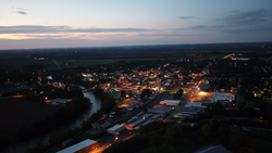 City of Cynthiana at Sunset | |
 Location of Cynthiana in Harrison County, Kentucky. | |
| Coordinates: 38°23′18″N 84°17′49″W / 38.38833°N 84.29694°WCoordinates: 38°23′18″N 84°17′49″W / 38.38833°N 84.29694°W | |
| Country | United States |
| State | Kentucky |
| County | Harrison |
| Government | |
| • Mayor | James Smith |
| Area | |
| • Total | 4.44 sq mi (11.50 km2) |
| • Land | 4.39 sq mi (11.37 km2) |
| • Water | 0.05 sq mi (0.14 km2) |
| Elevation | 735 ft (224 m) |
| Population (2010) | |
| • Total | 6,402 |
| • Estimate (2019)[1] | 6,337 |
| • Density | 1,443.84/sq mi (557.47/km2) |
| Time zone | UTC−5 (EST) |
| • Summer (DST) | UTC−4 (EDT) |
| ZIP Code | 41031 |
| Area code(s) | 859 |
| FIPS code | 21-19432 |
| GNIS feature ID | 0490519 |
| Website | www |


Cynthiana is a home rule-class city[3] in Harrison County, Kentucky, in the United States. The population was 6,402 at the 2010 census.[4] It is the seat of its county.[5]
History[]
Cynthiana was named after Cynthia and Anna Harrison,[6] daughters of Robert Harrison, who had donated land for its establishment,[7] though Harrison County was named after Colonel Benjamin Harrison, who was an early settler in the area and the sheriff of Bourbon County.[8]
Two Civil War battles were fought in Cynthiana; the first on July 17, 1862, was part of a raid into Kentucky by Confederate General John Hunt Morgan; the second on June 11 and 12, 1864, resulted in defeat of Confederate forces on Morgan's last raid into the state.[9][10]
On January 23, 1877, an LL chondrite meteorite fell in Cynthiana.[11]
March 2, 1997, the South Fork of the Licking River which bisects Cynthiana flooded, causing extensive damage in Cynthiana and neighboring communities.
In March, 2020, Cynthiana had the first case of COVID-19 in Kentucky.[12]
Geography[]
Cynthiana is located in southern Harrison County at 38°23′18″N 84°17′49″W / 38.38833°N 84.29694°W (38.388292, -84.296841).[13] U.S. Routes 27 and 62 pass through the city, passing west of the downtown area. US 27 leads north 56 miles (90 km) to Cincinnati and south 14 miles (23 km) to Paris, while US 62 leads northeast 46 miles (74 km) to Maysville and southwest 21 miles (34 km) to Georgetown. Lexington is 31 miles (50 km) to the southwest via US 27 or 29 miles (47 km) via Kentucky Route 353.
According to the United States Census Bureau, the city has a total area of 4.1 square miles (10.5 km2), of which 4.0 square miles (10.4 km2) are land and 0.04 square miles (0.1 km2), or 1.09%, are water.[4] The South Fork of the Licking River, a tributary of the Ohio River, flows south to north through the city, passing west of the downtown area.
Climate[]
The climate in this area is characterized by hot, humid summers and generally mild to cool winters. According to the Köppen Climate Classification system, Cynthiana has a humid subtropical climate, abbreviated "Cfa" on climate maps.[14]
Transportation[]
U.S. Highways[]
 US 27 is known otherwise as Paris Pike (going south from Cynthiana), and Falmouth Road (going north from Cynthiana).
 US 62 is known otherwise as Leesburg Rd (going west from Cynthiana), and Oddville Pike (going east from Cynthiana).
Kentucky state highways[]
 KY 36 is also known locally as Williamstown Road (west of Cynthiana) and Millersburg Pike (east of Cynthiana).
 KY 32 is also known locally as Connersville Pike (southwest of Cynthiana) and Millersburg Pike (east of Cynthiana). KY 32 and KY 36 merge downtown and leave Cynthiana concurrently.
 is also known as White Oak Road.
Education[]
Cynthiana is served by the Harrison County School District with a total of seven public schools located within the county limits:
- High schools:
- Harrison County High School
- Technical Schools
- KY Tech Harrison Area Technology Center (ATC)
- Middle schools:
- Harrison County Middle School
- Elementary schools:
- Eastside Elementary
- Westside Elementary
- Northside Elementary
- Southside Elementary
Cynthiana has one private school:
- St. Edward School (Pre-k-5)
Maysville Community and Technical College]has an extended campus located in Cynthiana
- Maysville Community and Technical College: Licking Valley Campus
Cynthiana has a public library, the Cynthiana-Harrison Public Library.[15]
Demographics[]
| Historical population | |||
|---|---|---|---|
| Census | Pop. | %± | |
| 1800 | 78 | — | |
| 1810 | 369 | 373.1% | |
| 1830 | 975 | — | |
| 1840 | 798 | −18.2% | |
| 1860 | 1,237 | — | |
| 1870 | 1,771 | 43.2% | |
| 1880 | 2,101 | 18.6% | |
| 1890 | 3,016 | 43.6% | |
| 1900 | 3,257 | 8.0% | |
| 1910 | 3,603 | 10.6% | |
| 1920 | 3,857 | 7.0% | |
| 1930 | 4,386 | 13.7% | |
| 1940 | 4,840 | 10.4% | |
| 1950 | 4,847 | 0.1% | |
| 1960 | 5,641 | 16.4% | |
| 1970 | 6,356 | 12.7% | |
| 1980 | 5,881 | −7.5% | |
| 1990 | 6,497 | 10.5% | |
| 2000 | 6,258 | −3.7% | |
| 2010 | 6,402 | 2.3% | |
| 2019 (est.) | 6,337 | [1] | −1.0% |
| U.S. Decennial Census[16] | |||
As of the census[17] of 2000, there were 6,258 people, 2,692 households, and 1,639 families residing in the city. The population density was 1,873.6 people per square mile (723.4/km2). There were 2,909 housing units at an average density of 870.9 per square mile (336.3/km2). The racial makeup of the city was 92.43% White, 5.29% Black or African American, 0.16% Native American, 0.18% Asian, 0.05% Pacific Islander, 0.81% from other races, and 1.09% from two or more races. Hispanic or Latino of any race were 1.41% of the population.
There were 2,692 households, out of which 27.3% had children under the age of 18 living with them, 42.2% were married couples living together, 14.9% had a female householder with no husband present, and 39.1% were non-families. 36.0% of all households were made up of individuals, and 18.7% had someone living alone who was 65 years of age or older. The average household size was 2.24 and the average family size was 2.89.
In the city, the population was spread out, with 22.7% under the age of 18, 9.0% from 18 to 24, 26.3% from 25 to 44, 21.9% from 45 to 64, and 20.1% who were 65 years of age or older. The median age was 40 years. For every 100 females, there were 80.9 males. For every 100 females age 18 and over, there were 77.3 males.
The median income for a household in the city was $28,519, and the median income for a family was $34,691. Males had a median income of $27,704 versus $20,659 for females. The per capita income for the city was $15,227. About 13.3% of families and 16.1% of the population were below the poverty line, including 23.1% of those under age 18 and 11.7% of those age 65 or over.
Economy[]
3M established a factory in Cynthiana in 1969. Post-it notes were developed in 1972 by Arthur Fry and Spencer Silver. Until patents expired in the late 1990s, the 3M factory in Cynthiana was the only production site of Post-it notes worldwide. Today, it still accounts for nearly all of the world's production.[18]
Media[]
Newspaper[]
The Cynthiana Democrat, owned by Landmark Community Newspaper Inc. Subscription-based weekly newspaper, printed every Thursday with in-home delivery. Has been in print since 1868. Also is available at www.cynthianademocrat.com
Radio[]
| Call sign | Frequency | Format | Description / Notes |
|---|---|---|---|
| WCYN-AM | 1400 kHz | Classic hits | |
| WCYN-FM | 102.3 MHz | Country music | owned by Cumulus Media |
Notable people[]
- Celia Ammerman, model and star of America's Next Top Model (cycle 12)
- William Tell Coleman, founder of the Harmony Borax Works, Death Valley, California
- Johnny Gruelle, creator of Raggedy Ann and Raggedy Andy
- Richard Gruelle, painter and member of the Hoosier Group
- Joe B. Hall, University of Kentucky men's basketball coach 1972–85; coached Wildcats to 1978 national championship
- Robert Kirkman, comic book writer, co-creator of The Walking Dead[19]
- William McKinney, jazz drummer and bandleader
- Tony Moore, comic book artist
- Betty Pariso, IFBB professional bodybuilder
- , Emeritus Professor of Organic Geochemistry at Oregon State University
- Lawrence Pressman, actor
- Pythias Russ, baseball player in the Negro leagues
- Walter E. Scott, namesake of Death Valley National Park's Scotty's Castle
- Marcus A. Smith, United States Senator from Arizona
- Chris Snopek, Major League Baseball player
- Mac Swinford, federal judge
- Phil Wagner, retired American professional basketball player who spent one season (1968–69) in the American Basketball Association for the Indiana Pacers
- Justin Wells, country and roots rock musician
- Caleb Walton West, last governor of Utah Territory
In popular culture[]
- In the film Blues Brothers 2000, The Blues Brothers band goes to Cynthiana Kentucky to perform a bluegrass concert, where they perform the song Ghost Riders in the Sky.
- In the comic book series The Walking Dead, the main character, Sheriff's Deputy Rick Grimes, wakes up in a nearby abandoned hospital to discover that his hometown of Cynthiana has been overrun with zombies and nearly the entire town's population has been killed or evacuated.[20]
References[]
- ^ Jump up to: a b "Population and Housing Unit Estimates". United States Census Bureau. May 24, 2020. Retrieved May 27, 2020.
- ^ "2019 U.S. Gazetteer Files". United States Census Bureau. Retrieved July 24, 2020.
- ^ "Summary and Reference Guide to House Bill 331 City Classification Reform" (PDF). Kentucky League of Cities. Retrieved December 30, 2014.
- ^ Jump up to: a b "Geographic Identifiers: 2010 Demographic Profile Data (G001): Cynthiana city, Kentucky". American Factfinder. U.S. Census Bureau. Retrieved June 29, 2017.[dead link]
- ^ "Find a County". National Association of Counties. Archived from the original on 2011-05-31. Retrieved 2011-06-07.
- ^ Gannett, Henry (1905). The Origin of Certain Place Names in the United States. Govt. Print. Off. p. 98.
- ^ Rennick, Robert M. (1987). Kentucky Place Names. University Press of Kentucky. p. 77. Retrieved 2013-04-28.
- ^ Collins, Lewis (1877). History of Kentucky. p. 321.
- ^ "Civil War in Kentucky". www.trailsrus.com. Retrieved 12 April 2018.
- ^ Penn, William A. (2016). Kentucky Rebel Town: Civil War Battles of Cynthiana and Harrison County. Lexington: Univ. Press of Kentucky. pp. 105, 175, 193, 205. ISBN 9780813167718.
- ^ "A Chapter in the history of Meteorites by Walter Flight". www.meteoritehistory.info. Retrieved 12 April 2018.
- ^ "A small town takes a big hit after coronavirus is confirmed in its midst". March 12, 2020.
- ^ "US Gazetteer files: 2010, 2000, and 1990". United States Census Bureau. 2011-02-12. Retrieved 2011-04-23.
- ^ "Cynthiana, Kentucky Köppen Climate Classification (Weatherbase)". Weatherbase. Retrieved 12 April 2018.
- ^ "Kentucky Public Library Directory". Kentucky Department for Libraries and Archives. Archived from the original on 11 January 2019. Retrieved 5 June 2019.
- ^ "Census of Population and Housing". Census.gov. Retrieved June 4, 2015.
- ^ "U.S. Census website". United States Census Bureau. Retrieved 2008-01-31.
- ^ "KY Plant makes the most Post-It Notes in the world". WRDB News. 13 July 2014. Retrieved 30 January 2019.
- ^ Sloan, Scott (2010-10-28). "Kentuckian's zombie comic strip leads to AMC series". Lexington Herald-Leader. Retrieved 2011-10-29.
- ^ "The Walking Dead: Q&A with Sarah Wayne Callies (Lori Grimes); Another Clip from Episode 3.05 - Say The Word - Dread Central". www.dreadcentral.com. Retrieved 12 April 2018.
External links[]
| Wikimedia Commons has media related to Cynthiana, Kentucky. |
| show Municipalities and communities of Harrison County, Kentucky, United States |
|---|

| show County seats in Kentucky |
|---|
| show Authority control |
|---|
- Cities in Kentucky
- Cities in Harrison County, Kentucky
- County seats in Kentucky