Harrodsburg, Kentucky
Harrodsburg, Kentucky | |
|---|---|
City | |
 Downtown Harrodsburg, 2007 | |
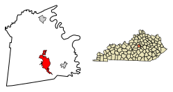 Location of Harrodsburg in Mercer County, Kentucky. | |
 Harrodsburg Location | |
| Coordinates: 37°45′50″N 84°50′46″W / 37.76389°N 84.84611°WCoordinates: 37°45′50″N 84°50′46″W / 37.76389°N 84.84611°W | |
| Country | United States |
| State | Kentucky |
| County | Mercer |
| Founded | June 16, 1774 |
| Incorporated | March 1, 1836 |
| Named for | James Harrod |
| Government | |
| • Mayor | Art Freeman |
| Area | |
| • Total | 6.94 sq mi (17.98 km2) |
| • Land | 6.92 sq mi (17.93 km2) |
| • Water | 0.02 sq mi (0.05 km2) |
| Elevation | 850 ft (260 m) |
| Population (2010) | |
| • Total | 8,340 |
| • Estimate (2019)[2] | 8,533 |
| • Density | 1,232.91/sq mi (476.01/km2) |
| Time zone | UTC-5 (Eastern (EST)) |
| • Summer (DST) | UTC-4 (EDT) |
| ZIP code | 40330 |
| Area code(s) | 859 |
| FIPS code | 21-34966 |
| GNIS feature ID | 0493831 |
| Website | harrodsburgcity.org |


Harrodsburg is a home rule-class city[3] in Mercer County, Kentucky, United States. It is the seat of its county.[4] The population was 8,340 at the 2010 census.
Although Harrodsburg was formally established by the House of Burgesses after Boonesborough and was not incorporated by the Kentucky legislature until 1836,[5] it is usually considered the oldest city in Kentucky and has been honored as the oldest permanent American settlement west of the Appalachians.
History[]
Harrodstown (sometimes Harrod's Town) was laid out and founded by James Harrod on June 16, 1774.[6][7] Harrod led a company of adventurers totaling thirty-one men, beginning May 25 at Fort Redstone in Pennsylvania,[8] down the Monongahela and Ohio rivers in canoes and through a series of other rivers and creeks to the town's present-day location.[9]
Later that same year, amid Dunmore's War, Lord Dunmore sent two men to warn the surveyors of imminent Shawnee attacks, Daniel Boone and Michael Stoner, who are said to have completed the round trip of eight hundred miles in 64 days.[10] Regardless, the pioneers remained for a few weeks until a man was killed by the Natives, at which point, the settlement was abandoned and resettled the following year by March. It was one of three settlements in present day Kentucky at the time the Thirteen Colonies declared independence in 1776, along with Logan's Fort and Boonesborough. Also known as Oldtown, Harrodstown was the first seat of Virginia's Kentucky (1776), Lincoln (1780), and Mercer (1785) counties upon their formations.[11] It remains the seat of Mercer County in Kentucky.
A census taken between Dec. 16, 1777 and Oct. 16, 1778[9] lists 52 residents, several of which were well-known pioneers and frontiersmen, including Daniel Boone's younger brother, Squire Boone, Silas Harlan, the Kentucky county's namesake,[12] James Harrod, Hugh McGary, Isaac Hite and his cousins, Isaac and John Bowman,[9] and David Glenn, who later travelled further west and settled in Yellow Banks (present Daviess County).[13] David Glenn, along with his brother Thomas, and Silas Harlan, with his brother James, had accompanied Harrod on his initial expedition in 1774.[9]
The settlement was formally established by the Virginia General Assembly in 1785 as Harrodsburg.[6] Four years later, it was named the location for the newly created United States District Court for the District of Kentucky by the Judiciary Act of 1789.[14] The Kentucky General Assembly incorporated Harrodsburg in 1836.[5]
During the Civil War, the town was pro-Confederate[11] but Union control permitted the organization 2 Union regiments, the 19th Regiment Kentucky Volunteer Infantry and the 11th Regiment Kentucky Volunteer Cavalry. The 19th Infantry as organized at nearby Camp Harwood for a three-year enlistment commencing January 2, 1862, under the command of Col. William J. Landram. Companies A, C, D, and F of the 11th Kentucky Cavalry were organized at Harrodsburg, Kentucky, in July 1862. The remainder of the regiment was organized in Louisville, Kentucky, and mustered in on September 26, 1862, and mustered in for three years under the command of Colonel Alexander W. Holeman. Following the Battle of Perryville, much of the city was converted into makeshift hospitals; 1600 sick and wounded Confederate soldiers were captured during a raid by the 9th Kentucky Cavalry under Lt Col. John Boyle on October 10, 1862. The city then remained under martial law for the remainder of the war.[11]
The Louisville Southern Railroad (LS) network reached the city in 1888. Louisville Southern Railway's construction commenced in 1884 and ran from Louisville through Shelbyville and Lawrenceburg to Harrodsburg, which was reached in 1888. A spur was constructed to Burgin, where the Louisville Southern joined the Cincinnati Southern's Cincinnati, New Orleans and Texas Pacific Railway CNO&TP mainline. Now all run and operated by Norfolk Southern Railway.
Pioneer Memorial Park (now Old Fort Harrod State Park) was opened on June 16, 1927. In 1936, president Franklin Delano Roosevelt honored the city with a monument honoring the 'first permanent settlement west of the Appalachians'.[11]
Company D of the 192nd Tank Battalion in the Battle of Bataan was from Harrodsburg.[15]
Geography[]
Harrodsburg is located at 37°45′50″N 84°50′46″W / 37.76389°N 84.84611°W (37.764019, -84.845974).[16] According to the United States Census Bureau, the city has a total area of 5.3 sq mi (13.7 km2), all land.
Transportation[]
U.S. 127 runs North-South through Harrodsburg. U.S. 127 Bypass goes around Harrodsburg. U.S. 68 runs East-West through Harrodsburg, but U.S. 68 turns onto U.S. 127 some of the time in Harrodsburg. SR 152 also runs East-West through Harrodsburg.
These are the following routes that runs through Harrodsburg.
Climate[]
Harrodsburg is in the humid subtropical climate zone, although verging on a humid continental climate.[17] Summers are hot and humid, and winters are cool with mild periods.
Average high is 87 °F in July and August, the warmest months, with the average lows of 26 °F in January, the coolest month. The highest recorded temperature was 105 °F in September 1954. The lowest recorded temperature was −18 °F in January 1985. Average annual precipitation is 45.73 inches (1,162 mm), with the wettest month being May, averaging 4.68 inches (119 mm).[18]
| hideClimate data for Harrodsburg, Kentucky | |||||||||||||
|---|---|---|---|---|---|---|---|---|---|---|---|---|---|
| Month | Jan | Feb | Mar | Apr | May | Jun | Jul | Aug | Sep | Oct | Nov | Dec | Year |
| Average high °F | 41 | 46 | 56 | 66 | 74 | 82 | 86 | 85 | 79 | 68 | 56 | 44 | 65 |
| Average low °F | 24 | 27 | 34 | 44 | 54 | 63 | 67 | 65 | 57 | 46 | 36 | 28 | 45 |
| Average precipitation inches | 3.36 | 3.52 | 4.28 | 3.81 | 4.68 | 4.29 | 4.56 | 3.85 | 3.09 | 2.95 | 3.45 | 3.89 | 45.73 |
| Average high °C | 5 | 8 | 13 | 19 | 23 | 28 | 30 | 29 | 26 | 20 | 13 | 7 | 18 |
| Average low °C | −4 | −3 | 1 | 7 | 12 | 17 | 19 | 18 | 14 | 8 | 2 | −2 | 7 |
| Average precipitation mm | 85 | 89 | 109 | 97 | 119 | 109 | 116 | 98 | 78 | 75 | 88 | 99 | 1,162 |
| Source: The Weather Channel[19] | |||||||||||||
Demographics[]

| Historical population | |||
|---|---|---|---|
| Census | Pop. | %± | |
| 1800 | 122 | — | |
| 1810 | 313 | 156.6% | |
| 1830 | 1,051 | — | |
| 1840 | 1,254 | 19.3% | |
| 1850 | 1,481 | 18.1% | |
| 1860 | 1,668 | 12.6% | |
| 1870 | 2,205 | 32.2% | |
| 1880 | 2,202 | −0.1% | |
| 1890 | 3,230 | 46.7% | |
| 1900 | 2,876 | −11.0% | |
| 1910 | 3,147 | 9.4% | |
| 1920 | 3,765 | 19.6% | |
| 1930 | 4,029 | 7.0% | |
| 1940 | 4,673 | 16.0% | |
| 1950 | 5,262 | 12.6% | |
| 1960 | 6,061 | 15.2% | |
| 1970 | 6,741 | 11.2% | |
| 1980 | 7,265 | 7.8% | |
| 1990 | 7,335 | 1.0% | |
| 2000 | 8,014 | 9.3% | |
| 2010 | 8,340 | 4.1% | |
| 2019 (est.) | 8,533 | [2] | 2.3% |
| U.S. Decennial Census[20] | |||
As of the census[21] of 2000, there were 8,014 people, 3,449 households, and 2,234 families residing in the city. The population density was 1,510.5/sq mi (583.2/km2). There were 3,709 housing units at an average density of 699.1/sq mi (269.9/km2). The racial makeup of the city was 88.92% White, 7.52% African American, 0.14% Native American, 0.76% Asian, 0.02% Pacific Islander, 1.14% from other races, and 1.50% from two or more races. Hispanics or Latinos of any race were 2.15% of the population.
There were 3,449 households, out of which 31.3% had children under the age of 18 living with them, 45.4% were married couples living together, 15.3% had a female householder with no husband present, and 35.2% were non-families. 32.1% of all households were made up of individuals, and 16.6% had someone living alone who was 65 years of age or older. The average household size was 2.32 and the average family size was 2.91.
The age distribution was 25.1% under the age of 18, 9.0% from 18 to 24, 28.2% from 25 to 44, 20.9% from 45 to 64, and 16.8% who were 65 years of age or older. The median age was 36 years. For every 100 females, there were 85.7 males. For every 100 females age 18 and over, there were 79.8 males.
The median income for a household in the city was US $27,500, and the median income for a family was $34,503. Males had a median income of $31,214 versus $21,216 for females. The per capita income for the city was $15,327. About 14.2% of families and 17.1% of the population were below the poverty line, including 21.1% of those under age 18 and 13.2% of those age 65 or over.
Education[]
Public education is provided by the Mercer County School District. The following list consists of the schools located within the district:[22]
- Harrodsburg Area Technology Center
- Mercer County Senior High School
- Kenneth D. King Middle School
- Mercer County Intermediate School
- Mercer County Elementary School
- Harlow Early Learning Center
Conover Education Center (Campbellsville University Branch) of Harrodsburg
The Harrodsburg Independent Schools, which operated , merged into the Mercer County Schools in 2006.[23]
Harrodsburg has a lending library, the Mercer County Public Library.[24]
Harrodsburg's Beaumont Inn (1917–present) was known as the Christian Baptist School (1830–1833); Greeneville Institute (1841–1856); Daughters' College (1856–1893);[7] Young Ladies College (1893–1894); Beaumont College (1895–1915); and Daughters' College (1916); prior to becoming Beaumont Inn. The following provides a history of Beaumont Inn: https://beaumontinn.com/history-of-beaumont-inn/
Economy[]
- Hitachi Automotive Products is based in Harrodsburg
- Corning Incorporated has a plant located in Harrodsburg that makes Gorilla Glass
Sister city[]
- Unnao, India
Notable people[]
- Ralph G. Anderson, founder Belcan Corporation, philanthropist
- Jane T. H. Cross (1817–1870), author
- Maria T. Daviess (1814–1896), author; grandmother of Maria Thompson Daviess
- Maria Thompson Daviess (1872–1924), author
- Jason Dunn, National Football League player
- David Winfield Huddleston, Christian author and minister
- Rachel Jackson, wife of President Andrew Jackson
- Frances Wisebart Jacobs, philanthropist
- Dennis Johnson, National Football League player
- William Logan, politician
- Beriah Magoffin, Governor of Kentucky (1859 − 1862) and namesake of Magoffin County, Kentucky
- William Sullivan, politician and lawyer
- John Burton Thompson, politician
- Al Wilson, actor and stunt pilot
- Craig Yeast, National Football League player
See also[]
References[]
- ^ "2019 U.S. Gazetteer Files". United States Census Bureau. Retrieved July 24, 2020.
- ^ Jump up to: a b "Population and Housing Unit Estimates". United States Census Bureau. May 24, 2020. Retrieved May 27, 2020.
- ^ "Summary and Reference Guide to House Bill 331 City Classification Reform" (PDF). Kentucky League of Cities. Retrieved December 30, 2014.
- ^ "Find a County". National Association of Counties. Retrieved 2011-06-07.
- ^ Jump up to: a b Commonwealth of Kentucky. Office of the Secretary of State. Land Office. "Harrodsburg, Kentucky". Accessed 30 July 2013.
- ^ Jump up to: a b Rennick, Robert M. (1987). Kentucky Place Names. University Press of Kentucky. p. 132. ISBN 0813126312. Retrieved 28 April 2013.
- ^ Jump up to: a b Chisholm, Hugh, ed. (1911). . Encyclopædia Britannica. 13 (11th ed.). Cambridge University Press. p. 27.
- ^ http://homepages.rootsweb.com/~george/johnsgermnotes/germhs26.html. Missing or empty
|title=(help) - ^ Jump up to: a b c d Collins, Lewis (1877). Collins' Historical Sketches of Kentucky. Richard H. Collins. pp. 517, 624.
- ^ Charleston, Max. "The Oldest Town in Kentucky".
- ^ Jump up to: a b c d Kleber, John E. (1992). The Kentucky Encyclopedia. Lexington KY: The University Press of Kentucky. ISBN 0-8131-1772-0.
- ^ Rennick, Robert (1984). Kentucky Place Names. University Press of Kentucky. p. 131. ISBN 0813126312.
- ^ History of Daviess County, Kentucky. Together with Sketches of Its Cities, Villages and Townships, Educational, Religious, Civil, Military, and Political History; Portraits of Prominent Persons, Biographies of Representative Citizens. And an Outline History of Kentucky. Chicago Inter-State Publishing Co. 1883. pp. 54, 556.
- ^ "Statutes at Large, 1st Congress, 1st Session". A Century of Lawmaking for a New Nation: U.S. Congressional Documents and Debates, 1774–1875. Library of Congress. Retrieved 2010-11-13.
- ^ Life Magazine 1942
- ^ "US Gazetteer files: 2010, 2000, and 1990". United States Census Bureau. 2011-02-12. Retrieved 2011-04-23.
- ^ How Stuff Works Archived 2014-10-19 at the Wayback Machine Map of American climate zones. Retrieved on 2010-04-03
- ^ Monthly Averages for Harrodsburg, Kentucky Retrieved on 2010-04-03
- ^ "Monthly Averages for Harrodsburg KY". The Weather Channel. Archived from the original on 2011-05-22.
- ^ "Census of Population and Housing". Census.gov. Retrieved June 4, 2015.
- ^ "U.S. Census website". United States Census Bureau. Retrieved 2008-01-31.
- ^ Mercer County School District Archived 2010-04-13 at the Wayback Machine Retrieved on 2010-05-04
- ^ Ellis, Ronnie (2007-01-15). "The ups and downs of merging school districts". Richmond Register. Retrieved 2018-05-21.
- ^ "Kentucky Public Library Directory". Kentucky Department for Libraries and Archives. Archived from the original on 11 January 2019. Retrieved 7 June 2019.
External links[]
| Wikimedia Commons has media related to Harrodsburg, Kentucky. |
| Wikivoyage has a travel guide for Harrodsburg, Kentucky. |
- City of Harrodsburg
- Mercer County Chamber of Commerce
- Harrodsburg / Mercer County Tourist Commission
| show Municipalities and communities of Mercer County, Kentucky, United States |
|---|


| show Authority control |
|---|
- Cities in Kentucky
- Cities in Mercer County, Kentucky
- County seats in Kentucky
- Populated places established in 1774
- Former county seats in Virginia