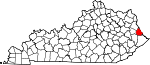
Eastern Kentucky Coalfield


The Eastern Kentucky Coalfield is part of the Central Appalachian bituminous coalfield, including all or parts of 30 Kentucky counties and adjoining areas in Ohio, West Virginia, Virginia and Tennessee.[3] It covers an area from the Allegheny Mountains in the east across the Cumberland Plateau to the Pottsville Escarpment in the west. The region is known for its coal mining; most family farms in the region have disappeared since the introduction of surface mining in the 1940s and 1950s.
The Daniel Boone National Forest is located on rough but beautiful[citation needed] terrain along and east of the Pottsville Escarpment. There are many natural arches and sandstone cliffs that are excellent for rock climbing and rappeling.[citation needed] The Red River Gorge, part of the National Forest, is known worldwide in rock climbing circles.[4]
The Sheltowee Trace Trail runs 260–270 mi (420–430 km) north and south, through the region.
During the American Civil War most of this region leaned toward the Union due to its makeup at the time of mostly small farmers, but more than 2,000 men from this area formed the 5th. Kentucky Vol. Inf., known as the Army of Eastern Kentucky, under Gen. Humphrey Marshall, C.S.A.. During the Great Depression, New Deal programs and the organizing of the United Mine Workers of America made many of the eastern counties Democratic.
Eastern Kentucky has a rich musical heritage. Many nationally acclaimed country music singers and musicians are from the area. These include: Loretta Lynn, Crystal Gayle, The Judds, Ricky Skaggs, Keith Whitley, Patty Loveless, Dwight Yoakam, Tom T. Hall, Billy Ray Cyrus, Jean Ritchie, Sturgill Simpson, Tyler Childers, Chris Stapleton, and George S. Davis.
As of the 1980s, the only counties in the United States where over half of the population cited "English" as their only ancestry group were in the hills of eastern Kentucky (and made up nearly every county in this region).[5] In the 1980 census, 1,267,079 Kentuckians out of a total population of 2,554,359 cited that they were of English ancestry, making them 49 percent of the state at that time. Large numbers of people of Scottish and Irish ancestry settled the area as well.[6]
Geography[]
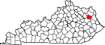
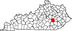
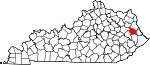
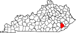
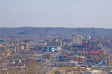
The Eastern Kentucky Coalfield covers 31 counties with a combined land area of 13,370 sq mi (34,628 km2), or about 33.1 percent of the state's land area. Its 2000 census population was 734,194 inhabitants, or about 18.2 percent of the state's population. The largest city, Ashland, has a population of 21,981. Other cities of significance in the region include Pikeville, London, and Middlesboro. The state's highest point, Black Mountain, is located in the southeastern part of the region in Harlan County.
Counties[]
| County |
FIPS code[7] | County seat[8] | Established[8] | Origin | Etymology | Population[8] | Area[8] | Map
|
|---|---|---|---|---|---|---|---|---|
| Bell County | 013 | Pineville | 1867 | Harlan County and Knox County | Joshua Fry Bell, Kentucky legislator (1862–1867) | 30,060 | 361 sq mi (935 km2) |

|
| Boyd County | 019 | Catlettsburg | 1860 | Greenup County, Carter County and Lawrence County | Linn Boyd, United States Congressman (1835–1837; 1839–1855) and Lieutenant Governor of Kentucky (1859) | 49,752 | 160 sq mi (414 km2) |

|
| Breathitt County | 025 | Jackson | 1839 | Clay County, Perry County and Estill County | John Breathitt, Governor of Kentucky (1832–1834) | 16,100 | 495 sq mi (1,282 km2) |

|
| Carter County | 043 | Grayson | 1838 | Greenup County and Lawrence County | William Grayson Carter, Kentucky state senator (1834–1838) | 26,889 | 411 sq mi (1,064 km2) |

|
| Clay County | 051 | Manchester | 1807 | Madison County, Floyd County, and Knox County | Green Clay (1757–1828), military general and surveyor | 24,556 | 471 sq mi (1,220 km2) |

|
| Elliott County | 063 | Sandy Hook | 1869 | Morgan County, Lawrence County, and Carter County | or John Milton Elliott (1820–1885), legislators | 6,748 | 234 sq mi (606 km2) |
|
| Floyd County | 071 | Prestonsburg | 1800 | Fleming County, Montgomery County, and Mason County | John Floyd (1750–1783), surveyor and pioneer | 42,441 | 394 sq mi (1,020 km2) |

|
| Greenup County | 089 | Greenup | 1803 | Mason County | Christopher Greenup, Governor of Kentucky (1804–1808) | 36,891 | 346 sq mi (896 km2) |

|
| Harlan County | 095 | Harlan | 1819 | Knox County | Silas Harlan (1753–1782), soldier in the Battle of Blue Licks | 33,202 | 467 sq mi (1,210 km2) |

|
| Jackson County | 109 | McKee | 1858 | Madison County, Estill County, Owsley County, Clay County, Laurel County, and Rockcastle County | Andrew Jackson, President of the United States (1829–1837) | 13,495 | 346 sq mi (896 km2) |
|
| Johnson County | 115 | Paintsville | 1843 | Floyd County, Lawrence County, and Morgan County | Richard Mentor Johnson, Vice President of the United States (1837–1841) | 23,445 | 262 sq mi (679 km2) |
|
| Knott County | 119 | Hindman | 1884 | Perry County, Letcher County, Floyd County, and Breathitt County | James Proctor Knott, Governor of Kentucky (1883–1887) | 17,649 | 352 sq mi (912 km2) |

|
| Knox County | 121 | Barbourville | 1799 | Lincoln County | Henry Knox, United States Secretary of War (1785–1794) | 31,795 | 388 sq mi (1,005 km2) |

|
| Laurel County | 125 | London | 1825 | Rockcastle County, Clay County, Knox County and Whitley County | Mountain laurel trees that are prominent in the area | 52,715 | 436 sq mi (1,129 km2) |

|
| Lawrence County | 127 | Louisa | 1821 | Greenup County and Floyd County | James Lawrence (1781–1813), naval commander during the War of 1812 | 15,569 | 419 sq mi (1,085 km2) |

|
| Lee County | 129 | Beattyville | 1870 | Breathitt County, Estill County, Owsley County, and Wolfe County | Robert E. Lee (1807–1870), Confederate general or Lee County, Virginia | 7,916 | 210 sq mi (544 km2) |

|
| Leslie County | 131 | Hyden | 1878 | Clay County, Harlan County and Perry County | Preston Leslie, Governor of Kentucky (1871–1875) | 12,401 | 404 sq mi (1,046 km2) |
|
| Letcher County | 133 | Whitesburg | 1842 | Perry County and Harlan County | Robert P. Letcher, Governor of Kentucky (1840–1844) | 25,277 | 339 sq mi (878 km2) |

|
| Magoffin County | 153 | Salyersville | 1860 | Floyd County, Johnson County and Morgan County | Beriah Magoffin, Governor of Kentucky (1859–1862) | 13,332 | 310 sq mi (803 km2) |

|
| Martin County | 159 | Inez | 1870 | Floyd County, Johnson County, Pike County, and Lawrence County | John P. Martin, United States Congressman (1845–1847) | 12,578 | 231 sq mi (598 km2) |
|
| McCreary County | 147 | Whitley City | 1912 | Pulaski County, Wayne County and Whitley County | James McCreary, Governor of Kentucky (1912–1916) | 17,080 | 428 sq mi (1,109 km2) |

|
| Morgan County | 175 | West Liberty | 1822 | Bath County and Floyd County | Daniel Morgan (1736–1802), Revolutionary War general | 13,948 | 381 sq mi (987 km2) |

|
| Owsley County | 189 | Booneville | 1843 | Breathitt County, Clay County, and Estill County | William Owsley, Governor of Kentucky (1844–1848) | 4,858 | 198 sq mi (513 km2) |

|
| Perry County | 193 | Hazard | 1820 | Floyd County and Clay County | Oliver Hazard Perry (1785–1819), Admiral in the War of 1812 | 29,390 | 342 sq mi (886 km2) |

|
| Pike County | 195 | Pikeville | 1821 | Floyd County | Zebulon Pike (1779–1813), discoverer of Pike's Peak | 68,736 | 788 sq mi (2,041 km2) |

|
| Whitley County | 235 | Williamsburg | 1818 | Knox County | William Whitley (1749–1813), Kentucky pioneer | 35,865 | 440 sq mi (1,140 km2) |

|
| Wolfe County | 237 | Campton | 1860 | Breathitt County, Owsley County, and Powell County | (1808–1865), member of the Kentucky General Assembly | 7,065 | 223 sq mi (578 km2) |

|
Major cities[]
The following list consists of Eastern Kentucky cities with populations over 4,000 according to the U.S. Census estimates released in 2016:[9]
| Rank | City | Population 2016 | County |
|---|---|---|---|
| 1 | Ashland | 21,038 | Boyd |
| 2 | Middlesboro | 9,626 | Bell |
| 3 | London | 8,157 | Laurel |
| 4 | Morehead | 7,758 | Rowan |
| 5 | Corbin | 7,398 | Whitley and Knox |
| 6 | Flatwoods | 7,311 | Greenup |
| 7 | Mount Sterling | 7,242 | Montgomery |
| 8 | Pikeville | 7,106 | Pike |
| 9 | Williamsburg | 5,313 | Whitley |
| 10 | Hazard | 5,300 | Perry |
| 11 | Paintsville | 4,203 | Johnson |
| 12 | Grayson | 4,043 | Carter |
Protected areas[]

Historical parks[]
- Cumberland Gap National Historical Park (part)
- Dr. Thomas Walker State Historic Site
State resort parks[]
- Buckhorn Lake State Resort Park
- Carter Caves State Resort Park
- Cumberland Falls State Resort Park
- Greenbo Lake State Resort Park
- Jenny Wiley State Resort Park
- Natural Bridge State Resort Park
- Pine Mountain State Resort Park
State recreational parks[]

- Carr Creek State Park
- Dawkins Line Rail Trail
- Fishtrap Lake State Park
- Grayson Lake State Park
- Kingdom Come State Park
- Levi Jackson Wilderness Road State Park
- Paintsville Lake State Park
- Pine Mountain State Scenic Trail
- Yatesville Lake State Park
Other[]
Economy[]
The region's economy is centered around the natural resources available, which includes coal, timber, natural gas, and oil. Recently, tourism has become a leading industry in the region, due to the region's cultural history and the creation of state parks.
Calgon Carbon constructed the Big Sandy Plant near Ashland in 1961 and it has since become the world's largest producer of granular activated carbon. The facility produces over 100 million pounds of granular activated carbon annually.[10]
Persistent poverty[]
Most of the counties in the Eastern Kentucky Coalfield are classified as "persistent poverty counties". The definition of a persistent poverty county by the Economic Research Service of the United States Department of Agriculture is that 20 percent or more of the total county population has been living in poverty since the 1980 census.[11]
A June 2014 article in The New York Times identified six counties in the Kentucky Coal Field as among the "hardest places to live in the United States." The lowest-ranking counties were Breathitt, Clay, Jackson, Lee, Leslie, and Magoffin. They ranked among the bottom ten counties nationwide. The factors which accounted for the low ranking of those six counties were unemployment, prevalence of disabilities, obesity, income, and education.[12] The Times declared Clay County the hardest place to live in the U.S.[13]
Appalachian Regional Commission[]
The Appalachian Regional Commission was formed in 1965 to aid economic development in the Appalachian region, which was lagging far behind the rest of the nation on most economic indicators. The Appalachian region currently defined by the Commission includes 420 counties in 13 states, including all counties in Kentucky's Eastern Coalfield. The Commission gives each county one of five possible economic designations—distressed, at-risk, transitional, competitive, or attainment—with "distressed" counties being the most economically endangered and "attainment" counties being the most economically prosperous. These designations are based primarily on three indicators—three-year average unemployment rate, market income per capita, and poverty rate.[14]
From 2012 to 2014, "Appalachian" Kentucky—which includes all of the Eastern Coalfield and several counties in South Central Kentucky and a few in the eastern part of the Bluegrass region—had a three-year average unemployment rate of 9.8%, compared with 7.6% statewide and 7.2% nationwide.[14] In 2014, Appalachian Kentucky had a per capita market income of $18,889, compared with $28,332 statewide and $38,117 nationwide. From 2010 to 2014, Appalachian Kentucky had an average poverty rate of 25.4%—the highest of any of the ARC regions—, compared to 18.9% statewide and 15.6% nationwide. Twenty-five Eastern Mountain Coal Field counties—Bell, Breathitt, Carter, Clay, Elliott, Floyd, Harlan, Jackson, Johnson, Knott, Knox, Lawrence, Lee, Leslie, Letcher, Magoffin, Martin, McCreary, Menifee, Morgan, Owsley, Powell, Rowan, Whitley, and Wolfe—were designated "distressed," while four – Laurel, Montgomery, Perry, and Pike – were designated "at-risk." Two Eastern Coalfield counties were designated "transitional" — Boyd and Greenup. No counties in the Eastern Coalfields region were given the "attainment" designation or were designated "competitive."
The following table illustrates the economic status of each county.
| County | Population (2010) | Unemployment Rate (2012–14)[14] | Per Capita Market Income (2014)[14] |
Poverty Rate (2010–14)[14] | Status (2017)[14] |
|---|---|---|---|---|---|
| Bell | 28,691 | 11.9% | $14,644 | 32.7% | Distressed |
| Boyd | 49,542 | 8.6% | $24,337 | 19.1% | Transitional |
| Breathitt | 13,878 | 13.7% | $14,386 | 31.5% | Distressed |
| Carter | 27,720 | 12.0% | $18,014 | 18.7% | Distressed |
| Clay | 21,730 | 13.3% | $11,531 | 35.7% | Distressed |
| Elliott | 7,852 | 13.5% | $10,529 | 39.6% | Distressed |
| Floyd | 39,451 | 11.7% | $18,473 | 29.5% | Distressed |
| Greenup | 36,910 | 9.3% | $23,879 | 18.0% | Transitional |
| Harlan | 29,278 | 15.4% | $13,620 | 32.1% | Distressed |
| Jackson | 13,494 | 15.4% | $13,496 | 31.7% | Distressed |
| Johnson | 23,356 | 10.1% | $19,008 | 25.3% | Distressed |
| Knott | 16,346 | 13.5% | $14,271 | 26.5% | Distressed |
| Knox | 31,883 | 11.9% | $15,549 | 33.8% | Distressed |
| Laurel | 58,849 | 9.2% | $21,051 | 23.3% | At-Risk |
| Lawrence | 15,860 | 10.5% | $15,399 | 23.5% | Distressed |
| Lee | 7,887 | 11.7% | $11,750 | 33.4% | Distressed |
| Leslie | 11,310 | 15.0% | $15,357 | 23.9% | Distressed |
| Letcher | 24,519 | 14.2% | $15,955 | 24.5% | Distressed |
| Magoffin | 13,333 | 16.3% | $11,139 | 26.8% | Distressed |
| Martin | 12,929 | 9.4% | $14,826 | 33.9% | Distressed |
| McCreary | 18,306 | 12.4% | $9,763 | 37.7% | Distressed |
| Menifee | 6,306 | 11.2% | $15,656 | 28.8% | Distressed |
| Montgomery | 26,499 | 8.2% | $23,093 | 25.2% | At-Risk |
| Morgan | 13,923 | 10.3% | $13,451 | 29.7% | Distressed |
| Owsley | 4,755 | 11.9% | $10,528 | 39.2% | Distressed |
| Perry | 28,712 | 12.3% | $20,131 | 26.6% | Distressed |
| Pike | 68,736 | 10.6% | $21,285 | 24.1% | At-Risk |
| Powell | 12,613 | 10.1% | $18,403 | 27.5% | Distressed |
| Rowan | 23,333 | 7.8% | $18,642 | 26.0% | At-Risk |
| Whitley | 35,637 | 10.0% | $17,321 | 24.1% | Distressed |
| Wolfe | 7,355 | 13.3% | $10,532 | 44.3% | Distressed |
Health[]
Most of the counties in the Eastern Kentucky Coalfield rank in the lowest ten percent of U.S. counties in average life expectancy. Both men and women have average life spans that are several years less than the average life span in the United States. Moreover, many counties have seen a decline in the life expectancy of men and/or women since 1985. Factors influencing the health of residents include a high prevalence of smoking and obesity and a low level of physical activity.[15]
Post-secondary education[]


Public universities[]
- Morehead State University
Private colleges and universities[]
- Alice Lloyd College
- Clear Creek Baptist Bible College
- Frontier Nursing University
- Kentucky Christian University
- Kentucky Mountain Bible College
- University of Pikeville
- Union College
- University of the Cumberlands
Community and technical colleges[]
- Ashland Community and Technical College
- Big Sandy Community and Technical College
- Hazard Community and Technical College
- Southeast Kentucky Community and Technical College
Political climate[]
As a whole, East Kentucky was long a Democratic stronghold. The only two counties in the state to vote against Mitch McConnell in each of his six senatorial campaigns through 2020 have been Wolfe and Elliott Counties, both in East Kentucky. However, the region has swung dramatically to the right recently. In 2004, eleven counties in East Kentucky supported Democratic candidate John F. Kerry, and in 2008, even as the nation as a whole shifted Democratic, the number of East Kentucky counties supporting Democratic candidate Barack Obama fell to just four, and in 2012 fell to just one.[16] Every county in East Kentucky supported Donald Trump in both 2016 and 2020 with at least 50% of the vote. In fact, each of the three most Republican counties in Kentucky (in terms of vote proportion) were all in East Kentucky (namely Leslie, Jackson and Martin Counties). Each gave less than a tenth of their vote to Hillary Clinton, the Democratic candidate. Elliott County, Kentucky, serves as a good representation of the political transformation throughout the region. It had the longest streak in the nation of any county to vote Democratic.[16] It has in recent years, however, shifted hard to the right, just like the rest of East Kentucky. In 2008 Elliott County was the most Democratic county in the state, giving over 60% of the vote to Barack Obama. In 2012, however, it supported him by a margin of just three percentage points (the lowest percentage for a Democrat in county history) and lost the title of most Democratic in the state to Jefferson County, home to Louisville, the most populous city in the state. And by 2016, it supported Donald Trump with over 70% of the county vote, and 75% four years later. In local elections (like East Kentucky), though it has trended more Republican, it still remains a Democratic stronghold. In the State Senate election, it gave Democrat Rocky Adkins 86% of the vote. As of November 2012, just 4.2% of registered voters were Republicans, the lowest proportion for any county in the state. By October 2016, this proportion had more than doubled (to 8.2%), and by April 2019 it stood at 10.6%. Indeed, Elliott County voters, just like most East Kentucky voters, are socially conservative and economically more liberal.[citation needed]
Notable residents[]
- Hylo Brown, bluegrass and country music singer, born in River.
- June Buchanan (1887–1988), educator who worked with Alice Spencer Geddes Lloyd (see below). Co-founder of Caney Junior College, now Alice Lloyd College. Lived in Knott County from 1919 until her death.
- Tyler Childers, a country, bluegrass, and folk musician from Paintsville, Kentucky.
- Earle Combs (1899–1976), Hall of Fame MLB center fielder for the New York Yankees. Born in Pebworth, a community in Owsley County.[17]
- Tim Couch, former NFL quarterback. Born and raised in Hyden.
- Billy Ray Cyrus (born 1961), American country music singer, songwriter and actor. Born in Flatwoods.
- Richie Farmer (born 1969), basketball standout for the University of Kentucky and politician (Kentucky Commissioner of Agriculture, 2003–2011). Born and raised in Manchester.
- Jim Ford, singer-songwriter, born in Johnson County.
- Mary Elliott Flanery, first woman elected to a state legislature south of the Mason–Dixon line.
- Crystal Gayle, country singer and younger sister of Loretta Lynn; both raised in Van Lear.
- Eula Hall, Founder of the .
- Roscoe Holcomb, American musician who lived the majority of his life in Daisy.
- Silas House (born 1971), author. Born and raised in Laurel County; also lived in Leslie County during his childhood.
- The Judds, a country music duo of mother Naomi (born 1946) and daughter Wynonna (born 1964). Born in Ashland.
- Ashley Judd (born 1968), actress; daughter of Naomi Judd and half-sister of Wynonna Judd. Born in Ashland.
- Alice Spencer Geddes Lloyd (1876–1962), social reformer who founded 100 elementary schools in the region as well as co-founding the college that now bears her name. Lived in Knott County from 1915 until her death.
- Patty Loveless, country music singer. Born in Pikeville.
- Loretta Lynn, country singer, raised in Van Lear.
- John Pelphrey (born 1968), basketball standout for the University of Kentucky (and teammate of Farmer); former head basketball coach at the University of Arkansas, and current assistant at the University of Florida. Born in Paintsville.
- Francis Gary Powers (August 17, 1929 – August 1, 1977) was an American pilot whose CIA U-2 spy plane was shot down while over the Soviet Union, causing the 1960 U-2 incident. Born in Jenkins.
- Venus Ramey, Miss America, 1944. Born in Ashland.
- Jeff Sheppard (born 1974), University of Kentucky basketball star (1998 NCAA Tournament Most Outstanding Player) and former player in the NBA and several European leagues. Has lived in London since he retired from play.
- Benjamin F. Stapleton, Mayor of Denver, Colorado between (1923–1931) and (1935–1947). Born in Paintsville.
- Gary Stewart, Country music singer and musician, 1944–2003, born in Jenkins.
- Jesse Stuart, author and former poet laureate of Kentucky
- Dwight Yoakam (born 1956), singer-songwriter, actor and film director. Born in Pikeville.
- Sturgill Simpson, born in Jackson in 1978
See also[]
- Huntington-Ashland-Ironton metropolitan area
- Coal mining in Kentucky
References[]
- ^ . March 28, 2008 https://web.archive.org/web/20080328072411/http://www.uky.edu/KentuckyAtlas/map-kentucky-geologic.gif. Archived from the original on March 28, 2008. Retrieved May 7, 2018. Missing or empty
|title=(help)CS1 maint: bot: original URL status unknown (link) - ^ "National Digital Newspaper Program: The Kentucky Edition, More about KY-NDNP: regions". Uky.edu. November 6, 2007. Archived from the original on October 1, 2013. Retrieved November 5, 2013.
- ^ Eastern Mountain Coal Fields Archived October 1, 2013, at the Wayback Machine Retrieved on January 30, 2010
- ^ Red River Gorge. RRG Tourism http://www.redrivergorge.com/adventures/climbing/. Retrieved August 21, 2021. Missing or empty
|title=(help) - ^ James Paul Allen and Eugene James Turner, We the People: An Atlas of America's Ethnic Diversity (Macmillan, 1988), 41.
- ^ "Archived copy" (PDF). Archived (PDF) from the original on February 24, 2012. Retrieved February 10, 2012.CS1 maint: archived copy as title (link)
- ^ "EPA County FIPS Code Listing". EPA. Archived from the original on September 22, 2004. Retrieved April 9, 2007.
- ^ Jump up to: a b c d National Association of Counties. "NACo – Find a county". Archived from the original on July 11, 2007. Retrieved July 22, 2007.
- ^ Annual Estimates of the Resident Population: April 1, 2010 to July 1, 2016 Population Estimates U.S. Census Bureau. Retrieved August 13, 2015
- ^ Calgon Carbon Big Sandy Plant Retrieved March 21, 2014.
- ^ "Geography of Poverty", "Archived copy". Archived from the original on February 17, 2017. Retrieved February 17, 2017.CS1 maint: archived copy as title (link), accessed February 17, 2017
- ^ Lowrey, Annie (June 29, 2014). "What's the Matter With Eastern Kentucky?". NYtimes.com. Archived from the original on December 1, 2017.
- ^ Flippen, Alan (June 26, 2014), "Where Are the Hardest Places to Live in the U.S.?" The New York Times.
- ^ Jump up to: a b c d e f County Economic Status, Fiscal Year 2017: Appalachian Kentucky Archived May 14, 2017, at the Wayback Machine. ARC. Retrieved: July 14, 2017.
- ^ "Institute for Health Metrics and Evaluation", "Archived copy". Archived from the original on February 24, 2017. Retrieved February 17, 2017.CS1 maint: archived copy as title (link), accessed February 17, 2017
- ^ Jump up to: a b Nelson, Eliot. "Not So Solid South: Democratic Party Survives In Rural Elliott County, Kentucky".
- ^ "Earle Combs / Baseball Legend". web.archive.org. March 15, 2012.
External links[]


- Eastern Kentucky Coalfield
- Mining in Kentucky
- Coal mining in Appalachia
- Coal mining regions in the United States
- Geography of Appalachia
- Regions of Kentucky