Russell County, Kentucky
Russell County | |
|---|---|
U.S. county | |
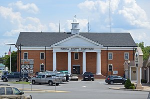 Russell County courthouse in Jamestown | |
 Location within the U.S. state of Kentucky | |
 Kentucky's location within the U.S. | |
| Coordinates: 36°59′N 85°04′W / 36.99°N 85.06°W | |
| Country | |
| State | |
| Founded | December 14, 1825 |
| Named for | William Russell |
| Seat | Jamestown |
| Largest city | Russell Springs |
| Area | |
| • Total | 283 sq mi (730 km2) |
| • Land | 254 sq mi (660 km2) |
| • Water | 29 sq mi (80 km2) 10% |
| Population (2010) | |
| • Total | 17,565 |
| • Estimate (2018) | 17,821 |
| • Density | 62/sq mi (24/km2) |
| Time zone | UTC−6 (Central) |
| • Summer (DST) | UTC−5 (CDT) |
| Congressional district | 1st |
| Website | www |

Russell County is a county located in the U.S. Commonwealth of Kentucky. As of the 2010 census, the population was 17,565.[1] Its county seat is Jamestown.[2] The county was formed on December 14, 1825, from portions of Adair, Cumberland and Wayne Counties and is named for William Russell.[3]
In 2015, the cities of Jamestown and Russell Springs became two of the first gigabit Internet communities in Kentucky with the completion of a state-of-the-art optical fiber network by the local telephone cooperative.[4]
Wolf Creek Dam is located in southern Russell County. The dam impounds Cumberland River to form Lake Cumberland, a major tourism attraction for the county. Wolf Creek National Fish Hatchery is also located in Russell County just below the dam.
Until relatively recently Russell County was a dry county, meaning that the sale of alcohol was prohibited. It voted to go "wet" in a referendum held on January 19, 2016, by a margin of 3,833 to 3,423 votes.[5][6]
Geography[]
According to the U.S. Census Bureau, the county has a total area of 283 square miles (730 km2), of which 254 square miles (660 km2) is land and 29 square miles (75 km2) (10%) is water.[7] The highest point is 1,140 feet (350 m) atop Dickerson Ridge in the extreme northern part of the county and the lowest point is 530 feet (160 m) along the Cumberland River.
Major highways[]
Adjacent counties[]
- Casey County (north/EST Border)
- Pulaski County (northeast/EST Border)
- Wayne County (southeast/EST Border)
- Clinton County (south)
- Cumberland County (southwest)
- Adair County (west)
Demographics[]
| Historical population | |||
|---|---|---|---|
| Census | Pop. | %± | |
| 1830 | 3,879 | — | |
| 1840 | 4,238 | 9.3% | |
| 1850 | 5,349 | 26.2% | |
| 1860 | 6,024 | 12.6% | |
| 1870 | 5,809 | −3.6% | |
| 1880 | 7,591 | 30.7% | |
| 1890 | 8,136 | 7.2% | |
| 1900 | 9,695 | 19.2% | |
| 1910 | 10,861 | 12.0% | |
| 1920 | 11,854 | 9.1% | |
| 1930 | 11,930 | 0.6% | |
| 1940 | 13,615 | 14.1% | |
| 1950 | 13,717 | 0.7% | |
| 1960 | 11,076 | −19.3% | |
| 1970 | 10,542 | −4.8% | |
| 1980 | 13,708 | 30.0% | |
| 1990 | 14,716 | 7.4% | |
| 2000 | 16,315 | 10.9% | |
| 2010 | 17,565 | 7.7% | |
| 2018 (est.) | 17,821 | [8] | 1.5% |
| U.S. Decennial Census[9] 1790–1960[10] 1900–1990[11] 1990–2000[12] 2010–2013[1] | |||
As of the census[13] of 2000, there were 16,315 people, 6,941 households, and 4,796 families residing in the county. The population density was 64 per square mile (25/km2). There were 9,064 housing units at an average density of 36 per square mile (14/km2). The racial makeup of the county was 98.34% White, 0.58% Black or African American, 0.12% Native American, 0.14% Asian, 0.02% Pacific Islander, 0.21% from other races, and 0.59% from two or more races. 0.86% of the population were Hispanic or Latino of any race.
There were 6,941 households, out of which 29.00% had children under the age of 18 living with them, 55.30% were married couples living together, 10.20% had a female householder with no husband present, and 30.90% were non-families. 28.00% of all households were made up of individuals, and 12.90% had someone living alone who was 65 years of age or older. The average household size was 2.33 and the average family size was 2.82.
In the county, the population was spread out, with 22.50% under the age of 18, 7.50% from 18 to 24, 27.50% from 25 to 44, 25.90% from 45 to 64, and 16.50% who were 65 years of age or older. The median age was 40 years. For every 100 females there were 93.90 males. For every 100 females age 18 and over, there were 91.00 males.
The median income for a household in the county was $22,042, and the median income for a family was $27,803. Males had a median income of $24,193 versus $18,289 for females. The per capita income for the county was $13,183. About 20.40% of families and 24.30% of the population were below the poverty line, including 30.80% of those under age 18 and 27.30% of those age 65 or over.
Politics[]
Russell County is part of the historically and currently rock-ribbed Republican bloc of southeastern Kentucky that also includes such counties as Clinton, Cumberland, Casey, Pulaski, Laurel, Rockcastle, Monroe, McCreary, Clay, Jackson, Owsley and Leslie. These counties were opposed to secession during the Civil War era, and consequently became and have remained intensely Republican ever since.[14] The last Democrat to win Russell County was Grover Cleveland in 1884, and the last Republican to not gain a majority was William Howard Taft in 1912 when his party was divided.
Communities[]
- Creelsboro
- Jamestown (county seat)
- Russell Springs
Notable people[]
- Tara Conner, Miss Kentucky USA 2006, Miss USA 2006
- Vernie McGaha, Former Kentucky State Senator
- Doug Moseley, later a Kentucky state senator, was pastor of the Russell Springs First United Methodist Church from 1958 to 1960
- Steve Wariner, country music singer and songwriter. Kentucky State Route 80 is named in his honor.
- Jeff Hoover, Republican member of the Kentucky House of Representatives, elected Speaker in late 2016.
See also[]
References[]
- ^ Jump up to: a b "State & County QuickFacts". United States Census Bureau. Archived from the original on July 17, 2011. Retrieved March 6, 2014.
- ^ "Find a County". National Association of Counties. Retrieved 2011-06-07.
- ^ "Russell County". The Kentucky Encyclopedia. 2000. Retrieved August 23, 2014.
- ^ https://duocounty.com/news-information/25-jamestown-russell-springs-columbia-among-first-in-kentucky-to-be-gigabit-internet-communities
- ^ The Register of the Kentucky State Historical Society, Volume 1. Kentucky State Historical Society. 1903. p. 36.
- ^ http://www.russellcountynewspapers.com/editionviewer/?Edition=b7e46efc-0b0d-401a-84c6-1badcd7e9a8d
- ^ "2010 Census Gazetteer Files". United States Census Bureau. August 22, 2012. Archived from the original on August 12, 2014. Retrieved August 19, 2014.
- ^ "Population and Housing Unit Estimates". Retrieved July 29, 2019.
- ^ "U.S. Decennial Census". United States Census Bureau. Retrieved August 19, 2014.
- ^ "Historical Census Browser". University of Virginia Library. Retrieved August 19, 2014.
- ^ "Population of Counties by Decennial Census: 1900 to 1990". United States Census Bureau. Retrieved August 19, 2014.
- ^ "Census 2000 PHC-T-4. Ranking Tables for Counties: 1990 and 2000" (PDF). United States Census Bureau. Retrieved August 19, 2014.
- ^ "U.S. Census website". United States Census Bureau. Retrieved 2008-01-31.
- ^ Sullivan, Robert David; "How the Red and Blue Map Evolved Over the Past Century"; America Magazine in The National Catholic Review; June 29, 2016
- ^ Leip, David. "Dave Leip's Atlas of U.S. Presidential Elections". uselectionatlas.org. Retrieved 2018-07-06.
External links[]
- Russell County Industrial Development Authority
- The Kentucky Highlands Project
- Russell County Public Library
| show Municipalities and communities of Russell County, Kentucky, United States |
|---|


Coordinates: 36°59′N 85°04′W / 36.99°N 85.06°W
| show Authority control |
|---|
- Kentucky counties
- Russell County, Kentucky
- 1825 establishments in Kentucky
- Populated places established in 1825
- Counties of Appalachia