DeTour Village, Michigan
DeTour Village, Michigan | |
|---|---|
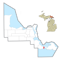 Location within Chippewa County | |
 DeTour Village Location within the state of Michigan | |
| Coordinates: 45°59′26″N 83°54′18″W / 45.99056°N 83.90500°W | |
| Country | United States |
| State | Michigan |
| County | Chippewa |
| Township | DeTour |
| Incorporated | 1899 |
| Government | |
| • President | Lindsey McGuire |
| Area | |
| • Total | 8.38 sq mi (21.70 km2) |
| • Land | 3.54 sq mi (9.18 km2) |
| • Water | 4.83 sq mi (12.52 km2) |
| Elevation | 600 ft (183 m) |
| Population | |
| • Total | 325 |
| • Estimate (2019)[5] | 317 |
| • Density | 89.47/sq mi (34.54/km2) |
| Time zone | UTC-5 (Eastern (EST)) |
| • Summer (DST) | UTC-4 (EDT) |
| ZIP code(s) | 49725 |
| Area code(s) | 906 |
| FIPS code | 26-21780[3] |
| GNIS feature ID | 0624391[4] |
| Website | Official website |


DeTour Village is a village in Chippewa County in the U.S. state of Michigan. The population was 325 at the 2010 census.
The village is at the extreme eastern tip of the Upper Peninsula of Michigan, in Detour Township, at the turning point for the shipping channel connecting the St. Mary's River with Lake Huron and the Straits of Mackinac. Drummond Island, one of the largest islands in the St. Mary's River, is only one mile across the river from DeTour. The DeTour Reef Light is nearby.
History[]
The place was originally an Ojibwe settlement. It was connected with the fur trade and over time it came to have a large Metis population. Over time the Metis inhabitants were redefined as being French-Canadian.
The area was organized in 1850 as Warren Township, named after Ebenezer Warren, the first postmaster of the township. The settlement was called Warrenville on an 1848 map. The name was changed to Detour in 1856 when a new postmaster, Henry A. Williams, assumed office. It incorporated as a village in 1899. The spelling was changed to "DeTour" in 1953 and the post office was renamed "DeTour Village" in 1961.[6]
M-134 runs through the village, connecting with I-75 43 miles (69 km) to the west and with M-129 25 miles (40 km) to the west, which runs north 37 miles (60 km) to Sault Ste. Marie. M-134 also continues east to Drummond Island via the Drummond Island Ferry.
Geography[]
According to the United States Census Bureau, the village has a total area of 8.38 square miles (21.70 km2), of which 3.55 square miles (9.19 km2) is land and 4.83 square miles (12.51 km2) is water.[7]
Climate[]
| hideClimate data for DeTour Village, Michigan (1991–2020 normals, extremes 1900–present) | |||||||||||||
|---|---|---|---|---|---|---|---|---|---|---|---|---|---|
| Month | Jan | Feb | Mar | Apr | May | Jun | Jul | Aug | Sep | Oct | Nov | Dec | Year |
| Record high °F (°C) | 53 (12) |
52 (11) |
62 (17) |
85 (29) |
88 (31) |
96 (36) |
102 (39) |
95 (35) |
91 (33) |
88 (31) |
70 (21) |
58 (14) |
102 (39) |
| Average high °F (°C) | 23.9 (−4.5) |
25.6 (−3.6) |
34.1 (1.2) |
45.9 (7.7) |
59.3 (15.2) |
69.9 (21.1) |
75.0 (23.9) |
74.0 (23.3) |
66.1 (18.9) |
52.9 (11.6) |
40.9 (4.9) |
30.9 (−0.6) |
49.9 (9.9) |
| Daily mean °F (°C) | 16.3 (−8.7) |
17.2 (−8.2) |
25.5 (−3.6) |
37.9 (3.3) |
50.4 (10.2) |
60.8 (16.0) |
66.3 (19.1) |
66.0 (18.9) |
58.7 (14.8) |
46.3 (7.9) |
35.2 (1.8) |
24.9 (−3.9) |
42.1 (5.6) |
| Average low °F (°C) | 8.7 (−12.9) |
8.7 (−12.9) |
17.0 (−8.3) |
29.9 (−1.2) |
41.5 (5.3) |
51.6 (10.9) |
57.6 (14.2) |
58.0 (14.4) |
51.3 (10.7) |
39.7 (4.3) |
29.6 (−1.3) |
18.8 (−7.3) |
34.4 (1.3) |
| Record low °F (°C) | −28 (−33) |
−39 (−39) |
−32 (−36) |
1 (−17) |
11 (−12) |
32 (0) |
38 (3) |
36 (2) |
27 (−3) |
19 (−7) |
−5 (−21) |
−24 (−31) |
−39 (−39) |
| Average precipitation inches (mm) | 1.93 (49) |
1.31 (33) |
1.75 (44) |
2.44 (62) |
2.62 (67) |
3.06 (78) |
3.07 (78) |
3.35 (85) |
3.61 (92) |
3.83 (97) |
2.58 (66) |
2.32 (59) |
31.87 (809) |
| Average snowfall inches (cm) | 20.2 (51) |
13.9 (35) |
12.0 (30) |
4.6 (12) |
0.0 (0.0) |
0.0 (0.0) |
0.0 (0.0) |
0.0 (0.0) |
0.0 (0.0) |
0.3 (0.76) |
5.7 (14) |
17.9 (45) |
74.6 (189) |
| Average precipitation days (≥ 0.01 in) | 12.8 | 9.3 | 9.2 | 9.5 | 10.8 | 9.9 | 10.8 | 10.5 | 11.3 | 13.2 | 11.1 | 12.3 | 130.7 |
| Average snowy days (≥ 0.1 in) | 11.1 | 8.6 | 6.7 | 2.6 | 0.1 | 0.0 | 0.0 | 0.0 | 0.0 | 0.2 | 3.8 | 9.4 | 42.5 |
| Source: NOAA[8][9] | |||||||||||||
Major highways[]
Demographics[]
| Historical population | |||
|---|---|---|---|
| Census | Pop. | %± | |
| 1900 | 880 | — | |
| 1910 | 721 | −18.1% | |
| 1920 | 612 | −15.1% | |
| 1930 | 616 | 0.7% | |
| 1940 | 595 | −3.4% | |
| 1950 | 611 | 2.7% | |
| 1960 | 669 | 9.5% | |
| 1970 | 494 | −26.2% | |
| 1980 | 466 | −5.7% | |
| 1990 | 407 | −12.7% | |
| 2000 | 421 | 3.4% | |
| 2010 | 325 | −22.8% | |
| 2019 (est.) | 317 | [5] | −2.5% |
| U.S. Decennial Census[10] | |||
As of 2000 the median income for a household in the village was $31,250, and the median income for a family was $45,104. Males had a median income of $27,188 versus $33,125 for females. The per capita income for the village was $19,967. About 6.5% of families and 10.4% of the population were below the poverty line, including 32.6% of those under age 18 and 5.7% of those age 65 or over.
2010 census[]
As of the census[2] of 2010, there were 325 people, 166 households, and 96 families residing in the village. The population density was 91.5 inhabitants per square mile (35.3/km2). There were 307 housing units at an average density of 86.5 per square mile (33.4/km2). The racial makeup of the village was 82.8% White, 12.9% Native American, and 4.3% from two or more races. Hispanic or Latino of any race were 0.6% of the population.
There were 166 households, of which 16.3% had children under the age of 18 living with them, 52.4% were married couples living together, 1.8% had a female householder with no husband present, 3.6% had a male householder with no wife present, and 42.2% were non-families. 38.6% of all households were made up of individuals, and 20.5% had someone living alone who was 65 years of age or older. The average household size was 1.96 and the average family size was 2.56.
The median age in the village was 57.6 years. 15.4% of residents were under the age of 18; 2.8% were between the ages of 18 and 24; 15.4% were from 25 to 44; 28.3% were from 45 to 64; and 38.2% were 65 years of age or older. The gender makeup of the village was 49.5% male and 50.5% female.
References[]
- ^ "2019 U.S. Gazetteer Files". United States Census Bureau. Retrieved July 25, 2020.
- ^ Jump up to: a b "U.S. Census website". United States Census Bureau. Retrieved 2012-11-25.
- ^ "U.S. Census website". United States Census Bureau. Retrieved 2008-01-31.
- ^ U.S. Geological Survey Geographic Names Information System: DeTour Village, Michigan
- ^ Jump up to: a b "Population and Housing Unit Estimates". United States Census Bureau. May 24, 2020. Retrieved May 27, 2020.
- ^ Romig, Walter (1986) [1973]. Michigan Place Names. Detroit, Michigan: Wayne State University Press. ISBN 0-8143-1838-X.
- ^ "US Gazetteer files 2010". United States Census Bureau. Archived from the original on 2012-07-02. Retrieved 2012-11-25.
- ^ "NowData - NOAA Online Weather Data". National Oceanic and Atmospheric Administration. Retrieved August 28, 2021.
- ^ "Station: DeTour Village, MI". U.S. Climate Normals 2020: U.S. Monthly Climate Normals (1991-2020). National Oceanic and Atmospheric Administration. Retrieved August 28, 2021.
- ^ "Census of Population and Housing". Census.gov. Retrieved June 4, 2015.
External links[]
| show Municipalities and communities of Chippewa County, Michigan, United States |
|---|

| show Authority control |
|---|
Coordinates: 45°59′40″N 83°54′10″W / 45.99444°N 83.90278°W
- Villages in Chippewa County, Michigan
- Villages in Michigan
- 1899 establishments in Michigan
- Populated places established in 1899