De Witt Township, Clinton County, Iowa
De Witt Township | |
|---|---|
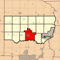 Location in Clinton County | |
| Coordinates: 41°49′25″N 090°31′33″W / 41.82361°N 90.52583°WCoordinates: 41°49′25″N 090°31′33″W / 41.82361°N 90.52583°W | |
| Country | |
| State | |
| County | Clinton |
| Area | |
| • Total | 54.48 sq mi (141.1 km2) |
| • Land | 54.32 sq mi (140.69 km2) |
| • Water | 0.16 sq mi (0.41 km2) 0.29% |
| Elevation | 689 ft (210 m) |
| Population (2000) | |
| • Total | 6,346 |
| • Density | 116.8/sq mi (45.1/km2) |
| GNIS feature ID | 0467713 |

De Witt Township is a township in Clinton County, Iowa, USA. As of the 2000 census, its population was 6,346.
History[]
De Witt Township was organized in 1843. It is named for DeWitt Clinton.[1]
Geography[]
De Witt Township covers an area of 54.48 square miles (141.1 km2) and contains one incorporated settlement, De Witt. According to the USGS, it contains two cemeteries: Elmwood and Saint Joseph.
Crystal Lake is within this township. The streams of Ames Creek, Crystal Creek, Rock Creek and Silver Creek run through this township. The Ames Creek Bridge, which carries 300th St. over Ames Creek, is listed on the National Register of Historic Places.
Notes[]
- ^ Wolfe, Patrick B. (1911). Wolfe's History of Clinton County, Iowa, Volume 1. B. F. Bowen. pp. 305.
References[]
External links[]
Municipalities and communities of Clinton County, Iowa, United States | ||
|---|---|---|
| Cities | ||
| Townships | ||
| CDP | ||
| Other communities | ||
| Footnotes | ‡This populated place also has portions in an adjacent county or counties | |
| ||
This article about the geography of Clinton County, Iowa is a stub. You can help Wikipedia by . |
Categories:
- Townships in Clinton County, Iowa
- Townships in Iowa
- 1843 establishments in Iowa Territory
- Southeast Iowa geography stubs