Spring Rock Township, Clinton County, Iowa
Spring Rock Township | |
|---|---|
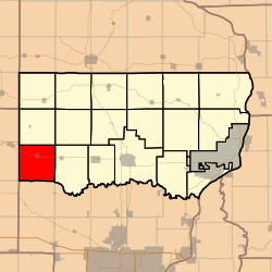 Location in Clinton County | |
| Coordinates: 41°49′00″N 090°51′06″W / 41.81667°N 90.85167°WCoordinates: 41°49′00″N 090°51′06″W / 41.81667°N 90.85167°W | |
| Country | |
| State | |
| County | Clinton |
| Area | |
| • Total | 36.25 sq mi (93.9 km2) |
| • Land | 36.25 sq mi (93.9 km2) |
| • Water | 0 sq mi (0 km2) 0% |
| Elevation | 682 ft (208 m) |
| Population (2000) | |
| • Total | 1,142 |
| • Density | 31.5/sq mi (12.2/km2) |
| GNIS feature ID | 0468744 |

Spring Rock Township is a township in Clinton County, Iowa, USA. As of the 2000 census, its population was 1,142.
History[]
Spring Rock Township was organized in 1844. The township takes its name from a huge rock at found at a spring in Scott County.[1]
Geography[]
Spring Rock Township covers an area of 36.25 square miles (93.9 km2) and contains one incorporated settlement, Wheatland, along with some unincorporated settlements such as Big Rock. According to the USGS, it contains four cemeteries: Homigrahusen, Pine Hill, Rose Hill and Saint Pauls.
The streams of Calamus Creek, Lizard Creek, Rock Creek and Yankee Run run through this township.
Notes[]
- ^ Wolfe, Patrick B. (1911). Wolfe's History of Clinton County, Iowa, Volume 1. B. F. Bowen. pp. 329.
References[]
External links[]
Municipalities and communities of Clinton County, Iowa, United States | ||
|---|---|---|
| Cities | ||
| Townships | ||
| CDP | ||
| Other communities | ||
| Footnotes | ‡This populated place also has portions in an adjacent county or counties | |
| ||
This article about the geography of Clinton County, Iowa is a stub. You can help Wikipedia by . |
Categories:
- Townships in Clinton County, Iowa
- Townships in Iowa
- 1844 establishments in Iowa Territory
- Southeast Iowa geography stubs