District Township, Berks County, Pennsylvania
District Township | |
|---|---|
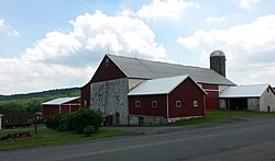 Farm in Landis Store, District Township | |
 District Township Location of District Township in Pennsylvania | |
| Coordinates: 40°25′57″N 75°39′44″W / 40.43250°N 75.66222°WCoordinates: 40°25′57″N 75°39′44″W / 40.43250°N 75.66222°W | |
| Country | United States |
| State | Pennsylvania |
| County | Berks |
| Area | |
| • Total | 11.61 sq mi (30.06 km2) |
| • Land | 11.58 sq mi (29.99 km2) |
| • Water | 0.03 sq mi (0.07 km2) |
| Elevation | 938 ft (286 m) |
| Population (2010) | |
| • Total | 1,337 |
| • Estimate (2016)[2] | 1,404 |
| • Density | 121.24/sq mi (46.81/km2) |
| Time zone | UTC-5 (EST) |
| • Summer (DST) | UTC-4 (EDT) |
| ZIP codes | 18011, 18062, 19504, 19512, 19539 |
| Area code(s) | 610 |
| FIPS code | 42-011-19312 |
| Website | www |


District Township is a township in eastern Berks County, Pennsylvania, United States. The population was 1,337 at the 2010 census.
District Township was founded in 1759.[3]
Geography[]
According to the United States Census Bureau, the township has a total area of 11.6 square miles (30 km2), all of it land. It is drained by the Schuylkill River via the Manatawny Creek and the Perkiomen Creek via the , which starts in the township. District Township is located in the South Mountains, and its elevations range from over 600 feet to over 1,100 feet. Its villages are Fredericksville and Landis Store.
District Township has a humid continental climate (Dfa/Dfb) and is in hardiness zone 6b except for some higher areas that are 6a. The average monthly temperature in Landis Store ranges from 27.2 °F in January to 71.6 °F in July. [1] The average annual absolute minimum temperature in Landis Store is -4.2 °F. [2]
Adjacent townships
- Longswamp Township (north)
- Hereford Township (east)
- Washington Township (southeast)
- Pike Township (south)
- Rockland Township (west)
Demographics[]
| Historical population | |||
|---|---|---|---|
| Census | Pop. | %± | |
| 1980 | 1,094 | — | |
| 1990 | 1,211 | 10.7% | |
| 2000 | 1,449 | 19.7% | |
| 2010 | 1,337 | −7.7% | |
| 2016 (est.) | 1,404 | [2] | 5.0% |
| Source: US Census Bureau | |||
At the 2000 census there were 1,449 people, 522 households, and 416 families living in the township. The population density was 124.4 people per square mile (48.0/km2). There were 548 housing units at an average density of 47.0/sq mi (18.2/km2). The racial makeup of the township was 99.03% White, 0.41% African American, 0.21% Native American, 0.07% Asian, 0.14% from other races, and 0.14% from two or more races. Hispanic or Latino of any race were 0.41%.[4]
There were 522 households, 36.4% had children under the age of 18 living with them, 70.9% were married couples living together, 5.6% had a female householder with no husband present, and 20.3% were non-families. 16.5% of households were made up of individuals, and 6.9% were one person aged 65 or older. The average household size was 2.78 and the average family size was 3.12.
The age distribution was 26.6% under the age of 18, 6.2% from 18 to 24, 29.6% from 25 to 44, 28.8% from 45 to 64, and 8.8% 65 or older. The median age was 38 years. For every 100 females, there were 101.8 males. For every 100 females age 18 and over, there were 100.4 males.
The median household income was $53,233 and the median family income was $58,158. Males had a median income of $42,404 versus $30,556 for females. The per capita income for the township was $21,663. About 4.1% of families and 3.5% of the population were below the poverty line, including 3.2% of those under age 18 and 6.7% of those age 65 or over.
Government and politics[]
Legislators[]
- State Representative David Maloney Sr., Republican, 130th district
- State Senator Judy Schwank, Democrat, 11th district
- US Representative Dan Meuser, Republican, 9th district
Board of supervisors[]
- Bruce B. Latshaw, chairman
- Ed Overberger, vice-chairman
- Leonard Robb
Transportation[]
The main roads in District Township include Bitting Road, Conrad Road, Forgedale Road/Baldy Hill Road, Huff Church Road, Landis Store Road, Long Lane, and Oysterdale Road.
Recreation[]
A parcel of the Pennsylvania State Game Lands Number 315 is located in the northwestern portion of the township. Gordon Park is located near the southern corner of the township.[5][6]
References[]
- ^ "2016 U.S. Gazetteer Files". United States Census Bureau. Retrieved Aug 13, 2017.
- ^ a b "Population and Housing Unit Estimates". Retrieved June 9, 2017.
- ^ Moser, Nick (May 5, 1956). "District Township". Reading Eagle. p. 44. Retrieved 2 December 2015.
- ^ "U.S. Census website". United States Census Bureau. Retrieved 2008-01-31.
- ^ https://viewer.nationalmap.gov/advanced-viewer/ The National Map, retrieved 2 November 2018
- ^ Pennsylvania State Game Lands Number 315, retrieved 2 November 2018

- Townships in Berks County, Pennsylvania
- Townships in Pennsylvania