Laureldale, Pennsylvania
Laureldale, Pennsylvania | |
|---|---|
Borough | |
 Rosedale United Church (1928) | |
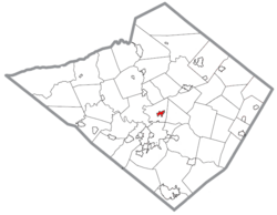 Location of Laureldale in Berks County, Pennsylvania. | |
 Laureldale Location in Pennsylvania | |
| Coordinates: 40°23′21″N 75°54′51″W / 40.38917°N 75.91417°WCoordinates: 40°23′21″N 75°54′51″W / 40.38917°N 75.91417°W | |
| Country | United States |
| State | Pennsylvania |
| County | Berks |
| Area | |
| • Total | 0.81 sq mi (2.10 km2) |
| • Land | 0.81 sq mi (2.10 km2) |
| • Water | 0.00 sq mi (0.00 km2) |
| Elevation | 400 ft (100 m) |
| Population (2010) | |
| • Total | 3,911 |
| • Estimate (2019)[2] | 3,909 |
| • Density | 4,825.93/sq mi (1,864.29/km2) |
| Time zone | UTC-5 (EST) |
| • Summer (DST) | UTC-4 (EDT) |
| ZIP code | 19605 |
| Area code(s) | 610 and 484 |
| FIPS code | 42-41768 |
| Website | www |


Laureldale is a borough in Berks County, Pennsylvania, United States. The population was 3,911 at the 2010 census.

Geography[]
Laureldale is at 40°23′21″N 75°54′51″W / 40.38917°N 75.91417°W (40.389293, -75.914150).[3]
According to the United States Census Bureau, the borough has a total area of 0.8 square miles (2.1 km2), all of it land.
Demographics[]

| Historical population | |||
|---|---|---|---|
| Census | Pop. | %± | |
| 1940 | 3,397 | — | |
| 1950 | 3,585 | 5.5% | |
| 1960 | 4,051 | 13.0% | |
| 1970 | 4,519 | 11.6% | |
| 1980 | 4,047 | −10.4% | |
| 1990 | 3,726 | −7.9% | |
| 2000 | 3,759 | 0.9% | |
| 2010 | 3,911 | 4.0% | |
| 2019 (est.) | 3,909 | [2] | −0.1% |
| Sources:[4][5][6] | |||
At the 2010 census there were 3,911 people living in the borough. The racial makeup of the borough was 86.8% White, 2.5% African American, 0.4% Native American, 0.9% Asian, 0.0% Pacific Islander, 6.8% from other races, and 2.7% from two or more races. Hispanic or Latino of any race were 16.1%.[5]
At the 2000 census there were 3,759 people, 1,636 households, and 1,073 families living in the borough. The population density was 4,618.7 people per square mile (1,791.8/km²). There were 1,685 housing units at an average density of 2,070.4 per square mile (803.2/km²). The racial makeup of the borough was 95.90% White, 0.74% African American, 0.05% Native American, 0.37% Asian, 0.03% Pacific Islander, 2.02% from other races, and 0.88% from two or more races. Hispanic or Latino of any race were 5.43%.[5]
There were 1,636 households, 24.0% had children under the age of 18 living with them, 53.3% were married couples living together, 8.1% had a female householder with no husband present, and 34.4% were non-families. 29.2% of households were made up of individuals, and 16.2% were one person aged 65 or older. The average household size was 2.30 and the average family size was 2.80.
The age distribution was 20.2% under the age of 18, 5.5% from 18 to 24, 27.0% from 25 to 44, 24.8% from 45 to 64, and 22.4% 65 or older. The median age was 43 years. For every 100 females there were 89.7 males. For every 100 females age 18 and over, there were 89.6 males.
The median household income was $42,951 and the median family income was $48,846. Males had a median income of $37,650 versus $24,924 for females. The per capita income for the borough was $20,522. About 0.9% of families and 4.3% of the population were below the poverty line, including 2.8% of those under age 18 and 5.8% of those age 65 or over.
Gallery[]

Calvary Lutheran Church (1956).

Centre Square Barbers on Kutztown Rd.

Grumpy's Bar on Elizabeth Ave.


References[]
- ^ "2019 U.S. Gazetteer Files". United States Census Bureau. Retrieved July 28, 2020.
- ^ Jump up to: a b "Population and Housing Unit Estimates". United States Census Bureau. May 24, 2020. Retrieved May 27, 2020.
- ^ "US Gazetteer files: 2010, 2000, and 1990". United States Census Bureau. 2011-02-12. Retrieved 2011-04-23.
- ^ "Census of Population and Housing". U.S. Census Bureau. Retrieved 11 December 2013.
- ^ Jump up to: a b c "U.S. Census website". United States Census Bureau. Retrieved 2008-01-31.
- ^ "Incorporated Places and Minor Civil Divisions Datasets: Subcounty Resident Population Estimates: April 1, 2010 to July 1, 2012". Population Estimates. U.S. Census Bureau. Archived from the original on 17 June 2013. Retrieved 11 December 2013.
| Wikimedia Commons has media related to Laureldale, Pennsylvania. |
| show Municipalities and communities of Berks County, Pennsylvania, United States |
|---|

| show Authority control |
|---|
- Populated places established in 1930
- Boroughs in Berks County, Pennsylvania