North Heidelberg Township, Berks County, Pennsylvania
North Heidelberg Township | |
|---|---|
 | |
 North Heidelberg Township Location of North Heidelberg Township in Pennsylvania | |
| Coordinates: 40°23′46″N 76°06′44″W / 40.39611°N 76.11222°WCoordinates: 40°23′46″N 76°06′44″W / 40.39611°N 76.11222°W | |
| Country | United States |
| State | Pennsylvania |
| County | Berks |
| School District | Conrad Weiser |
| Area | |
| • Total | 13.84 sq mi (35.84 km2) |
| • Land | 13.47 sq mi (34.88 km2) |
| • Water | 0.37 sq mi (0.96 km2) |
| Elevation | 459 ft (140 m) |
| Population (2010) | |
| • Total | 1,214 |
| • Estimate (2016)[2] | 1,226 |
| • Density | 91.04/sq mi (35.15/km2) |
| Time zone | UTC-5 (EST) |
| • Summer (DST) | UTC-4 (EDT) |
| Area code(s) | 610 |
| FIPS code | 42-011-55088 |


North Heidelberg Township is a township in Berks County, Pennsylvania, United States. The population was 1,214 at the 2010 census.
History[]
The Stupp-Oxenrider Farm and Tulpehocken Creek Historic District are listed on the National Register of Historic Places.[3]
Geography[]
According to the United States Census Bureau, the township has a total area of 13.9 square miles (36.0 km2), of which, 13.5 square miles (34.9 km2) of it is land and 0.4 square miles (1.1 km2) of it (2.95%) is water.
Adjacent townships
- Jefferson Township (northwest)
- Penn Township (northeast)
- Lower Heidelberg Township (southeast)
- Heidelberg Township (south)
- Marion Township (west)
Demographics[]
| Historical population | |||
|---|---|---|---|
| Census | Pop. | %± | |
| 1980 | 953 | — | |
| 1990 | 1,288 | 35.2% | |
| 2000 | 1,325 | 2.9% | |
| 2010 | 1,214 | −8.4% | |
| 2016 (est.) | 1,226 | [2] | 1.0% |
| Source: US Census Bureau | |||
At the 2000 census there were 1,325 people, 474 households, and 388 families living in the township. The population density was 98.3 people per square mile (38.0/km2). There were 488 housing units at an average density of 36.2/sq mi (14.0/km2). The racial makeup of the township was 98.72% White, 0.08% African American, 0.23% Asian, 0.45% from other races, and 0.53% from two or more races. Hispanic or Latino of any race were 1.36%.[4]
There were 474 households, 34.6% had children under the age of 18 living with them, 74.3% were married couples living together, 4.6% had a female householder with no husband present, and 18.1% were non-families. 13.7% of households were made up of individuals, and 5.1% were one person aged 65 or older. The average household size was 2.80 and the average family size was 3.09.
The age distribution was 25.4% under the age of 18, 5.9% from 18 to 24, 26.6% from 25 to 44, 31.5% from 45 to 64, and 10.5% 65 or older. The median age was 41 years. For every 100 females, there were 104.2 males. For every 100 females age 18 and over, there were 104.6 males.
The median household income was $56,648 and the median family income was $62,727. Males had a median income of $41,667 versus $28,077 for females. The per capita income for the township was $25,334. About 0.5% of families and 1.7% of the population were below the poverty line, including 1.2% of those under age 18 and 5.5% of those age 65 or over.
Gallery[]

North Heidelberg Twp Office.
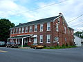
Breyer's Luncheon.
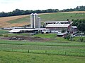
Farm on Charming Forge Rd.
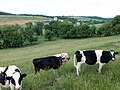
North Heidelberg Pasture.


References[]
- ^ "2016 U.S. Gazetteer Files". United States Census Bureau. Retrieved Aug 13, 2017.
- ^ a b "Population and Housing Unit Estimates". Retrieved June 9, 2017.
- ^ "National Register Information System". National Register of Historic Places. National Park Service. July 9, 2010.
- ^ "U.S. Census website". United States Census Bureau. Retrieved 2008-01-31.
External links[]
 Media related to North Heidelberg Township, Berks County, Pennsylvania at Wikimedia Commons

- Townships in Berks County, Pennsylvania
- Townships in Pennsylvania