Lenhartsville, Pennsylvania
Lenhartsville, Pennsylvania | |
|---|---|
Borough | |
 A winter day in Lenhartsville | |
 Location of Lenhartsville in Berks County, Pennsylvania. | |
 Lenhartsville Location of Lenhartsville in Pennsylvania | |
| Coordinates: 40°34′24″N 75°53′12″W / 40.57333°N 75.88667°WCoordinates: 40°34′24″N 75°53′12″W / 40.57333°N 75.88667°W | |
| Country | United States |
| State | Pennsylvania |
| County | Berks |
| Area | |
| • Total | 0.19 sq mi (0.49 km2) |
| • Land | 0.18 sq mi (0.48 km2) |
| • Water | 0.01 sq mi (0.01 km2) |
| Elevation | 381 ft (116 m) |
| Population (2010) | |
| • Total | 165 |
| • Estimate (2019)[2] | 171 |
| • Density | 924.32/sq mi (357.00/km2) |
| Time zone | UTC-5 (EST) |
| • Summer (DST) | UTC-4 (EDT) |
| ZIP Code | 19534 |
| Area code(s) | 610 Exchange: 562 |
| FIPS code | 42-42688 |


Lenhartsville is a borough in Berks County, Pennsylvania, United States. The population was 165 at the 2010 census.[3]
Geography[]
Lenhartsville is located in northern Berks County at 40°34′24″N 75°53′12″W / 40.57333°N 75.88667°W (40.573438, -75.886717),[4] in the valley of Maiden Creek. It is surrounded by Greenwich Township but is separate from it.
According to the United States Census Bureau, Lenhartsville has a total area of 0.14 square miles (0.35 km2), of which 0.004 square miles (0.01 km2), or 2.75%, is water.[3]
Demographics[]
| Historical population | |||
|---|---|---|---|
| Census | Pop. | %± | |
| 1880 | 161 | — | |
| 1890 | 152 | −5.6% | |
| 1900 | 144 | −5.3% | |
| 1910 | 153 | 6.3% | |
| 1920 | 144 | −5.9% | |
| 1930 | 204 | 41.7% | |
| 1940 | 211 | 3.4% | |
| 1950 | 229 | 8.5% | |
| 1960 | 209 | −8.7% | |
| 1970 | 220 | 5.3% | |
| 1980 | 200 | −9.1% | |
| 1990 | 195 | −2.5% | |
| 2000 | 173 | −11.3% | |
| 2010 | 165 | −4.6% | |
| 2019 (est.) | 171 | [2] | 3.6% |
| Sources:[5][6][7] | |||
At the 2000 census there were 173 people, 78 households, and 47 families living in the borough. The population density was 1,296.6 people per square mile (513.8/km²). There were 82 housing units at an average density of 614.6 per square mile (243.5/km²). The racial makeup of the borough was 100.00% White. Hispanic or Latino of any race were 0.58%.[6] Historically there is a large Pennsylvania Dutch population.
There were 78 households, 23.1% had children under the age of 18 living with them, 53.8% were married couples living together, 7.7% had a female householder with no husband present, and 38.5% were non-families. 28.2% of households were made up of individuals, and 14.1% were one person aged 65 or older. The average household size was 2.22 and the average family size was 2.73.
The age distribution was 17.3% under the age of 18, 8.7% from 18 to 24, 31.2% from 25 to 44, 26.0% from 45 to 64, and 16.8% 65 or older. The median age was 37 years. For every 100 females there were 96.6 males. For every 100 females age 18 and over, there were 93.2 males.
The median household income was $36,071 and the median family income was $36,964. Males had a median income of $35,000 versus $20,500 for females. The per capita income for the borough was $16,998. About 9.4% of families and 9.8% of the population were below the poverty line, including 7.1% of those under the age of eighteen and 8.3% of those sixty five or over.
History[]
Heinrich (Henry) Lenhart, 1773–1837, son of Jacob Lenhart, is considered the founder of Lenhartsville, on land once owned by his grandfather Johan Peter Lenhart.[8][9]
The Lenhart Farm was listed on the National Register of Historic Places in 1978.[10]
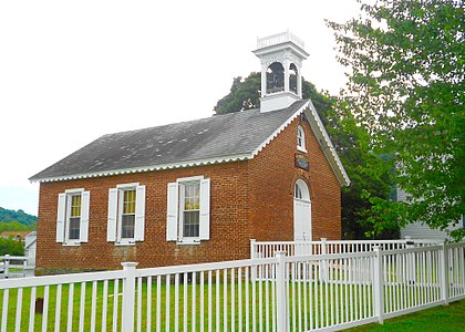
Borough Hall

Transportation[]
The Interstate 78/U.S. Route 22 freeway passes just north of the borough, with access from Exit 35 (Pennsylvania Route 143). I-78/US 22 leads east 23 miles (37 km) to Allentown and west 59 miles (95 km) to Harrisburg. PA 143 leads south 8 miles (13 km) via Pennsylvania Route 662 to U.S. Route 222 between Kutztown and Reading, and northeast 13 miles (21 km) to New Tripoli.
References[]
- ^ "2019 U.S. Gazetteer Files". United States Census Bureau. Retrieved July 28, 2020.
- ^ Jump up to: a b "Population and Housing Unit Estimates". United States Census Bureau. May 24, 2020. Retrieved May 27, 2020.
- ^ Jump up to: a b "Geographic Identifiers: 2010 Demographic Profile Data (G001): Lenhartsville borough, Pennsylvania". U.S. Census Bureau, American Factfinder. Archived from the original on February 12, 2020. Retrieved March 7, 2014.
- ^ "US Gazetteer files: 2010, 2000, and 1990". United States Census Bureau. 2011-02-12. Retrieved 2011-04-23.
- ^ "Census of Population and Housing". U.S. Census Bureau. Retrieved 11 December 2013.
- ^ Jump up to: a b "U.S. Census website". United States Census Bureau. Retrieved 2008-01-31.
- ^ "Incorporated Places and Minor Civil Divisions Datasets: Subcounty Resident Population Estimates: April 1, 2010 to July 1, 2012". Population Estimates. U.S. Census Bureau. Archived from the original on 11 June 2013. Retrieved 11 December 2013.
- ^ The Lenhart Family of Greenwich and Albany Twps., Berks County, and York County, PA. By Wm. H. Rinkenbach, A.B., M.S. 1937. Transcription and other information
- ^ Johan Peter Lenhart arrived in Philadelphia in 1748, on the ship Two Brothers. By 1749, he owned land in Philadelphia County (became Berks County in 1752). Between 1758-1767 he removed to Dover Township, York County, where he and his wife Maria Margaretha are buried. Additional information about Johan Peter Lenhart
- ^ "National Register Information System". National Register of Historic Places. National Park Service. July 9, 2010.
External links[]
 Media related to Lenhartsville, Pennsylvania at Wikimedia Commons
| show Municipalities and communities of Berks County, Pennsylvania, United States |
|---|

| show Authority control |
|---|
- Populated places established in 1854
- Boroughs in Berks County, Pennsylvania
- 1854 establishments in Pennsylvania