Donnellson, Illinois
Donnellson, Illinois | |
|---|---|
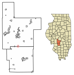 Location of Donnellson in Bond County, Illinois. | |
 Location of Illinois in the United States | |
| Coordinates: 39°1′52″N 89°28′27″W / 39.03111°N 89.47417°WCoordinates: 39°1′52″N 89°28′27″W / 39.03111°N 89.47417°W | |
| Country | United States |
| State | Illinois |
| County | Montgomery and Bond |
| Area | |
| • Total | 0.33 sq mi (0.85 km2) |
| • Land | 0.33 sq mi (0.85 km2) |
| • Water | 0.00 sq mi (0.00 km2) 0% |
| Elevation | 617 ft (188 m) |
| Population (2010) | |
| • Total | 210 |
| • Estimate (2019)[2] | 195 |
| • Density | 596.33/sq mi (230.30/km2) |
| Time zone | UTC-6 (CST) |
| • Summer (DST) | UTC-5 (CDT) |
| ZIP Code(s) | 62019 |
| Area code(s) | 217 |
| FIPS code | 17-20318 |
| FIPS code | 17-20318 |
| GNIS ID | 2398737 |
| Wikimedia Commons | Donnellson, Illinois |
| Website | www |

Donnellson is a village in Montgomery and Bond counties, Illinois, United States. The population was 210 at the 2010 census and as of 2018, the population had declined to an estimated 172.[3][4]
History[]
Donnellson was laid out ca. 1858.[5] The village's name honors Thomas Carson Donnell, an early settler.[6] Donnellson was incorporated as a village in 1897.[7]
Geography[]
Donnellson is located at 39°01′52″N 89°28′27″W / 39.031159°N 89.474037°W.[8]
According to the 2010 census, Donnellson has a total area of 0.33 square miles (0.85 km2), all land.[9]
Demographics[]
| Historical population | |||
|---|---|---|---|
| Census | Pop. | %± | |
| 1900 | 268 | — | |
| 1910 | 405 | 51.1% | |
| 1920 | 403 | −0.5% | |
| 1930 | 452 | 12.2% | |
| 1940 | 356 | −21.2% | |
| 1950 | 336 | −5.6% | |
| 1960 | 292 | −13.1% | |
| 1970 | 311 | 6.5% | |
| 1980 | 256 | −17.7% | |
| 1990 | 167 | −34.8% | |
| 2000 | 243 | 45.5% | |
| 2010 | 210 | −13.6% | |
| 2019 (est.) | 195 | [2] | −7.1% |
| U.S. Decennial Census[10] | |||
As of the census[11] of 2000, there were 243 people, 93 households, and 63 families residing in the village. The population density was 1,021.2 people per square mile (390.9/km2). There were 100 housing units at an average density of 420.3 per square mile (160.9/km2). The racial makeup of the village was 97.94% White, 0.41% African American, 0.41% Native American, and 1.23% from two or more races.
There were 93 households, out of which 36.6% had children under the age of 18 living with them, 53.8% were married couples living together, 11.8% had a female householder with no husband present, and 31.2% were non-families. 25.8% of all households were made up of individuals, and 14.0% had someone living alone who was 65 years of age or older. The average household size was 2.61 and the average family size was 3.23.
In the village, the population was spread out, with 30.9% under the age of 18, 10.3% from 18 to 24, 26.7% from 25 to 44, 18.5% from 45 to 64, and 13.6% who were 65 years of age or older. The median age was 34 years. For every 100 females, there were 104.2 males. For every 100 females age 18 and over, there were 97.6 males.
The median income for a household in the village was $28,365, and the median income for a family was $27,917. Males had a median income of $36,875 versus $22,500 for females. The per capita income for the village was $13,665. About 7.6% of families and 13.4% of the population were below the poverty line, including 29.5% of those under the age of eighteen and 5.4% of those 65 or over.
References[]
- ^ "2019 U.S. Gazetteer Files". United States Census Bureau. Retrieved July 14, 2020.
- ^ a b "Population and Housing Unit Estimates". United States Census Bureau. May 24, 2020. Retrieved May 27, 2020.
- ^ "Geographic Identifiers: 2010 Demographic Profile Data (G001): Donnellson village, Illinois". U.S. Census Bureau, American Factfinder. Archived from the original on February 12, 2020. Retrieved November 12, 2013.
- ^ "ACS DEMOGRAPHIC AND HOUSING ESTIMATES". data.census.gov. Retrieved 2020-04-02.
- ^ Callary, Edward (29 September 2008). Place Names of Illinois. University of Illinois Press. p. 96. ISBN 978-0-252-09070-7.
- ^ Historical Encyclopedia of Illinois. Munsell Publishing Company. 1918. p. 874.
- ^ Keith, Allan H. (1 January 2002). Historical Stories: About Greenville and Bond County, IL. Allan H. Keith. p. 13. ISBN 978-0-9774628-1-0.
- ^ "US Gazetteer files: 2010, 2000, and 1990". United States Census Bureau. 2011-02-12. Retrieved 2011-04-23.
- ^ "G001 - Geographic Identifiers - 2010 Census Summary File 1". United States Census Bureau. Archived from the original on 2020-02-13. Retrieved 2015-08-02.
- ^ "Census of Population and Housing". Census.gov. Retrieved June 4, 2015.
- ^ "U.S. Census website". United States Census Bureau. Retrieved 2008-01-31.
External links[]
- Donnellson Illinois, Historical Society of Montgomery County Illinois
Municipalities and communities of Bond County, Illinois, United States | ||
|---|---|---|
| City | ||
| Villages | ||
| Townships | ||
| Unincorporated communities | ||
| Ghost town | ||
| Footnotes | ‡This populated place also has portions in an adjacent county or counties | |
| ||
Municipalities and communities of Montgomery County, Illinois, United States | ||
|---|---|---|
| Cities | ||
| Villages | ||
| Townships | ||
| Unincorporated communities | ||
| Footnotes | ‡This populated place also has portions in an adjacent county or counties | |
| ||
- Villages in Bond County, Illinois
- Villages in Illinois
- Villages in Montgomery County, Illinois
- Populated places established in 1897
- 1858 establishments in Illinois
- Populated places established in 1858