Pleasant Mound Township, Bond County, Illinois
Pleasant Mound Township | |
|---|---|
 Location in Bond County | |
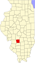 Bond County's location in Illinois | |
| Coordinates: 38°52′54″N 89°18′51″W / 38.88167°N 89.31417°WCoordinates: 38°52′54″N 89°18′51″W / 38.88167°N 89.31417°W | |
| Country | United States |
| State | Illinois |
| County | Bond |
| Settlement | November 6, 1888 |
| Area | |
| • Total | 37.86 sq mi (98.1 km2) |
| • Land | 37.81 sq mi (97.9 km2) |
| • Water | 0.05 sq mi (0.1 km2) 0.13% |
| Elevation | 561 ft (171 m) |
| Population (2010) | |
| • Estimate (2016)[1] | 958 |
| • Density | 26.9/sq mi (10.4/km2) |
| Time zone | UTC-6 (CST) |
| • Summer (DST) | UTC-5 (CDT) |
| ZIP codes | 62246, 62262, 62284 |
| FIPS code | 17-005-60586 |

Pleasant Mound Township is one of nine townships in Bond County, Illinois, USA. As of the 2010 census, its population was 1,018 and it contained 498 housing units.[2]
Geography[]
According to the 2010 census, the township has a total area of 37.86 square miles (98.1 km2), of which 37.81 square miles (97.9 km2) (or 99.87%) is land and 0.05 square miles (0.13 km2) (or 0.13%) is water.[2]
Cities[]
- Greenville (east quarter)
- Smithboro
Unincorporated towns[]
Cemeteries[]
The township contains these six cemeteries: Durham, Halls Grove, Maxey, Mulberry Grove, Noffsinger and Seagraves.
Major highways[]
 Interstate 70
 U.S. Route 40
 Illinois Route 127
 Illinois Route 140
Demographics[]
| Historical population | |||
|---|---|---|---|
| Census | Pop. | %± | |
| 2016 (est.) | 958 | [1] | |
| U.S. Decennial Census[3] | |||
School districts[]
- Bond County Community Unit School District 2
- Mulberry Grove Community Unit School District 1
- Vandalia Community Unit School District 203
Political districts[]
- Illinois' 19th congressional district
- State House District 102
- State Senate District 51
References[]
- "Pleasant Mound Township, Bond County, Illinois". Geographic Names Information System. United States Geological Survey. Retrieved 2010-01-04.
- United States Census Bureau 2007 TIGER/Line Shapefiles
- United States National Atlas
- ^ a b "Population and Housing Unit Estimates". Retrieved June 9, 2017.
- ^ a b "Population, Housing Units, Area, and Density: 2010 - County -- County Subdivision and Place -- 2010 Census Summary File 1". United States Census. Archived from the original on 2020-02-12. Retrieved 2013-05-28.
- ^ "Census of Population and Housing". Census.gov. Retrieved June 4, 2016.
External links[]
Places adjacent to Pleasant Mound Township, Bond County, Illinois | |
|---|---|
Municipalities and communities of Bond County, Illinois, United States | ||
|---|---|---|
| City | ||
| Villages | ||
| Townships | ||
| Unincorporated communities | ||
| Ghost town | ||
| Footnotes | ‡This populated place also has portions in an adjacent county or counties | |
| ||
Categories:
- Townships in Bond County, Illinois
- 1888 establishments in Illinois
- Townships in Illinois