Bear Grove Township, Fayette County, Illinois
Bear Grove Township | |
|---|---|
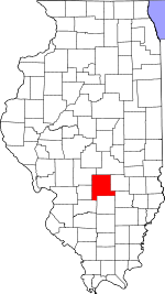
 Location in Fayette County | |
 Fayette County's location in Illinois | |
| Coordinates: 38°57′38″N 89°11′29″W / 38.96056°N 89.19139°WCoordinates: 38°57′38″N 89°11′29″W / 38.96056°N 89.19139°W | |
| Country | United States |
| State | Illinois |
| County | Fayette |
| Established | 1859 |
| Area | |
| • Total | 37.41 sq mi (96.9 km2) |
| • Land | 37.35 sq mi (96.7 km2) |
| • Water | 0.06 sq mi (0.2 km2) 0.16% |
| Elevation | 525 ft (160 m) |
| Population (2010) | |
| • Estimate (2016)[1] | 580 |
| • Density | 16/sq mi (6/km2) |
| Time zone | UTC-6 (CST) |
| • Summer (DST) | UTC-5 (CDT) |
| ZIP codes | 62262, 62471 |
| FIPS code | 17-051-04377 |

Bear Grove Township is one of twenty townships in Fayette County, Illinois, USA. As of the 2010 census, its population was 599 and it contained 259 housing units.[2] The township was originally known as Johnson Township.
Geography[]
According to the 2010 census, the township has a total area of 37.41 square miles (96.9 km2), of which 37.35 square miles (96.7 km2) (or 99.84%) is land and 0.06 square miles (0.16 km2) (or 0.16%) is water.[2]
Unincorporated towns[]
Extinct towns[]
- Jimtown
Cemeteries[]
The township contains these five cemeteries: Bethlehem, Eakle, Evans, McInturff and Wright and Neathery.
Major highways[]
 Interstate 70
 U.S. Route 40
 Illinois Route 140
Airports and landing strips[]
- Lutz Airport
- Vandalia Municipal Airport
Lakes[]
Demographics[]
| Historical population | |||
|---|---|---|---|
| Census | Pop. | %± | |
| 2016 (est.) | 580 | [1] | |
| U.S. Decennial Census[3] | |||
School districts[]
- Mulberry Grove Community Unit School District 1
- Vandalia Community Unit School District 203
Political districts[]
- Illinois' 19th congressional district
- State House District 102
- State Senate District 51
References[]
- "Bear Grove Township, Fayette County, Illinois". Geographic Names Information System. United States Geological Survey. Retrieved 2010-01-16.
- United States Census Bureau 2007 TIGER/Line Shapefiles
- United States National Atlas
- ^ a b "Population and Housing Unit Estimates". Retrieved June 9, 2017.
- ^ a b "Population, Housing Units, Area, and Density: 2010 - County -- County Subdivision and Place -- 2010 Census Summary File 1". United States Census. Archived from the original on 2020-02-12. Retrieved 2013-05-28.
- ^ "Census of Population and Housing". Census.gov. Retrieved June 4, 2016.
External links[]
Places adjacent to Bear Grove Township, Fayette County, Illinois | |
|---|---|
Municipalities and communities of Fayette County, Illinois, United States | ||
|---|---|---|
| Cities | ||
| Villages | ||
| Townships | ||
| CDP | ||
| Other communities | ||
| ||
Categories:
- Townships in Fayette County, Illinois
- 1859 establishments in Illinois
- Populated places established in 1859
- Townships in Illinois