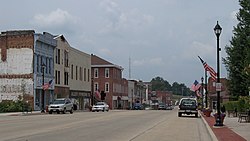
Vandalia, Illinois
Vandalia | |
|---|---|
City | |
 | |
| Motto(s): "Oldest Existing Illinois Capital City" | |
 Location of Vandalia in Fayette County, Illinois. | |
 Location of Illinois in the United States | |
| Coordinates: 38°58′5″N 89°6′7″W / 38.96806°N 89.10194°WCoordinates: 38°58′5″N 89°6′7″W / 38.96806°N 89.10194°W | |
| Country | |
| State | |
| County | Fayette |
| Townships | Vandalia, Bear Grove, Sharon |
| Founded | 1819 |
| Government | |
| • Mayor | Ricky J. Gottman |
| Area | |
| • Total | 8.16 sq mi (21.14 km2) |
| • Land | 8.15 sq mi (21.10 km2) |
| • Water | 0.02 sq mi (0.04 km2) |
| Population (2010) | |
| • Total | 7,042 |
| • Estimate (2019)[2] | 6,684 |
| • Density | 820.42/sq mi (316.78/km2) |
| Time zone | UTC−6 (CST) |
| • Summer (DST) | UTC−5 (CDT) |
| ZIP Code | 62471 |
| Area code(s) | 618 |
| FIPS code | 17-77317 |
| Website | vandaliaillinois |

Vandalia is a city in Fayette County, Illinois, United States. At the 2010 Census, the population was 7,042. Vandalia is 69 miles (111 km) northeast of St. Louis, on the Kaskaskia River. It served as the state capital of Illinois from 1819 until 1839, when the seat of state government moved to the current capital of Springfield. Vandalia was for years the western terminus of the National Road. Today, Vandalia is the county seat of Fayette County[3] and the home of the Vandalia State House State Historic Site (1836).
History[]

Vandalia was founded in 1819 as a new capital city for Illinois.[4] The previous capital, Kaskaskia, was unsuitable because it was under the constant threat of flooding. The townsite, located in Bond County at the time,[5]:5 was hastily prepared for the 1820 meeting of the Illinois General Assembly.[4] In 1821, Fayette County was created, including Vandalia.[5]:5
The history of the name Vandalia is uncertain. Different theories can be found in almost all of the books written about Vandalia over the years. In her book Vandalia: Wilderness Capital of Lincoln's Land, Mary Burtschi tells of a conversation between one of the original surveyors of the town and a Vandalia resident. The surveyor, Colonel Greenup, explained that Van was suggested by one of the men. He recommended this as an abbreviation to the word vanguard meaning the forefront of an advancing movement. Another suggestion was made for the term dalia, derived from the Anglo-Saxon word dale which means a valley between hills. Greenup takes credit in the conversation for connecting the two terms to form the name Vandalia.
Another possible source of the name is the Vandalia colony, a failed attempt to establish a fourteenth colony in part of what is now West Virginia and Kentucky. The Vandalia colony was named in honor of Queen Charlotte, who claimed descent from the Wendish tribe of Obodrites, also called the Vandals.
Another theory put forth is that Vandalia was named by those who located the state capital in the town; according to the story, they mistakenly thought the Vandals were a brave Native American tribe, rather than of Germanic origins.[6][7]
The law under which Vandalia was founded included a provision that the capital would not be moved for twenty years.[8] Even before the end of this period, the population center of the state had shifted far north of Vandalia.[9] In 1837, the General Assembly voted to move the capital to Springfield.[9]
On November 21, 1915, the Liberty Bell passed through Vandalia on its nationwide tour, while being returned to Philadelphia, Pennsylvania from the Panama-Pacific International Exposition in San Francisco.[6][10]
In the early 1960s the sociologist Joseph Lyford examined the social structure of Vandalia in a book-length study that revealed the essentially corporatist nature of decision-making in the city; this work was recently revisited by the Economist newspaper.[11]
Population trends[]
In 1900, 2,665 people lived in Vandalia; in 1910, 2,974; and in 1940, 5,288. The population was 6,975 at the 2000 census.
Education[]
The city has a Board of Education.[12] Among the public schools in the city are Jefferson Elementary School and former Central School, which was condemned in 1980.[12] The city's first high school was established in 1858.[13] Vandalia is home to the Okaw Valley Area Vocational Center,[14] which trains high school students in vocational trades. It also serves vocational students from nearby high schools such as those in Greenville and Mulberry Grove. The building trades class at the center each year purchases property in Vandalia, builds a house, and sells the improved property. They have sold 33 homes constructed by students.[15]
Geography[]
Vandalia is located at 38°58′5″N 89°6′7″W / 38.96806°N 89.10194°W (38.568077, -89.101995).[16]
According to the 2010 census, Vandalia has a total area of 8.116 square miles (21.02 km2), of which 8.1 square miles (20.98 km2) (or 99.8%) is land and 0.016 square miles (0.04 km2) (or 0.2%) is water.[17]
Vandalia is situated on Interstate 70, U.S. Route 40 (the National Road) and U.S. Route 51.
Climate[]
| hideClimate data for Vandalia, Illinois (1991–2020 normals, extremes 1899–present) | |||||||||||||
|---|---|---|---|---|---|---|---|---|---|---|---|---|---|
| Month | Jan | Feb | Mar | Apr | May | Jun | Jul | Aug | Sep | Oct | Nov | Dec | Year |
| Record high °F (°C) | 72 (22) |
77 (25) |
84 (29) |
89 (32) |
94 (34) |
104 (40) |
111 (44) |
106 (41) |
98 (37) |
97 (36) |
81 (27) |
72 (22) |
111 (44) |
| Average high °F (°C) | 36.9 (2.7) |
41.9 (5.5) |
52.7 (11.5) |
65.1 (18.4) |
74.9 (23.8) |
83.7 (28.7) |
86.8 (30.4) |
85.9 (29.9) |
79.6 (26.4) |
67.7 (19.8) |
53.7 (12.1) |
41.5 (5.3) |
64.2 (17.9) |
| Daily mean °F (°C) | 28.8 (−1.8) |
33.0 (0.6) |
42.9 (6.1) |
54.2 (12.3) |
64.6 (18.1) |
73.5 (23.1) |
76.7 (24.8) |
75.2 (24.0) |
67.7 (19.8) |
55.8 (13.2) |
43.9 (6.6) |
33.6 (0.9) |
54.2 (12.3) |
| Average low °F (°C) | 20.7 (−6.3) |
24.2 (−4.3) |
33.2 (0.7) |
43.3 (6.3) |
54.2 (12.3) |
63.2 (17.3) |
66.6 (19.2) |
64.4 (18.0) |
55.8 (13.2) |
44.0 (6.7) |
34.1 (1.2) |
25.6 (−3.6) |
44.1 (6.7) |
| Record low °F (°C) | −22 (−30) |
−19 (−28) |
−9 (−23) |
20 (−7) |
28 (−2) |
39 (4) |
48 (9) |
41 (5) |
20 (−7) |
22 (−6) |
5 (−15) |
−17 (−27) |
−22 (−30) |
| Average precipitation inches (mm) | 2.97 (75) |
2.49 (63) |
3.32 (84) |
4.86 (123) |
5.30 (135) |
4.87 (124) |
3.90 (99) |
3.24 (82) |
3.07 (78) |
3.26 (83) |
3.76 (96) |
2.69 (68) |
43.73 (1,111) |
| Average precipitation days (≥ 0.01 in) | 8.9 | 7.2 | 9.5 | 11.0 | 12.4 | 9.9 | 8.0 | 7.4 | 6.8 | 8.2 | 9.2 | 8.3 | 106.8 |
| Source: NOAA[18][19] | |||||||||||||
Demographics[]
| Historical population | |||
|---|---|---|---|
| Census | Pop. | %± | |
| 1850 | 419 | — | |
| 1860 | 1,145 | 173.3% | |
| 1870 | 1,771 | 54.7% | |
| 1880 | 2,056 | 16.1% | |
| 1890 | 2,144 | 4.3% | |
| 1900 | 2,665 | 24.3% | |
| 1910 | 2,974 | 11.6% | |
| 1920 | 3,316 | 11.5% | |
| 1930 | 4,342 | 30.9% | |
| 1940 | 5,288 | 21.8% | |
| 1950 | 5,471 | 3.5% | |
| 1960 | 5,537 | 1.2% | |
| 1970 | 5,160 | −6.8% | |
| 1980 | 5,338 | 3.4% | |
| 1990 | 6,114 | 14.5% | |
| 2000 | 6,975 | 14.1% | |
| 2010 | 7,042 | 1.0% | |
| 2019 (est.) | 6,684 | [2] | −5.1% |
| U.S. Decennial Census[20] | |||
As of the census[21] of 2000, there were 6,975 people, 2,344 households, and 1,425 families residing in the city. The population density was 1,231.3 people per square mile (475.8/km2). There were 2,543 housing units at an average density of 448.9 per square mile (173.5/km2). The racial makeup of the city was 95.57% White, 2.01% African American, 0.13% Native American, 0.30% Asian, 0.50% from other races, and 0.49% from two or more races. Hispanic or Latino of any race were 0.71% of the population.
There were 2,344 households, out of which 28.6% had children under the age of 18 living with them, 45.3% were married couples living together, 11.2% had a female householder with no husband present, and 39.2% were non-families. 35.1% of all households were made up of individuals, and 17.2% had someone living alone who was 65 years of age or older. The average household size was 2.25 and the average family size was 2.90.
In the city, the population was spread out, with 18.3% under the age of 18, 12.4% from 18 to 24, 34.3% from 25 to 44, 17.9% from 45 to 64, and 17.1% who were 65 years of age or older. The median age was 36 years. For every 100 females, there were 134.4 males. For every 100 females age 18 and over, there were 144.4 males.
The median income for a household in the city was $30,857, and the median income for a family was $39,762. Males had a median income of $27,342 versus $19,109 for females. The per capita income for the city was $14,918. About 8.9% of families and 15.6% of the population were below the poverty line, including 21.4% of those under age 18 and 13.8% of those age 65 or over.
Government[]
Vandalia is governed using the mayor council system. The council consists of eight members elected from one of four wards with each ward electing two members. The mayor along with the city clerk and treasurer are elected in a citywide vote.[22]
Notable people[]
- Alfred Elisha Ames, politician and physician
- Josie Barnes, professional ten-pin bowler and winner of the 2021 U.S. Women's Open
- Henry P. H. Bromwell, U.S. Representative from Illinois
- John J. Bullington, Illinois politician
- H. Joel Deckard, U.S. Representative from Indiana
- Levi Davis, Illinois Auditor and lawyer
- William Lee D. Ewing, U.S. Senator and fifth Governor of Illinois
- William M. Farmer, Chief Justice of the Illinois Supreme Court
- Ferris Foreman, politician and Army colonel
- John W. Heavey, U.S. Army brigadier general, chief of the National Guard Bureau
- Miles E. Mills, Illinois politician and educator
- Frederick Remann, Illinois politician
- Levi Stewart, Mormon pioneer
- June Squibb, Academy Award-nominated actress
In fiction and popular culture[]
- In Jules Verne's An Antarctic Mystery (1897), Dirk Peters, AKA Hunt, lived for many years in Vandalia before resuming his quest for his companion Arthur Gordon Pym. This novel is an imagined sequel to Edgar Allan Poe's only novel, The Narrative of Arthur Gordon Pym of Nantucket.
- The case of Frier v. City of Vandalia was a case decided by the Seventh Circuit Court of Appeals on the issue of res judicata. The case originally involved a parking dispute in Vandalia but became a pivotal case in civil procedure.[23]
- Four US Navy ships have been named for Vandalia.[citation needed]
References[]
- ^ "2019 U.S. Gazetteer Files". United States Census Bureau. Retrieved July 14, 2020.
- ^ Jump up to: a b "Population and Housing Unit Estimates". United States Census Bureau. May 24, 2020. Retrieved May 27, 2020.
- ^ "Find a County". National Association of Counties. Archived from the original on May 31, 2011. Retrieved June 7, 2011.
- ^ Jump up to: a b "Vandalia, Illinois History". Vandalia, Illinois. City of Vandalia. Archived from the original on May 8, 2015. Retrieved July 10, 2015.
- ^ Jump up to: a b Documentary History of Vandalia, Illinois. October 1954 – via Internet Archive.
- ^ Jump up to: a b Allan H. Keith, Historical Stories: About Greenville and Bond County, IL Archived 2016-01-20 at the Wayback Machine. Consulted on August 15, 2007.
- ^ Allen, John W. (January 11, 1963). "Place Names Have Colorful History". The Southeast Missourian. p. 6. Archived from the original on September 4, 2015. Retrieved April 27, 2015.
- ^ "Springfield's Long Nine". the New York Times. December 1, 1900. Archived from the original on January 17, 2016. Retrieved July 10, 2015.
- ^ Jump up to: a b Power, John Carroll (1876). History of the early settlers of Sangamon County, Illinois : centennial record. Springfield, Illinois: Edwin A. Wilson & Co. p. 46. Archived from the original on January 18, 2016. Retrieved July 10, 2015.
- ^ "Liberty Bell Attracts Crowd in Greenville During 1915 Stop". Greenville Advocate. July 3, 2007.
- ^ "The view from Vandalia: A half century on, a much-studied small city has lessons to teach". The Economist. December 22, 2012. Archived from the original on October 19, 2017. Retrieved September 17, 2017.
- ^ Jump up to: a b Petrina, David (December 19, 1980). "Scaled-down school addition considered". Herald & Review. 101 (298). Decatur, Illinois: Lee Enterprises. p. A5. Archived from the original on June 7, 2019 – via Newspapers.com.
- ^ Belting, Paul E. (1919). Development of the Free Public High School in Illinois to 1860. Springfield, Illinois: Illinois State Journal Press. pp. 523 – via Internet Archive.
- ^ 2000-2001 Directory: Illinois Public Schools, Public School Districts, Other Education Units. Illinois State Board of Education. 1989. pp. 153 – via Internet Archive.
Okaw Area Vocational Center
- ^ "BUILDING TRADES CLASS BUILDS 33RD HOME". WGEL. May 21, 2007. Archived from the original on August 23, 2007. Retrieved August 14, 2007.
- ^ "US Gazetteer files: 2010, 2000, and 1990". United States Census Bureau. February 12, 2011. Retrieved April 23, 2011.
- ^ "G001 - Geographic Identifiers - 2010 Census Summary File 1". United States Census Bureau. Archived from the original on February 13, 2020. Retrieved December 27, 2015.
- ^ "NowData – NOAA Online Weather Data". National Oceanic and Atmospheric Administration. Retrieved July 24, 2021.
- ^ "Station: Vandalia, IL". U.S. Climate Normals 2020: U.S. Monthly Climate Normals (1991-2020). National Oceanic and Atmospheric Administration. Retrieved July 24, 2021.
- ^ "Census of Population and Housing". Census.gov. Retrieved June 4, 2015.
- ^ "U.S. Census website". United States Census Bureau. Retrieved January 31, 2008.
- ^ "Elected Officials". City of Vandalia, IL. Retrieved January 10, 2020.
- ^ "Archived copy". Archived from the original on January 20, 2016. Retrieved March 10, 2015.CS1 maint: archived copy as title (link)
External links[]
| show Municipalities and communities of Fayette County, Illinois, United States |
|---|
| show Authority control |
|---|
- Cities in Illinois
- Cities in Fayette County, Illinois
- Former state capitals in the United States
- County seats in Illinois
- Populated places established in 1819
- 1819 establishments in Illinois