Farina, Illinois
Farina, Illinois | |
|---|---|
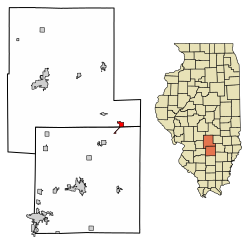 Location of Farina in Marion County, Illinois. | |
 Location of Illinois in the United States | |
| Coordinates: 38°49′59″N 88°46′33″W / 38.83306°N 88.77583°WCoordinates: 38°49′59″N 88°46′33″W / 38.83306°N 88.77583°W | |
| Country | United States |
| State | Illinois |
| Counties | Fayette, Marion |
| Townships | La Clede, Meacham |
| Area | |
| • Total | 1.46 sq mi (3.79 km2) |
| • Land | 1.46 sq mi (3.77 km2) |
| • Water | 0.01 sq mi (0.02 km2) |
| Elevation | 178 ft (54 m) |
| Population (2010) | |
| • Total | 518 |
| • Estimate (2019)[2] | 499 |
| • Density | 342.48/sq mi (132.23/km2) |
| Time zone | UTC-6 (CST) |
| • Summer (DST) | UTC-5 (CDT) |
| ZIP Code(s) | 62838 |
| Area code(s) | 618 |
| FIPS code | 17-25375 |
| Wikimedia Commons | Farina, Illinois |
Farina is a village in Fayette and Marion counties, Illinois, United States. The population was 518 at the 2010 census.[3] It is the only community with the name "Farina" in the United States.
History[]
Farina was founded in 1867.[4] The community was named after farina (food), from its location in the wheat-growing district.[5]
Geography[]
Farina is located in southeastern Fayette County at 38°49′59″N 88°46′33″W / 38.83306°N 88.77583°W (38.833008, -88.775786).[6] The village limits extend southwest along Illinois Route 37 into Marion County. Interstate 57 passes through the northwest corner of the village at Exit 135, leading northeast 26 miles (42 km) to Effingham and southwest 21 miles (34 km) to Salem. Illinois Route 37 passes through the enter of Farina and runs parallel to I-57. Illinois Route 185 leads northwest 24 miles (39 km) to Vandalia, the Fayette County seat.
According to the 2010 census, Farina has a total area of 1.467 square miles (3.80 km2), of which 1.46 square miles (3.78 km2) (or 99.52%) is land and 0.007 square miles (0.02 km2) (or 0.48%) is water.[7]
Demographics[]
| Historical population | |||
|---|---|---|---|
| Census | Pop. | %± | |
| 1870 | 232 | — | |
| 1880 | 318 | 37.1% | |
| 1890 | 618 | 94.3% | |
| 1900 | 693 | 12.1% | |
| 1910 | 774 | 11.7% | |
| 1920 | 701 | −9.4% | |
| 1930 | 694 | −1.0% | |
| 1940 | 804 | 15.9% | |
| 1950 | 787 | −2.1% | |
| 1960 | 692 | −12.1% | |
| 1970 | 634 | −8.4% | |
| 1980 | 594 | −6.3% | |
| 1990 | 575 | −3.2% | |
| 2000 | 558 | −3.0% | |
| 2010 | 518 | −7.2% | |
| 2019 (est.) | 499 | [2] | −3.7% |
| U.S. Decennial Census[8] | |||
As of the census[9] of 2000, there were 558 people, 237 households, and 147 families residing in the village. The population density was 387.6 people per square mile (149.6/km2). There were 267 housing units at an average density of 185.5 per square mile (71.6/km2). The racial makeup of the village was 99.28% White, 0.36% Native American, and 0.36% from two or more races. Hispanic or Latino of any race were 0.18% of the population.
There were 237 households, out of which 25.7% had children under the age of 18 living with them, 50.6% were married couples living together, 8.0% had a female householder with no husband present, and 37.6% were non-families. 34.6% of all households were made up of individuals, and 19.0% had someone living alone who was 65 years of age or older. The average household size was 2.28 and the average family size was 2.96.
In the village, the population was spread out, with 22.6% under the age of 18, 7.0% from 18 to 24, 22.6% from 25 to 44, 25.8% from 45 to 64, and 22.0% who were 65 years of age or older. The median age was 43 years. For every 100 females, there were 86.6 males. For every 100 females age 18 and over, there were 87.0 males.
The median income for a household in the village was $31,406, and the median income for a family was $41,875. Males had a median income of $27,917 versus $19,886 for females. The per capita income for the village was $17,068. About 6.2% of families and 10.8% of the population were below the poverty line, including 10.7% of those under age 18 and 17.2% of those age 65 or over.
References[]
- ^ "2019 U.S. Gazetteer Files". United States Census Bureau. Retrieved July 14, 2020.
- ^ a b "Population and Housing Unit Estimates". United States Census Bureau. May 24, 2020. Retrieved May 27, 2020.
- ^ "Geographic Identifiers: 2010 Census Summary File 1 (G001), Farina village, Illinois". American FactFinder. U.S. Census Bureau. Archived from the original on February 13, 2020. Retrieved May 3, 2016.
- ^ Illinois Central Magazine. Illinois Central Railroad Company. 1922. p. 46.
- ^ Gannett, Henry (1905). The Origin of Certain Place Names in the United States. Govt. Print. Off. pp. 124.
- ^ "US Gazetteer files: 2010, 2000, and 1990". United States Census Bureau. 2011-02-12. Retrieved 2011-04-23.
- ^ "G001 - Geographic Identifiers - 2010 Census Summary File 1". United States Census Bureau. Archived from the original on 2020-02-13. Retrieved 2015-08-03.
- ^ "Census of Population and Housing". Census.gov. Retrieved June 4, 2015.
- ^ "U.S. Census website". United States Census Bureau. Retrieved 2008-01-31.
Municipalities and communities of Fayette County, Illinois, United States | ||
|---|---|---|
| Cities | ||
| Villages | ||
| Townships | ||
| CDP | ||
| Other communities | ||
| ||
Municipalities and communities of Marion County, Illinois, United States | ||
|---|---|---|
| Cities | ||
| Villages | ||
| Townships | ||
| Unincorporated communities | ||
| Footnotes | ‡This populated place also has portions in an adjacent county or counties | |
| ||
- Villages in Fayette County, Illinois
- Villages in Illinois