Mount Sterling, Illinois
Mount Sterling, Illinois | |
|---|---|
City | |
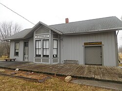 Former train station in Mount Sterling | |
 Location of Illinois in the United States | |
| Coordinates: 39°59′12″N 90°45′55″W / 39.98667°N 90.76528°WCoordinates: 39°59′12″N 90°45′55″W / 39.98667°N 90.76528°W | |
| Country | United States |
| State | Illinois |
| County | Brown |
| Area | |
| • Total | 1.11 sq mi (2.87 km2) |
| • Land | 1.11 sq mi (2.87 km2) |
| • Water | 0.00 sq mi (0.00 km2) 0% |
| Population (2010) | |
| • Total | 2,025 |
| • Estimate (2019)[2] | 1,909 |
| • Density | 1,722.92/sq mi (665.07/km2) |
| Time zone | UTC-6 (CST) |
| • Summer (DST) | UTC-5 (CDT) |
| ZIP Code(s) | 62353 |
| Area code(s) | 217 |
| FIPS code | 17-51154 |
| Wikimedia Commons | Mount Sterling, Illinois |
| Website | mtsterlingil |

Mount Sterling is a city in and the county seat of Brown County, Illinois, United States. The population was 2,025 at the 2010 census.[3] Foodservice distributor Dot Foods is based in Mount Sterling.
History[]
Mount Sterling was organized in 1854. It did not have a court house until 1868 although it was designated the county seat from when the county was organized.[4]
Geography[]
According to the 2010 census, Mount Sterling has a total area of 1.11 square miles (2.87 km2), all land.[5]
Demographics[]
| Historical population | |||
|---|---|---|---|
| Census | Pop. | %± | |
| 1850 | 556 | — | |
| 1870 | 1,352 | — | |
| 1880 | 1,445 | 6.9% | |
| 1890 | 1,655 | 14.5% | |
| 1900 | 1,960 | 18.4% | |
| 1910 | 1,986 | 1.3% | |
| 1920 | 1,932 | −2.7% | |
| 1930 | 1,724 | −10.8% | |
| 1940 | 2,140 | 24.1% | |
| 1950 | 2,246 | 5.0% | |
| 1960 | 2,262 | 0.7% | |
| 1970 | 2,182 | −3.5% | |
| 1980 | 2,186 | 0.2% | |
| 1990 | 1,922 | −12.1% | |
| 2000 | 2,070 | 7.7% | |
| 2010 | 2,025 | −2.2% | |
| 2019 (est.) | 1,909 | [2] | −5.7% |
| U.S. Decennial Census[6] | |||
At the 2000 census there were 2,070 people in 934 households, including 535 families, in the city. The population density was 1,923.5 people per square mile (740.0/km2). There were 1,048 housing units at an average density of 973.8 per square mile (374.7/km2). The racial makeup of the city was 98.55% White, 0.14% African American, 0.34% Asian, 0.14% Pacific Islander, 0.19% from other races, and 0.63% from two or more races. Hispanic or Latino of any race were 0.97%.[7]
Of the 934 households 26.6% had children under the age of 18 living with them, 45.1% were married couples living together, 8.8% had a female householder with no husband present, and 42.7% were non-families. 39.0% of households were one person and 17.6% were one person aged 65 or older. The average household size was 2.15 and the average family size was 2.89.
The age distribution was 23.0% under the age of 18, 8.2% from 18 to 24, 28.4% from 25 to 44, 19.5% from 45 to 64, and 21.0% 65 or older. The median age was 38 years. For every 100 females, there were 92.2 males. For every 100 females age 18 and over, there were 89.5 males.
The median household income was $27,434 and the median family income was $40,363. Males had a median income of $29,333 versus $19,258 for females. The per capita income for the city was $15,755. About 4.7% of families and 10.9% of the population were below the poverty line, including 12.5% of those under age 18 and 10.2% of those age 65 or over.
References[]
- ^ "2019 U.S. Gazetteer Files". United States Census Bureau. Retrieved July 14, 2020.
- ^ a b "Population and Housing Unit Estimates". United States Census Bureau. May 24, 2020. Retrieved May 27, 2020.
- ^ "Geographic Identifiers: 2010 Demographic Profile Data (G001): Mount Sterling city, Illinois". U.S. Census Bureau, American Factfinder. Archived from the original on February 12, 2020. Retrieved November 12, 2013.
- ^ History of Mount Sterling
- ^ "G001 - Geographic Identifiers - 2010 Census Summary File 1". United States Census Bureau. Archived from the original on 2020-02-13. Retrieved 2015-12-27.
- ^ "Census of Population and Housing". Census.gov. Retrieved June 4, 2015.
- ^ "U.S. Census website". United States Census Bureau. Retrieved 2008-01-31.
External links[]
Municipalities and communities of Brown County, Illinois, United States | ||
|---|---|---|
| Cities | ||
| Villages | ||
| Townships | ||
| Unincorporated communities | ||
| Ghost towns | ||
| ||
- Cities in Brown County, Illinois
- Cities in Illinois
- County seats in Illinois
- 1854 establishments in Illinois
- Populated places established in 1854