Lacon, Illinois
Lacon | |
|---|---|
City | |
 5th Street, Lacon, view towards the Illinois River | |
 Location of Lacon in Marshall County, Illinois. | |
 Location of Illinois in the United States | |
| Coordinates: 41°1′26″N 89°24′28″W / 41.02389°N 89.40778°WCoordinates: 41°1′26″N 89°24′28″W / 41.02389°N 89.40778°W | |
| Country | United States |
| State | Illinois |
| County | Marshall |
| Area | |
| • Total | 1.64 sq mi (4.25 km2) |
| • Land | 1.60 sq mi (4.14 km2) |
| • Water | 0.04 sq mi (0.11 km2) |
| Elevation | 484 ft (148 m) |
| Population (2010) | |
| • Total | 1,937 |
| • Estimate (2019)[2] | 1,739 |
| • Density | 1,086.88/sq mi (419.60/km2) |
| Time zone | UTC-6 (CST) |
| • Summer (DST) | UTC-5 (CDT) |
| ZIP Code(s) | 61540 |
| Area code(s) | 309 |
| FIPS code | 17-40559 |
| Wikimedia Commons | Lacon, Illinois |
| Website | laconcity |

Lacon is a city in, and the county seat of,[3] Marshall County, Illinois, United States. It is part of the Peoria, Illinois Metropolitan Statistical Area. The population was 1,937 at the 2010 census, down from 1,979 in 2000.
History[]
Lacon was named after Laconia, a region of Greece.[4] Lacon was established in 1831.[5] It was the site of the lynching of F. W. Stewart in 1898.[6]
Geography[]

Lacon in September 2018
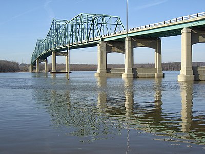
The bridge across the Illinois River at Lacon, technically a continuous truss bridge


Lacon is located at 41°01′26″N 89°24′28″W / 41.023904°N 89.407669°W.[7] It is situated on the east shoreline of the Illinois River. According to the 2010 census, Lacon has a total area of 1.641 square miles (4.25 km2), of which 1.6 square miles (4.14 km2) (or 97.5%) is land and 0.041 square miles (0.11 km2) (or 2.5%) is water.[8]
Demographics[]
| Historical population | |||
|---|---|---|---|
| Census | Pop. | %± | |
| 1850 | 963 | — | |
| 1870 | 2,105 | — | |
| 1880 | 1,814 | −13.8% | |
| 1890 | 1,649 | −9.1% | |
| 1900 | 1,601 | −2.9% | |
| 1910 | 1,495 | −6.6% | |
| 1920 | 1,464 | −2.1% | |
| 1930 | 1,548 | 5.7% | |
| 1940 | 1,627 | 5.1% | |
| 1950 | 2,020 | 24.2% | |
| 1960 | 2,175 | 7.7% | |
| 1970 | 2,147 | −1.3% | |
| 1980 | 2,135 | −0.6% | |
| 1990 | 1,986 | −7.0% | |
| 2000 | 1,979 | −0.4% | |
| 2010 | 1,937 | −2.1% | |
| 2019 (est.) | 1,739 | [2] | −10.2% |
| U.S. Decennial Census[9] | |||

As of the census[10] of 2000, there were 1,979 people, 797 households, and 540 families residing in the city. The population density was 1,233.9 people per square mile (477.6/km2). There were 852 housing units at an average density of 531.2 per square mile (205.6/km2). The racial makeup of the city was 80.09% White, 7.10% African American, 0.10% Native American, 0.20% Asian, 0.10% from other races, and 0.40% from two or more races. Hispanic or Latino of any race were 12.91% of the population.
There were 797 households, out of which 28.1% had children under the age of 18 living with them, 55.6% were married couples living together, 7.9% had a female householder with no husband present, and 32.2% were non-families. 28.6% of all households were made up of individuals, and 15.4% had someone living alone who was 65 years of age or older. The average household size was 2.35 and the average family size was 2.87.
In the city, the population was spread out, with 21.7% under the age of 18, 7.0% from 18 to 24, 25.4% from 25 to 44, 21.9% from 45 to 64, and 24.1% who were 65 years of age or older. The median age was 42 years. For every 100 females, there were 88.8 males. For every 100 females age 18 and over, there were 83.6 males.
The median income for a household in the city was $40,203, and the median income for a family was $47,670. Males had a median income of $36,250 versus $20,694 for females. The per capita income for the city was $18,309. About 3.6% of families and 5.0% of the population were below the poverty line, including 6.2% of those under age 18 and 5.2% of those age 65 or over.
Notable people[]
This section does not cite any sources. (December 2021) |
- Charles N. Barnes, Illinois politician and lawyer
- Robert Boal, Illinois politician
- Lucy Page Gaston, anti-tobacco crusader
- Valerie Allen Marland, First Lady of West Virginia (1953-1957)
- Robert V. McGarvey, U.S. National Champion racehorse trainer
- Robert Sproull, educator and physicist
References[]
- ^ "2019 U.S. Gazetteer Files". United States Census Bureau. Retrieved July 14, 2020.
- ^ a b "Population and Housing Unit Estimates". United States Census Bureau. May 24, 2020. Retrieved May 27, 2020.
- ^ "Find a County". National Association of Counties. Retrieved 2011-06-07.
- ^ Gannett, Henry (1905). The Origin of Certain Place Names in the United States. Government Printing Office. pp. 178.
- ^ Lacon city website
- ^ "Miners Hang a Negro at Lacon". Chicago Tribune. November 7, 1898. Retrieved January 31, 2022 – via Newspapers.com.
- ^ "US Gazetteer files: 2010, 2000, and 1990". United States Census Bureau. 2011-02-12. Retrieved 2011-04-23.
- ^ "G001 - Geographic Identifiers - 2010 Census Summary File 1". United States Census Bureau. Archived from the original on 2020-02-13. Retrieved 2015-12-27.
- ^ "Census of Population and Housing". Census.gov. Retrieved June 4, 2015.
- ^ "U.S. Census website". United States Census Bureau. Retrieved 2008-01-31.
External links[]
![]() Media related to Lacon, Illinois at Wikimedia Commons
Media related to Lacon, Illinois at Wikimedia Commons
Municipalities and communities of Marshall County, Illinois, United States | ||
|---|---|---|
| Cities | ||
| Villages | ||
| Townships | ||
| Unincorporated communities | ||
| Footnotes | ‡This populated place also has portions in an adjacent county or counties | |
| ||
- Cities in Illinois
- Cities in Marshall County, Illinois
- County seats in Illinois
- Peoria metropolitan area, Illinois
- 1831 establishments in Illinois