Drahoňův Újezd
Drahoňův Újezd | |
|---|---|
Municipality | |
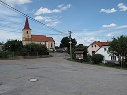 Church of Saint James the Greater | |
 Flag  Coat of arms | |
 Location in Rokycany District | |
 Drahoňův Újezd Location in the Czech Republic | |
| Coordinates: 49°51′46″N 13°43′2″E / 49.86278°N 13.71722°ECoordinates: 49°51′46″N 13°43′2″E / 49.86278°N 13.71722°E | |
| Country | |
| Region | Plzeň |
| District | Rokycany |
| Area | |
| • Total | 13.99 km2 (5.40 sq mi) |
| Elevation | 410 m (1,350 ft) |
| Population (1.1.2015) | |
| • Total | 141 |
| • Density | 10/km2 (26/sq mi) |
| Postal code | 338 08 |
| Website | http://www.drahonuv-ujezd.cz/ |

Drahoňův Újezd is a village and municipality (obec) in Rokycany District in the Plzeň Region of the Czech Republic.
The municipality covers an area of 13.99 square kilometres (5.40 sq mi), and has a population of 130 (as at 28 August 2006).
Drahoňův Újezd lies approximately 16 kilometres (10 mi) north-east of Rokycany, 28 km (17 mi) north-east of Plzeň, and 57 km (35 mi) south-west of Prague.
References[]
| Wikimedia Commons has media related to Drahoňův Újezd. |
| Authority control: National libraries |
|---|
This Plzeň Region location article is a stub. You can help Wikipedia by . |
Categories:
- Villages in Rokycany District
- Plzeň Region geography stubs