Eastchester–Dyre Avenue station
Eastchester–Dyre Avenue | ||||||||||||||||||||||||||||||||||||||||||||||||||||||||||||||||||||||||||||||||||||||||||||||||||||||||||||||||||||||||||||||||||||||||||||||||||||||||
|---|---|---|---|---|---|---|---|---|---|---|---|---|---|---|---|---|---|---|---|---|---|---|---|---|---|---|---|---|---|---|---|---|---|---|---|---|---|---|---|---|---|---|---|---|---|---|---|---|---|---|---|---|---|---|---|---|---|---|---|---|---|---|---|---|---|---|---|---|---|---|---|---|---|---|---|---|---|---|---|---|---|---|---|---|---|---|---|---|---|---|---|---|---|---|---|---|---|---|---|---|---|---|---|---|---|---|---|---|---|---|---|---|---|---|---|---|---|---|---|---|---|---|---|---|---|---|---|---|---|---|---|---|---|---|---|---|---|---|---|---|---|---|---|---|---|---|---|---|---|---|---|---|
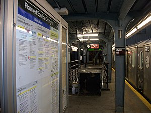 Dusk shot of a train on Track Number 1 in November 2013 | ||||||||||||||||||||||||||||||||||||||||||||||||||||||||||||||||||||||||||||||||||||||||||||||||||||||||||||||||||||||||||||||||||||||||||||||||||||||||
| Station statistics | ||||||||||||||||||||||||||||||||||||||||||||||||||||||||||||||||||||||||||||||||||||||||||||||||||||||||||||||||||||||||||||||||||||||||||||||||||||||||
| Address | Dyre Avenue & Light Street Bronx, NY 10466 | |||||||||||||||||||||||||||||||||||||||||||||||||||||||||||||||||||||||||||||||||||||||||||||||||||||||||||||||||||||||||||||||||||||||||||||||||||||||
| Borough | The Bronx | |||||||||||||||||||||||||||||||||||||||||||||||||||||||||||||||||||||||||||||||||||||||||||||||||||||||||||||||||||||||||||||||||||||||||||||||||||||||
| Locale | Eastchester | |||||||||||||||||||||||||||||||||||||||||||||||||||||||||||||||||||||||||||||||||||||||||||||||||||||||||||||||||||||||||||||||||||||||||||||||||||||||
| Coordinates | 40°53′21″N 73°49′50″W / 40.889055°N 73.830614°WCoordinates: 40°53′21″N 73°49′50″W / 40.889055°N 73.830614°W | |||||||||||||||||||||||||||||||||||||||||||||||||||||||||||||||||||||||||||||||||||||||||||||||||||||||||||||||||||||||||||||||||||||||||||||||||||||||
| Division | A (IRT, formerly NYW&B)[1] | |||||||||||||||||||||||||||||||||||||||||||||||||||||||||||||||||||||||||||||||||||||||||||||||||||||||||||||||||||||||||||||||||||||||||||||||||||||||
| Line | IRT Dyre Avenue Line | |||||||||||||||||||||||||||||||||||||||||||||||||||||||||||||||||||||||||||||||||||||||||||||||||||||||||||||||||||||||||||||||||||||||||||||||||||||||
| Services | 5 | |||||||||||||||||||||||||||||||||||||||||||||||||||||||||||||||||||||||||||||||||||||||||||||||||||||||||||||||||||||||||||||||||||||||||||||||||||||||
| Transit | ||||||||||||||||||||||||||||||||||||||||||||||||||||||||||||||||||||||||||||||||||||||||||||||||||||||||||||||||||||||||||||||||||||||||||||||||||||||||
| Structure | Embankment / Elevated | |||||||||||||||||||||||||||||||||||||||||||||||||||||||||||||||||||||||||||||||||||||||||||||||||||||||||||||||||||||||||||||||||||||||||||||||||||||||
| Platforms | 1 Island platform | |||||||||||||||||||||||||||||||||||||||||||||||||||||||||||||||||||||||||||||||||||||||||||||||||||||||||||||||||||||||||||||||||||||||||||||||||||||||
| Tracks | 2 | |||||||||||||||||||||||||||||||||||||||||||||||||||||||||||||||||||||||||||||||||||||||||||||||||||||||||||||||||||||||||||||||||||||||||||||||||||||||
| Other information | ||||||||||||||||||||||||||||||||||||||||||||||||||||||||||||||||||||||||||||||||||||||||||||||||||||||||||||||||||||||||||||||||||||||||||||||||||||||||
| Opened | May 29, 1912 (NYW&B station) | |||||||||||||||||||||||||||||||||||||||||||||||||||||||||||||||||||||||||||||||||||||||||||||||||||||||||||||||||||||||||||||||||||||||||||||||||||||||
| Closed | December 12, 1937 (NYW&B station) | |||||||||||||||||||||||||||||||||||||||||||||||||||||||||||||||||||||||||||||||||||||||||||||||||||||||||||||||||||||||||||||||||||||||||||||||||||||||
| Rebuilt | May 15, 1941 (as a Subway station) | |||||||||||||||||||||||||||||||||||||||||||||||||||||||||||||||||||||||||||||||||||||||||||||||||||||||||||||||||||||||||||||||||||||||||||||||||||||||
| Station code | 442[2] | |||||||||||||||||||||||||||||||||||||||||||||||||||||||||||||||||||||||||||||||||||||||||||||||||||||||||||||||||||||||||||||||||||||||||||||||||||||||
| Opposite- direction transfer | N/A | |||||||||||||||||||||||||||||||||||||||||||||||||||||||||||||||||||||||||||||||||||||||||||||||||||||||||||||||||||||||||||||||||||||||||||||||||||||||
| Traffic | ||||||||||||||||||||||||||||||||||||||||||||||||||||||||||||||||||||||||||||||||||||||||||||||||||||||||||||||||||||||||||||||||||||||||||||||||||||||||
| 2019 | 1,331,886[4] | |||||||||||||||||||||||||||||||||||||||||||||||||||||||||||||||||||||||||||||||||||||||||||||||||||||||||||||||||||||||||||||||||||||||||||||||||||||||
| Rank | 321 out of 424[4] | |||||||||||||||||||||||||||||||||||||||||||||||||||||||||||||||||||||||||||||||||||||||||||||||||||||||||||||||||||||||||||||||||||||||||||||||||||||||
| Station succession | ||||||||||||||||||||||||||||||||||||||||||||||||||||||||||||||||||||||||||||||||||||||||||||||||||||||||||||||||||||||||||||||||||||||||||||||||||||||||
| Next north | (Terminal): 5 | |||||||||||||||||||||||||||||||||||||||||||||||||||||||||||||||||||||||||||||||||||||||||||||||||||||||||||||||||||||||||||||||||||||||||||||||||||||||
| Next south | Baychester Avenue: 5 Pelham Parkway (Dyre express): no regular service | |||||||||||||||||||||||||||||||||||||||||||||||||||||||||||||||||||||||||||||||||||||||||||||||||||||||||||||||||||||||||||||||||||||||||||||||||||||||
| ||||||||||||||||||||||||||||||||||||||||||||||||||||||||||||||||||||||||||||||||||||||||||||||||||||||||||||||||||||||||||||||||||||||||||||||||||||||||
| ||||||||||||||||||||||||||||||||||||||||||||||||||||||||||||||||||||||||||||||||||||||||||||||||||||||||||||||||||||||||||||||||||||||||||||||||||||||||
| ||||||||||||||||||||||||||||||||||||||||||||||||||||||||||||||||||||||||||||||||||||||||||||||||||||||||||||||||||||||||||||||||||||||||||||||||||||||||
| ||||||||||||||||||||||||||||||||||||||||||||||||||||||||||||||||||||||||||||||||||||||||||||||||||||||||||||||||||||||||||||||||||||||||||||||||||||||||
| ||||||||||||||||||||||||||||||||||||||||||||||||||||||||||||||||||||||||||||||||||||||||||||||||||||||||||||||||||||||||||||||||||||||||||||||||||||||||


The Eastchester–Dyre Avenue station (signed as simply Dyre Avenue) is the northern terminal station of the IRT Dyre Avenue Line of the New York City Subway, at Dyre Avenue and Light Street (one block south of East 233rd Street) in the Eastchester neighborhood of the Bronx. It is served by the 5 train at all times.
History[]
This station opened on May 29, 1912 as a local station of the New York, Westchester and Boston Railway (NYW&B). It closed on December 12, 1937 when the NYW&B went bankrupt.[5] In 1940, New York City purchased the right of way from the Bronx/Westchester County boundary southward. On May 15, 1941, a shuttle service was implemented between Dyre Avenue and East 180th Street using IRT gate cars.[6] In 1957, a physical connection was made to the IRT White Plains Road Line, and through service was provided.[7]
On February 27, 1962, the Transit Authority announced a $700,000 modernization plan of the Dyre Avenue Line. The plan included the reconstruction of the Dyre Avenue station.[8][9] At the time, the line was served by 9-car trains during the day, and 3-car shuttles overnight. Between 1954 and 1961, ridership on the line increased by 100%, owing to the development of the northeast Bronx. Ridership at this station increased from 207,250 to 579,474.[10]
The reconstruction of the Dyre Avenue station was rebuilt as part of the plan in 1963–1964. A 525 feet (160 m)-long concrete island platform was built atop the line's former northbound express track, and the wooden northbound platform was removed following the project's completion. Two new staircases were installed to the platform. A canopy was installed, covering the center of the platform, in addition to fluorescent lighting. The preexisting entrance to the station was sealed off, replaced by a new entrance on the station's west side. A new change booth and restrooms were installed.[10] Previously, trains had used the northbound side platform as the terminal with the southbound platform unused. Remnants of the side platforms still exist.[11][12][13]
Station layout[]
| P Platform level |
Track 1 | |
| Island platform | ||
| Track 2 | ||
| M | Mezzanine | Fare control, station agent, MetroCard machines |
| G | Street level | Exit/entrance |
This station has two tracks and an island platform, and is located on an elevated structure on its southern end and on an embankment at its northern end. The city of Mount Vernon, in Westchester County, is 0.3 miles (0.48 km) uphill. The station originally consisted of four tracks flanked by two side platforms. After the line was taken over by the NYCTA, the side platforms were removed, with a small piece of the northbound remaining, and the four tracks were converted to two tracks using the northbound local and southbound express tracks. The island platform was placed over the northbound express trackbed. The NYW&B's southbound local trackbed can still be seen, and is currently used only for an electrical shed on the north end of the bridge,[14] as well as girders holding up two construction trailers used by Metropolitan Transportation Authority crew members over the south end of the bridge.[15] The two tracks extend one train length past the station, and end at bumper blocks.
Exit[]
The station's only station house is on ground level with doors to the east side of Dyre Avenue on the northeast corner of Light Street. It has a token booth, turnstile bank, and two staircases to the platform.[16]
References[]
- ^ "Glossary". Second Avenue Subway Supplemental Draft Environmental Impact Statement (SDEIS) (PDF). Vol. 1. Metropolitan Transportation Authority. March 4, 2003. pp. 1–2. Archived from the original (PDF) on February 26, 2021. Retrieved January 1, 2021.
- ^ "Station Developers' Information". Metropolitan Transportation Authority. Retrieved June 13, 2017.
- ^ "Facts and Figures: Annual Subway Ridership 2014–2019". Metropolitan Transportation Authority. 2020. Retrieved May 26, 2020.
- ^ a b "Facts and Figures: Annual Subway Ridership 2014–2019". Metropolitan Transportation Authority. 2020. Retrieved May 26, 2020.
- ^ "Westchester Line Passes with 1937". The New York Times. January 1, 1938. p. 36. Retrieved October 4, 2011.
- ^ "Rail Line is Added to Subway System". The New York Times. May 16, 1941. p. 25. Retrieved October 4, 2011.
- ^ "Subway Trains Run to Dyre Avenue: Through Service Replacing Shuttle for Part of Each Day on Bronx Line" (PDF). New York Times. May 7, 1957. Retrieved December 20, 2015.
- ^ "IRT Improvements Set: $700,000 Contract Awarded for Work on Dyre Ave. Line" (PDF). New York Times. February 28, 1962. Retrieved December 20, 2015.
- ^ "NYW&B R'way-IRT Dyre Line - Morris Park to Dyre Ave". Flickr. Retrieved August 31, 2016.
- ^ a b "For Release: Tuesday, Feb. 27, 1962 #238" (PDF). New York City Transit Authority. February 27, 1962. Retrieved March 8, 2019.
- ^ "N on NB Local Track-Dyre STA to S. end old NB platform2008". Flickr. Retrieved August 31, 2016.
- ^ Henderson, John (1992). Gotham Turnstiles: A Visual Depiction of Rapid Transit in the New York Metropolitan Area from 1958-1968. Flushing, New York: H&M Productions. ISBN 0-9629037-8-7.
- ^ "N. at end of Dyre Line (ex-NYW&B RR) Track -6-1973". Flickr. Retrieved August 31, 2016.
- ^ DanTD (November 18, 2014). Eastchester - Dyre Avenue; Former NYW&B Right-Of-Way-North View (photograph). Retrieved November 28, 2018.
{{cite AV media}}: External link in|people= - ^ DanTD (November 18, 2014). Eastchester - Dyre Avenue; Former NYW&B Right-Of-Way-SW View (photograph). Retrieved November 28, 2018.
{{cite AV media}}: External link in|people= - ^ "Eastchester–Dyre Avenue Neighborhood Map" (PDF). new.mta.info. Metropolitan Transportation Authority. April 2018. Retrieved February 28, 2019.
External links[]
| Wikimedia Commons has media related to Eastchester – Dyre Avenue (IRT Dyre Avenue Line). |
- nycsubway.org – IRT White Plains Road Line: Dyre Avenue
- Station Reporter — 5 Train
- The Subway Nut — Eastchester–Dyre Avenue Pictures
- Dyre Avenue entrance from Google Maps Street View
- Southern end of the platform from Google Maps Street View (during 2017 reconstruction)
- Northern end of the platform from Google Maps Street View (during 2017 reconstruction)
| Dyre Ave. Line | |
|---|---|
| |
- IRT Dyre Avenue Line stations
- New York City Subway stations in the Bronx
- New York City Subway stations located aboveground
- Railway stations in the United States opened in 1912
- Railway stations in the United States opened in 1941
- 1912 establishments in New York City
- Eastchester, Bronx