Eastwood, Strathclyde
Coordinates: 55°48′25″N 4°17′42″W / 55.807°N 4.295°W

| Eastwood | |
|---|---|
 Eastwood district within Scotland | |
| Population | |
| • 1994 | 60,600 |
| History | |
| • Created | 1975 |
| • Abolished | 1996 |
| • Succeeded by | East Renfrewshire |
| Status | District |
| Government | Eastwood District Council |
| • HQ | Giffnock |
Eastwood (Scottish Gaelic: A' Choille an Ear, Scots: Eastwid) was a local government district in the Strathclyde region of Scotland from 1975 to 1996,[1] lying south-west of the City of Glasgow.
Local government[]
The district was named after the larger civil parish of Eastwood,[2] itself named after a long-vanished woodland.[3] The Local Government district was formed from the area of the First District of the former county of Renfrewshire. It was one of nineteen local government districts in the Strathclyde region. The council's headquarters were at Giffnock.
The Local Government etc. (Scotland) Act 1994 abolished all of the districts and regions. The Eastwood District was merged with a few parts of the Renfrew District (the sector covering Barrhead) to form the East Renfrewshire unitary council area.
Electoral history[]
| Election | Control | Administration | |
|---|---|---|---|
| Conservative | Conservative | ||
| 1977 | Conservative | Conservative | |
| 1980 | Conservative | Conservative | |
| 1984 | Conservative | Conservative | |
| 1988 | Conservative | Conservative | |
| 1992 | Conservative | Conservative | |
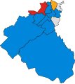
District result maps[]

1980 results map
1984 results map
1988 results map

1992 results map


Constituencies[]
The Eastwood Westminster constituency was created in 1983, and the Eastwood Holyrood constituency, with the same boundaries, in 1999.
The Westminster constituency was renamed East Renfrewshire in 2005. The Holyrood constituency retains its original name.
See also[]
References[]
- ^ Eastwood, Undiscovered Scotland
- ^ Parish of Eastwood at Gazetteer for Scotland
- ^ Eaglesfield - Edenton | British History Online Eastwood, or Pollock, Topographical Dictionary of Scotland, 1846 (British History Online)]
| hide Local government areas of Scotland, in use 1973 to 1996 | ||
|---|---|---|
| Borders |
|  |
| Central Region | ||
| Dumfries and Galloway |
| |
| Fife | ||
| Grampian |
| |
| Highland |
| |
| Lothian |
| |
| Strathclyde |
| |
| Tayside |
| |
| Island areas1 | ||
This East Renfrewshire location article is a stub. You can help Wikipedia by . |
- Districts of Scotland
- East Renfrewshire
- Parishes of Scotland
- Giffnock
- History of Renfrewshire
- Newton Mearns
- Clarkston, East Renfrewshire
- West of Scotland geography stubs