Dumbarton (district)
Coordinates: 56°01′N 4°38′W / 56.01°N 4.63°W
| Dumbarton | |
|---|---|
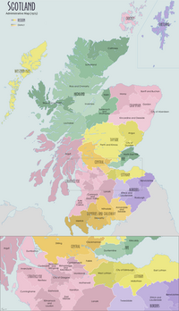
 Dumbarton district within Scotland | |
| Population | |
| • 1994 | 77,222 |
| History | |
| • Created | 1975 |
| • Abolished | 1996 |
| • Succeeded by | (Part of) West Dunbartonshire (Part of) Argyll and Bute |
| Status | District |
| Government | Dumbarton District Council |
| • HQ | Dumbarton |
Dumbarton (Scottish Gaelic: Dùn Breatainn) was a local government district in the Strathclyde region of Scotland from 1975 to 1996,[1] lying to the north-west of the regional capital Glasgow.
Local Government[]
As its name suggests, the district (one of five in the Dunbarton sub-region and 19 overall across the Strathclyde region, which contained more than half of Scotland's population) was centred around the town of Dumbarton, capital of the historic county of Dunbartonshire, although its boundaries extended far beyond the town. In the Local Government (Scotland) Act 1973 leading to its creation, the district's desired composition was described as:[2]
- In the county of Dunbarton—the burghs of Dumbarton, Cove and Kilcreggan, Helensburgh; the districts of Helensburgh, Vale of Leven; the electoral divisions of Bowling, Dunbarton.
Other than Dumbarton and the Vale of Leven settlements just to its north, plus the town of Helensburgh and neighbouring coastal villages on the Firth of Clyde further west, the terrain was increasingly mountainous and sparsely populated (much lying beyond the Highland Boundary Fault). The middle of Loch Long was the western boundary and the middle of Loch Lomond the eastern boundary, excepting everything south of the Endrick Water which belonged wholly to Dumbarton. Much of the rest of the eastern border was with Stirling district in Central region, while the smaller Clydebank district in Dunbarton was to the south-east (with the division at Old Kilpatrick).
The Local Government etc. (Scotland) Act 1994 abolished all of the districts and regions. The eastern, more populated part of the Dumbarton district was merged with the Clydebank district to form the West Dunbartonshire unitary council area, with the Dumbarton district offices continuing as the headquarters for WDC. The western part of the district (everything west of Duck Bay/Cameron House at Loch Lomond and the Castlehill neighbourhood on the edge of Dumbarton) was allocated to Argyll and Bute following a referendum on the matter in 1994,[3] while a small rural area at Croftamie went to Stirling Council.
See also[]
References[]
- ^ Dumbarton, Undiscovered Scotland
- ^ "New Local Government areas". Hansard. 22 October 1973. Retrieved 24 February 2020.
- ^ Was Argyll and Bute move right decision, Helensburgh Advertiser, 15 August 2014
- Districts of Scotland
- Dumbarton
- Vale of Leven
- Helensburgh
- Politics of West Dunbartonshire
- Politics of Argyll and Bute
- 1975 establishments in Scotland
- 1996 disestablishments in Scotland

