Elk City, Kansas
Elk City, Kansas | |
|---|---|
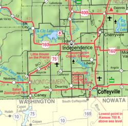
 Location within Montgomery County and Kansas | |
 | |
| Coordinates: 37°17′25″N 95°54′37″W / 37.29028°N 95.91028°WCoordinates: 37°17′25″N 95°54′37″W / 37.29028°N 95.91028°W | |
| Country | United States |
| State | Kansas |
| County | Montgomery |
| Founded | 1868 |
| Incorporated | 1871 |
| Area | |
| • Total | 0.34 sq mi (0.88 km2) |
| • Land | 0.34 sq mi (0.88 km2) |
| • Water | 0.00 sq mi (0.00 km2) |
| Elevation | 833 ft (254 m) |
| Population | |
| • Total | 325 |
| • Estimate (2019)[3] | 292 |
| • Density | 863.91/sq mi (333.37/km2) |
| Time zone | UTC-6 (CST) |
| • Summer (DST) | UTC-5 (CDT) |
| ZIP code | 67344 |
| Area code | 620 |
| FIPS code | 20-20250 [4] |
| GNIS ID | 469850 [5] |

Elk City is a city in Montgomery County, Kansas, United States, along the Elk River. As of the 2010 census, the city population was 325.[6]
History[]
Elk City had its start in the year 1868 by the building of a trading post at that location.[7] The first post office in Elk City was established in November 1869.[8]
Geography[]
Elk City is located at 37°17′25″N 95°54′37″W / 37.29028°N 95.91028°W (37.290235, -95.910244).[9] According to the United States Census Bureau, the city has a total area of 0.34 square miles (0.88 km2), all of it land.[10]
Demographics[]
| Historical population | |||
|---|---|---|---|
| Census | Pop. | %± | |
| 1880 | 383 | — | |
| 1890 | 796 | 107.8% | |
| 1900 | 709 | −10.9% | |
| 1910 | 659 | −7.1% | |
| 1920 | 725 | 10.0% | |
| 1930 | 607 | −16.3% | |
| 1940 | 680 | 12.0% | |
| 1950 | 524 | −22.9% | |
| 1960 | 498 | −5.0% | |
| 1970 | 432 | −13.3% | |
| 1980 | 404 | −6.5% | |
| 1990 | 334 | −17.3% | |
| 2000 | 305 | −8.7% | |
| 2010 | 325 | 6.6% | |
| 2019 (est.) | 292 | [3] | −10.2% |
| U.S. Decennial Census | |||
2010 census[]
As of the census[2] of 2010, there were 325 people, 132 households, and 91 families residing in the city. The population density was 955.9 inhabitants per square mile (369.1/km2). There were 172 housing units at an average density of 505.9 per square mile (195.3/km2). The racial makeup of the city was 93.5% White, 0.6% African American, 0.9% Native American, 0.3% Pacific Islander, 0.6% from other races, and 4.0% from two or more races. Hispanic or Latino of any race were 0.9% of the population.
There were 132 households, of which 31.8% had children under the age of 18 living with them, 54.5% were married couples living together, 10.6% had a female householder with no husband present, 3.8% had a male householder with no wife present, and 31.1% were non-families. 25.8% of all households were made up of individuals, and 15.2% had someone living alone who was 65 years of age or older. The average household size was 2.46 and the average family size was 2.89.
The median age in the city was 42.3 years. 23.7% of residents were under the age of 18; 7.1% were between the ages of 18 and 24; 21.9% were from 25 to 44; 26.7% were from 45 to 64; and 20.6% were 65 years of age or older. The gender makeup of the city was 52.0% male and 48.0% female.
2000 census[]
As of the census[4] of 2000, there were 305 people, 135 households, and 83 families residing in the city. The population density was 889.7 people per square mile (346.4/km2). There were 170 housing units at an average density of 495.9 per square mile (193.1/km2). The racial makeup of the city was 94.75% White, 2.62% Native American, 0.98% from other races, and 1.64% from two or more races. Hispanic or Latino of any race were 2.30% of the population.
There were 135 households, out of which 20.7% had children under the age of 18 living with them, 51.9% were married couples living together, 6.7% had a female householder with no husband present, and 38.5% were non-families. 35.6% of all households were made up of individuals, and 23.0% had someone living alone who was 65 years of age or older. The average household size was 2.26 and the average family size was 2.93.
In the city, the population was spread out, with 21.6% under the age of 18, 8.5% from 18 to 24, 22.6% from 25 to 44, 26.2% from 45 to 64, and 21.0% who were 65 years of age or older. The median age was 44 years. For every 100 females, there were 96.8 males. For every 100 females age 18 and over, there were 92.7 males.
The median income for a household in the city was $25,000, and the median income for a family was $35,833. Males had a median income of $21,250 versus $17,708 for females. The per capita income for the city was $15,152. About 15.0% of families and 18.6% of the population were below the poverty line, including 32.8% of those under the age of eighteen and 5.8% of those 65 or over.
Education[]
The community is served by Independence USD 446 public school district.
Notable people[]
Harry Hines Woodring, 25th Governor of Kansas and 53rd United States Secretary of War
See also[]
References[]
- ^ "2019 U.S. Gazetteer Files". United States Census Bureau. Retrieved July 24, 2020.
- ^ a b "U.S. Census website". United States Census Bureau. Retrieved 2012-07-06.
- ^ a b "Population and Housing Unit Estimates". United States Census Bureau. May 24, 2020. Retrieved May 27, 2020.
- ^ a b "U.S. Census website". United States Census Bureau. Retrieved 2008-01-31.
- ^ "US Board on Geographic Names". United States Geological Survey. 2007-10-25. Retrieved 2008-01-31.
- ^ "2010 City Population and Housing Occupancy Status". U.S. Census Bureau. Retrieved January 8, 2012.[dead link]
- ^ Blackmar, Frank Wilson (1912). Kansas: A Cyclopedia of State History, Embracing Events, Institutions, Industries, Counties, Cities, Towns, Prominent Persons, Etc. Standard Publishing Company. pp. 572.
- ^ "Kansas Post Offices, 1828-1961". Kansas Historical Society. Retrieved 16 June 2014.
- ^ "US Gazetteer files: 2010, 2000, and 1990". United States Census Bureau. 2011-02-12. Retrieved 2011-04-23.
- ^ "US Gazetteer files 2010". United States Census Bureau. Archived from the original on 2012-01-25. Retrieved 2012-07-06.
Further reading[]
External links[]
Municipalities and communities of Montgomery County, Kansas, United States | ||
|---|---|---|
| Cities |  | |
| Unincorporated communities | ||
| Ghost towns | ||
| Footnotes | †This community is designated a Census-Designated Place (CDP) by the United States Census Bureau. | |
| ||
- Cities in Kansas
- Cities in Montgomery County, Kansas