European route E55
 | |
|---|---|
 | |
| Route information | |
| Length | 3,305 km (2,054 mi) |
| Major junctions | |
| North end | Helsingborg, Sweden |
| South end | Kalamáta, Greece |
| Location | |
| Countries | |
| Highway system | |
| |
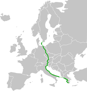
European route E55 is an E-route. It passes through the following cities: Helsingborg … Helsingør – Copenhagen – Køge – Vordingborg – Nykøbing Falster – Gedser … Rostock – Berlin – Lübbenau – Dresden – Teplice – Prague – Tábor – Linz – Salzburg – Villach – Tarvisio – Udine – Palmanova – Venice – Ravenna – Cesena – Rimini – Fano – Ancona – Pescara – Canosa di Puglia – Bari – Brindisi … Igoumenitsa – Preveza – Rhion – Patrai – Pyrgos – Kalamáta.[1]
From Helsingborg, the route was supposed to continue northward through Sweden and into Finland, but a decision was made to keep the E4 designation in Sweden, formerly used for a European route from Lisbon to Helsinki. E55 is not and has not been signposted in Sweden. Since 2018 E55 is not signposted between Helsingør and Køge in Denmark, but is signposted south of Køge.[2]
Route[]

Sweden[]
- Helsingborg
Ferry[]

 Helsingborg –
  Helsingør, the HH Ferry route.
Denmark[]
Exits and service areas in Denmark[]

 3 Espergærde
- 4 Kvistgård
- 5 Humlebæk
- 6 Nivå
- 7 Kokkedal
- 9 Hørsholm C
 | Isterød
- 10 Hørsholm S
- 12 Vedbæk
- 13
- 14 Nærum
- |
 Lærkereden/Storkereden
 - 15 Lundtofte
- 16 Lyngby C
 Kgs. Lyngby
  Copenhagen
- 17
- 18
- 19 Buddinge
- Gladsaxe
 Hillerød Copenhagen
 - 20 Gladsaxe
- 21
- 23
- Rødovre
 Frederikssund,
  Ballerup
 - 24 Roskildevej
- Brøndby
 Primærrute 21 Roskilde Primærrute 21 Copenhagen
 - Avedøre
 E20 Malmö
 - 25 Vallensbæk S
- 26
- Ishøj Ballerup, Primærrute 21 Ishøj, Copenhagen V
- 27 Greve N
- 28 Greve C
- 29 Greve S

 | Karlslunde
- 30 Solrød N
- 31 Solrød S
 Roskilde
 - 32 Køge
- E20 Odense
- 33
- 34 Herfølge
- 35 Haslev
- |
 Piberhus
 - 36 Bregentved
- Rønnede
 Næstved (planned 2031)
 - 37 Rønnede
- 38 |
- 39
- 40
- 41 Vordingborg
- Northern Farø bridge
- 42 Farø
- Southern Farø bridge
- 43 Nørre Alslev
- 44 Eskildstrup
 E47 Nykøbing F, Gedser
 Nykøbing F Ø
Ferry[]
- Gedser –
 Rostock
Germany[]
 A19: Rostock - Wittstock/Dosse (
 E20)
E20) A24: Wittstock/Dosse - Oberkrämer, Kremmen (
 E26)
E26) A10: Oberkrämer, Kremmen - Schönefeld (
 E30)
E30) A13: Schönefeld - Dresden
 A4: Dresden (
 E40)
E40) A17: Dresden - near Geising
Czechia[]
 D8: Petrovice - Ústí nad Labem - Trmice (Start of Concurrency with E 442) - Řehlovice (end of concurrency with E 442 - Prague
 D0: Prague(
 E48),
E48),  E50),
E50),  E59),
E59),  E65),
E65),  E67)
E67) D1: Prague - Mirošovice
 D3: Mirošovice - Tábor - České Budějovice (
 E49),
E49),  E53) - Dolní Dvořiště
Austria[]
 B310: Leopoldschlag - Freistadt
 S10: Freistadt - Unterweitersdorf
 A7: Unterweitersdorf - Linz - Ansfelden
 A1: Ansfelden (Start of Concurrency with
  E60,
E60,  E552) - Sattledt(End of Concurrency with E552) - Salzburg (End of Concurrency with E60), (
 E52), (
 E641)
E641) A10: Salzburg - Spittal an der Drau (Start of Concurrency with
 E66) - Villach, ((End of Concurrency with E66), (
 E61)
E61) A2: Villach - Arnoldstein
Italy[]
 A23: Tarvisio - Udine - Palmanova
 A4: Palmanova (Start of Concurrency with
  ) - Quarto d'Altino (End of Concurrency with )
 A57: Quarto d'Altino - Venice
 SS 309: Venice- Ravenna
 SS 3bis: Ravenna-Cesena(
 )
) A14: Cesena () - Rimini - Fano - Ancona - Pescara (
 ) - Canosa di Puglia (
 ) - Bari
 SS 96: Bari
 SS 16: Bari (
 ) - Fasano
 SS 379: Fasano - Brindisi(
Ferry[]
-
 Brindisi -
  Igoumenitsa
Greece[]
 EO18: Igoumenitsa - Preveza
 EO42: Preveza - Amfilochia
 EO5: Amfilochia
 A5: Amfilochia - Antirrio (Nafpaktia)
- Rio-Antirrio bridge
- Olympia Odos: Rio (Patras) - Patras
 EO9: Patras - Kalo Nero (Trifylia)
- Kalo Nero - Oichalia
 A7: Oichalia (Start of Concurrency with
  E65) - Kalamata, (End of Concurrency with E65)
References[]

External links[]
| Wikimedia Commons has media related to E55. |

- International E-road network
- Roads in Sweden
- Roads in Denmark
- Roads in Mecklenburg-Vorpommern
- Roads in Berlin
- Roads in Brandenburg
- Roads in Saxony
- Roads in the Czech Republic
- Roads in Austria
- Roads in Italy
- Roads in Greece