Faulkner, Kansas
Faulkner, Kansas | |
|---|---|
 | |
 Faulkner | |
| Coordinates: 37°6′5″N 95°0′42″W / 37.10139°N 95.01167°WCoordinates: 37°6′5″N 95°0′42″W / 37.10139°N 95.01167°W[1] | |
| Country | United States |
| State | Kansas |
| County | Cherokee |
| Elevation | 823 ft (251 m) |
| Time zone | UTC-6 (CST) |
| • Summer (DST) | UTC-5 (CDT) |
| Area code | 620 |
| FIPS code | 20-23300 [1] |
| GNIS ID | 484435 [1] |


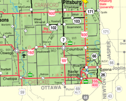
Faulkner is an unincorporated community in Cherokee County, Kansas, United States. Its elevation is 823 feet.[1]
History[]
Faulkner was a shipping point on the Missouri Pacific Railroad.[2]
Economy[]
Faulkner has one business, Faulkner Grain.[citation needed]
References[]
- ^ a b c d e Geographic Names Information System (GNIS) details for Faulkner, Kansas; United States Geological Survey (USGS); October 13, 1978.
- ^ Blackmar, Frank Wilson (1912). Kansas: A Cyclopedia of State History, Embracing Events, Institutions, Industries, Counties, Cities, Towns, Prominent Persons, Etc. Standard Publishing Company. pp. 633.
Further reading[]
External links[]
- Faulkner early history, skyways
- USD 493, local school district
- Cherokee County maps: Current, Historic, KDOT
Municipalities and communities of Cherokee County, Kansas, United States | ||
|---|---|---|
| Cities |  | |
| Unincorporated communities | ||
| Ghost towns | ||
| Townships | ||
| Footnotes | †This populated place is designated a Census-Designated Place (CDP) by the United States Census Bureau. ‡This populated place also has portions in an adjacent county or counties. | |
| ||
Categories:
- Unincorporated communities in Cherokee County, Kansas
- Unincorporated communities in Kansas
- Southeast Kansas geography stubs