Fernbank, Victoria
| Fernbank Victoria | |||||||||
|---|---|---|---|---|---|---|---|---|---|
 Fernbank | |||||||||
| Coordinates | 37°52′S 147°20′E / 37.867°S 147.333°ECoordinates: 37°52′S 147°20′E / 37.867°S 147.333°E | ||||||||
| Population | 152 (2016 census)[1] | ||||||||
| Postcode(s) | 3864 | ||||||||
| Elevation | 122 m (400 ft) | ||||||||
| Location | |||||||||
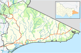
| LGA(s) | Shire of East Gippsland | ||||||||
| Region | Gippsland | ||||||||
| County | Australia | ||||||||
| State electorate(s) | Gippsland East | ||||||||
| Federal division(s) | Gippsland | ||||||||
| |||||||||

Fernbank is a small country town on the Perry River in Victoria, Australia, approximately 310 km east of Melbourne. In the 2016 census, the small town of Fernbank had a population of 152.[1] With the main highway, Princes Highway close by, the small community not only services itself, but travellers along the main highway that stop for a break.
History[]
The origin of the town's name is somewhat of a mystery. It is commonly believed that the town was named after the plants that grow by the banks of the Perry River, the fern, giving rise to the name, Fern-bank.
Fernbank Post Office opened on 1 January 1868 and closed in 1977.[2]
Today[]
Approximately 2.5 km south-west of Fernbank is the Fernbank Landscape and Flora Reserve, just off of the main highway, Princes Highway. There are some walking tracks and picnic spots.
Transport[]
Fernbank used to be serviced by the Bairnsdale railway line, but the station closed to passengers in 1981 and then fully closed in 1996. There is still a disused crossing loop and goods platform at the station.
References[]
- ^ a b "ABS 2001 Census". 9 March 2006. Retrieved 5 October 2008.
- ^ Premier Postal History. "Post Office List". Retrieved 11 April 2008.
This article about a location in Gippsland (region) is a stub. You can help Wikipedia by . |
- Towns in Victoria (Australia)
- Towns in Central Gippsland
- Shire of East Gippsland
- Gippsland geography stubs