Mount Hotham
| Mount Hotham | |
|---|---|
 Mount Hotham, view from the summit in 2007. | |
| Highest point | |
| Elevation | 1,862 metres (6,109 ft) AHD [1] |
| Prominence | 242 metres (794 ft) AHD [1] |
| Coordinates | 36°58′31″S 147°7′58″E / 36.97528°S 147.13278°ECoordinates: 36°58′31″S 147°7′58″E / 36.97528°S 147.13278°E[2] |
| Geography | |
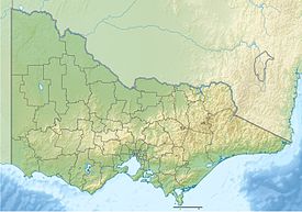 Mount Hotham Location in Victoria | |
| Location | Victoria, Australia |
| Parent range | Victorian Alps, Great Dividing Range |


Mount Hotham is a mountain in the Victorian Alps of the Great Dividing Range, located in the Australian state of Victoria. The mountain is located approximately 357 kilometres (222 mi) north east of Melbourne, 746 kilometres (464 mi) from Sydney, and 997 kilometres (620 mi) from Adelaide by road. The nearest major road to the mountain is the Great Alpine Road. The mountain is named after Charles Hotham, Governor of Victoria from 1854 to 1855.
Mt Hotham's summit rises to an altitude of 1,862 metres (6,109 ft) AHD.[1]
Hotham Alpine Resort, a commercial ski resort, is located on the slopes of Mount Hotham and adjoining mountains.
Climate[]
As with most of the Australian Alps, Mount Hotham's climate is, compared to the bulk of Australia, cold throughout the year; with particularly cold maximum temperatures, and Mount Hotham is one of very few areas in Australia that frequently records maximum temperatures below freezing. Mount Hotham is also one of the only places in Australia to have never recorded a temperature above 30 °C (86 °F); during the early 2009 southeastern Australia heat wave, whilst most of the state sweltered above 45 °C (113 °F), the mountain's peak temperature was a mild 28.1 °C (82.6 °F).[3] Snowfall occurs frequently and heavily, and sub-freezing maximum temperatures can be recorded throughout the year—even at the height of summer. Mount Hotham receives an average of 66.1 snowy days annually.[4]
Owing to its short, cool summers and long, very cold winters, Mount Hotham yields a Subantarctic climate (Dfc) bordering on Tundra (ET).
| hideClimate data for Hotham Heights (1,783 m AMSL) | |||||||||||||
|---|---|---|---|---|---|---|---|---|---|---|---|---|---|
| Month | Jan | Feb | Mar | Apr | May | Jun | Jul | Aug | Sep | Oct | Nov | Dec | Year |
| Record high °C (°F) | 27.8 (82.0) |
28.2 (82.8) |
26.8 (80.2) |
21.0 (69.8) |
15.4 (59.7) |
11.5 (52.7) |
7.5 (45.5) |
10.0 (50.0) |
15.3 (59.5) |
19.6 (67.3) |
25.5 (77.9) |
25.3 (77.5) |
28.2 (82.8) |
| Average high °C (°F) | 16.3 (61.3) |
15.8 (60.4) |
13.7 (56.7) |
8.4 (47.1) |
4.9 (40.8) |
2.1 (35.8) |
0.3 (32.5) |
1.1 (34.0) |
3.9 (39.0) |
7.6 (45.7) |
11.4 (52.5) |
14.2 (57.6) |
8.3 (46.9) |
| Average low °C (°F) | 6.8 (44.2) |
6.9 (44.4) |
5.7 (42.3) |
1.5 (34.7) |
−0.7 (30.7) |
−2.9 (26.8) |
−4.1 (24.6) |
−3.7 (25.3) |
−2.1 (28.2) |
0.3 (32.5) |
2.8 (37.0) |
5.1 (41.2) |
1.3 (34.3) |
| Record low °C (°F) | −3.5 (25.7) |
−5.4 (22.3) |
−6.8 (19.8) |
−5.0 (23.0) |
−7.2 (19.0) |
−9.0 (15.8) |
−10.0 (14.0) |
−8.5 (16.7) |
−8.1 (17.4) |
−8.0 (17.6) |
−6.7 (19.9) |
−6.3 (20.7) |
−10.0 (14.0) |
| Average precipitation mm (inches) | 88.0 (3.46) |
59.4 (2.34) |
120.9 (4.76) |
154.0 (6.06) |
188.9 (7.44) |
163.2 (6.43) |
250.8 (9.87) |
202.9 (7.99) |
175.2 (6.90) |
176.1 (6.93) |
167.6 (6.60) |
161.6 (6.36) |
1,908.6 (75.14) |
| Average precipitation days (≥ 0.2 mm) | 9.5 | 7.3 | 11.8 | 12.8 | 13.9 | 14.0 | 18.7 | 15.8 | 14.6 | 15.2 | 13.8 | 12.4 | 159.8 |
| Source 1: Hotham Heights (Average Temperatures) | |||||||||||||
| Source 2: Mount Hotham (Records and Precipitation) | |||||||||||||
Gallery[]

See also[]
- Alpine National Park
- List of mountains in Victoria
References[]
- ^ Jump up to: a b c "Mount Hotham, Australia". Peakbagger.com.
- ^ "Mount Hotham". Gazetteer of Australia online. Geoscience Australia, Australian Government.
- ^ "Special Climate Statement 17" (PDF). Bureau of Meteorology. Retrieved 21 March 2013.
- ^ "Annual Snow Days (66.1)". australianweathernews.com. Retrieved 3 April 2021.
External links[]
| Wikivoyage has a travel guide for Mount Hotham. |
| Wikimedia Commons has media related to Mount Hotham, Victoria. |
| show Authority control |
|---|
- Mountains of Victoria (Australia)
- Hume (region)
- Victorian Alps