Mount Wycheproof
| Mount Wycheproof | |
|---|---|
 View from the Mount Wycheproof lookout | |
| Highest point | |
| Elevation | 148 metres (486 ft) AHD [1] |
| Prominence | 43 metres (141 ft) AHD |
| Coordinates | 36°4′37″S 143°14′2″E / 36.07694°S 143.23389°ECoordinates: 36°4′37″S 143°14′2″E / 36.07694°S 143.23389°E |
| Geography | |
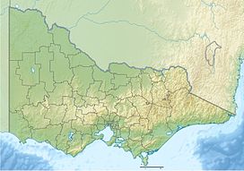 Mount Wycheproof Location in Victoria | |
| Location | Wycheproof, Victoria, Australia |
| Parent range | Terrick Terrick Range |

Mount Wycheproof is a mountain in the small town of Wycheproof, Victoria, Australia, which stands at 43 metres (141 ft) above the surrounding terrain. The township of Wycheproof is located on the hillside, and a unique geological substance known as Wycheproofite is exclusive to the local area.
History[]
The township of Wycheproof is located on the hill's south western slopes[2] The settlement was started as early as 1846, but the township was not surveyed until 1875. The name 'Wycheproof' originates from the local Aboriginal language, 'wichi-poorp', meaning 'grass on a hill'.[3] The hill plays a role in the local community, with annual races to the hilltop.[3] There are many walking tracks in the area, and local wildlife such as emus and kangaroos can be seen.[3]
Geology[]
Mount Wycheproof is a granite outcrop. Located in a flat grassland area, the rounded terrain of Mount Wycheproof is consistent with that of the surrounding area.[2][4] Sharing several similarities to nearby Pyramid Hill, Mount Wycheproof is part of the low-lying Terrick Terrick range.[2] The mountain rises to a height of 148 metres (486 ft)[1] above sea level or only 43 metres (141 ft) above the surrounding plains,[5] The hill is characterised by a rocky, conical peak, common in the western areas of Victoria.[2] Phosphate materials are relatively rare in Victoria,[6] yet the Wycheproof area is known to have its own unique mineral, known as wycheproofite.[7] Wycheproofite can be characterised by its pinkish colour and its transparency.[7]
References[]
- ^ a b St Arnaud (Map) (1st ed.). 1:250,000. Series 1501. The Royal Australian Survey Corps. 1987. § YF0105.
- ^ a b c d "4.4 Hills and Low Hills". State of Victoria. 24 September 2008. Retrieved 20 November 2008.
- ^ a b c "Wycheproof - Victoria - Australia". Sydney Morning Herald. 8 February 2004. Retrieved 20 November 2008.
- ^ "Our Environment". Friends of Mount Wycheproof. Archived from the original on 18 July 2008. Retrieved 20 November 2008.
- ^ "7:30 Report - 01/11/2004". Australian Broadcasting Corporation. 1 November 2004. Retrieved 20 November 2008.
- ^ "Mineralogy and Petrology". Museum Victoria. 20 August 1996. Archived from the original on 16 August 2008. Retrieved 20 November 2008.
- ^ a b "mineral general info". Queensland University of Technology. Archived from the original on 8 July 2009. Retrieved 20 November 2008.
- Mountains of Victoria (Australia)