Mount Zero (Mura Mura)
| Mount Zero (Mura Mura) | |
|---|---|
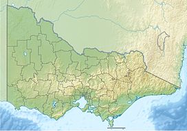 Mount Zero (Mura Mura) Location in Victoria | |
| Highest point | |
| Elevation | 364 metres (1,194 ft) AHD |
| Coordinates | 36°53′06″S 142°22′08″E / 36.88500°S 142.36889°ECoordinates: 36°53′06″S 142°22′08″E / 36.88500°S 142.36889°E |
| Geography | |
| Location | Victoria, Australia |
| Parent range | Grampians |
| Topo map | Geoscience Australia Mount Zero |
| Climbing | |
| First ascent | Sir Thomas Mitchell[1] (Scottish explorer and surveyor) |

Mount Zero, also known as Mura Mura in the Jardwadjali language is the northernmost mountain of the Grampian range.[2] Its prominent conical shape is visible from the Western Highway south of Horsham. Scottish explorer Sir Thomas Livingstone Mitchell named and then described the mountain as "Mount Zero, a name I applied to a remarkable cone at the western extermity of the chain of mountains."[1] While the peak is inside the National Park, the Mount Zero Olive Farm runs along its northern approaches.[3] Scrub covers the sandstone slopes, with a track running up to the summit from the Mt Zero Picnic Area.[4]
Mount Zero will be the terminus of a new 144-km walking track starting at Dunkeld in the south.[5]
See also[]
- List of mountains in Victoria
References[]
- ^ a b Reid, John; Lovett, Keith H.; Blake, les J. (1996). Road Board to Restructure: The History of the Shire of Wimmera. Bacchus Marsh: Joval. p. 8. ISBN 095881127X.
- ^ "VICNAMES The Register of Geographic Names". maps.land.viv.gov.au. Victorian Government. Retrieved 8 June 2018.
- ^ "Mount Zero". Walkingmaps.com.au. Walking Maps. Retrieved 7 June 2018.
- ^ "Mount Zero Walk". Victoria.com. Visit Victoria. Retrieved 7 June 2018.
- ^ Martinich, Rex (15 January 2018). "Region to Benefit from Grampians trail". Stawell Times. Stawell. Retrieved 7 June 2018.
External links[]
Categories:
- Mountains of Victoria (Australia)
- Grampians (national park)