Finale Emilia
Finale Emilia | |
|---|---|
| Comune di Finale Emilia | |
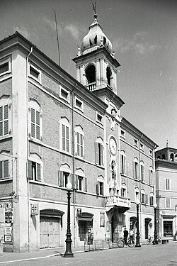 The town hall in 1976. | |
 Coat of arms | |
show Location of Finale Emilia | |
 Finale Emilia Location of Finale Emilia in Italy | |
| Coordinates: 44°50′N 11°17′E / 44.833°N 11.283°E | |
| Country | Italy |
| Region | Emilia-Romagna |
| Province | Modena (MO) |
| Frazioni | Massa Finalese, Canaletto, Reno Finalese, Casumaro |
| Government | |
| • Mayor | Sandro Palazzi |
| Area | |
| • Total | 105.13 km2 (40.59 sq mi) |
| Elevation | 15 m (49 ft) |
| Population | |
| • Total | 15,573 |
| • Density | 150/km2 (380/sq mi) |
| Demonym(s) | Finalesi |
| Time zone | UTC+1 (CET) |
| • Summer (DST) | UTC+2 (CEST) |
| Postal code | 41034 |
| Dialing code | 0535 |
| Patron saint | Saint Zeno of Verona |
| Saint day | 8 September |
| Website | Official website |


Finale Emilia (Finalese: Al Finàl; Modenese: Al Finèl) is a comune (municipality) in the Province of Modena, in the Italian region Emilia-Romagna, located about 35 kilometres (22 mi) north of Bologna and about 35 kilometres (22 mi) northeast of Modena.
Finale was struck by an earthquake on 20 May 2012, which destroyed or damaged several historical structures, such as the (a clock tower), and most of both the local castle and cathedral.
Main sights[]
- (remains)
- Castello delle Rocche, also known as Rocca Estense, built in 1402 by will of , marquis of Ferrara. It has a quadrangular plan with for towers and a central keep (originally built by Boniface III of Tuscany in medieval times). It is currently under restoration after the 2012 earthquake.
Twin towns[]
 Grézieu-la-Varenne, France
 Villa Sant'Angelo, Italy
- Formigine, Italy
People[]
- Jean-Baptiste Ventura (1794–1858) - general in Punjab Kingdom
- (1856–1945) - founder member of Italian Socialist Party
- (1937–2013) - writer
References[]
- ^ "Superficie di Comuni Province e Regioni italiane al 9 ottobre 2011". Istat. Retrieved 16 March 2019.
- ^ "Popolazione Residente al 1° Gennaio 2018". Istat. Retrieved 16 March 2019.
- ^ All demographics and other statistics: Italian statistical institute Istat.
External links[]
- Official website
- News on Finale Emilia
- . New International Encyclopedia. 1905.
| show Authority control |
|---|
Categories:
- Cities and towns in Emilia-Romagna
- Municipalities of the Province of Modena
- Emilia-Romagna geography stubs