Montese
Montese | |
|---|---|
| Comune di Montese | |
 | |
 Coat of arms | |
show Location of Montese | |
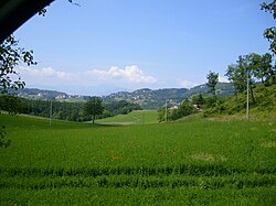
 Montese Location of Montese in Italy | |
| Coordinates: 44°16′10″N 10°56′45″E / 44.26944°N 10.94583°E | |
| Country | Italy |
| Region | Emilia-Romagna |
| Province | Modena (MO) |
| Frazioni | Bertocchi, Castelluccio di Moscheda, Iola, Maserno, Montalto, Montespecchio, Salto, San Giacomo Maggiore, San Martino, Semelano |
| Government | |
| • Mayor | Luciano Mazza |
| Area | |
| • Total | 80.80 km2 (31.20 sq mi) |
| Elevation | 842 m (2,762 ft) |
| Population (2008)[3] | |
| • Total | 3,380 |
| • Density | 42/km2 (110/sq mi) |
| Demonym(s) | Montesini |
| Time zone | UTC+1 (CET) |
| • Summer (DST) | UTC+2 (CEST) |
| Postal code | 41055 |
| Dialing code | 059 |
| ISTAT code | 036026 |
| Patron saint | St. Lawrence |
| Website | Official website |


Montese (Frignanese: Muntês) is a town in the province of Modena, Emilia-Romagna, Italy.
During World War II, the town was liberated by Brazilian forces on 17 April 1945, after three days of battle against German forces.
There is a neighborhood in the Brazilian city of Fortaleza, Ceará and the city of Belém Pará named after the Italian city. This was to pay homage to the Brazilian soldiers who had died in the battle to take Montese from the Germans during World War II.
Sources[]
- ^ "Superficie di Comuni Province e Regioni italiane al 9 ottobre 2011". Istat. Retrieved 16 March 2019.
- ^ "Popolazione Residente al 1° Gennaio 2018". Istat. Retrieved 16 March 2019.
- ^ All demographics and other statistics from the Italian statistical institute (Istat)
| Authority control |
|---|
Categories:
- Cities and towns in Emilia-Romagna
- Municipalities of the Province of Modena
- Emilia-Romagna geography stubs