Fridefont
Fridefont | |
|---|---|
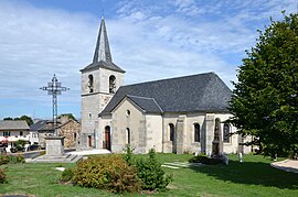 The church in Fridefont | |
 Coat of arms | |
show Location of Fridefont | |
 Fridefont | |
| Coordinates: 44°54′07″N 3°05′15″E / 44.9019°N 3.0875°ECoordinates: 44°54′07″N 3°05′15″E / 44.9019°N 3.0875°E | |
| Country | France |
| Region | Auvergne-Rhône-Alpes |
| Department | Cantal |
| Arrondissement | Saint-Flour |
| Canton | Neuvéglise-sur-Truyère |
| Intercommunality | Saint-Flour Communauté |
| Government | |
| • Mayor (2020–2026) | Pierre Chassang |
| Area 1 | 13.96 km2 (5.39 sq mi) |
| Population (Jan. 2018)[1] | 97 |
| • Density | 6.9/km2 (18/sq mi) |
| Time zone | UTC+01:00 (CET) |
| • Summer (DST) | UTC+02:00 (CEST) |
| INSEE/Postal code | 15073 /15110 |
| Elevation | 660–956 m (2,165–3,136 ft) (avg. 950 m or 3,120 ft) |
| 1 French Land Register data, which excludes lakes, ponds, glaciers > 1 km2 (0.386 sq mi or 247 acres) and river estuaries. | |


Fridefont (French pronunciation: [fʁidfɔ̃]; Occitan: Freidafònt) is a commune in the Cantal department in south-central France.
Population[]
| Year | Pop. | ±% |
|---|---|---|
| 1962 | 131 | — |
| 1968 | 148 | +13.0% |
| 1975 | 131 | −11.5% |
| 1982 | 124 | −5.3% |
| 1990 | 126 | +1.6% |
| 1999 | 134 | +6.3% |
| 2008 | 114 | −14.9% |
See also[]
References[]
- ^ "Populations légales 2018". INSEE. 28 December 2020.
| Wikimedia Commons has media related to Fridefont. |
This Cantal geographical article is a stub. You can help Wikipedia by . |
Categories:
- Communes of Cantal
- Cantal geography stubs