Thiézac
Thiézac | |
|---|---|
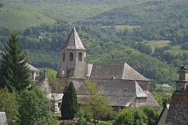 The church of Saint-Martin, in Thiézac | |
show Location of Thiézac | |
 Thiézac | |
| Coordinates: 45°00′56″N 2°39′55″E / 45.0156°N 2.6653°ECoordinates: 45°00′56″N 2°39′55″E / 45.0156°N 2.6653°E | |
| Country | France |
| Region | Auvergne-Rhône-Alpes |
| Department | Cantal |
| Arrondissement | Aurillac |
| Canton | Vic-sur-Cère |
| Intercommunality | Cère et Goul en Carladès |
| Government | |
| • Mayor (2008–2014) | Guillaume Laybros |
| Area 1 | 41.7 km2 (16.1 sq mi) |
| Population (Jan. 2018)[1] | 601 |
| • Density | 14/km2 (37/sq mi) |
| Time zone | UTC+01:00 (CET) |
| • Summer (DST) | UTC+02:00 (CEST) |
| INSEE/Postal code | 15236 /15800 |
| Elevation | 673–1,565 m (2,208–5,135 ft) (avg. 805 m or 2,641 ft) |
| 1 French Land Register data, which excludes lakes, ponds, glaciers > 1 km2 (0.386 sq mi or 247 acres) and river estuaries. | |


Thiézac is a commune in the Cantal department in south-central France.
Population[]
| Year | Pop. | ±% |
|---|---|---|
| 1962 | 1,073 | — |
| 1968 | 1,010 | −5.9% |
| 1975 | 789 | −21.9% |
| 1982 | 742 | −6.0% |
| 1990 | 693 | −6.6% |
| 1999 | 614 | −11.4% |
| 2008 | 604 | −1.6% |
See also[]
References[]
- ^ "Populations légales 2018". INSEE. 28 December 2020.
| Wikimedia Commons has media related to Thiézac. |
This Cantal geographical article is a stub. You can help Wikipedia by . |
Categories:
- Communes of Cantal
- Cantal geography stubs